
When Geo Week selected Pointerra3D’s Digital Surveyor Bundle as one of its 2025 Game Changers, the recognition extended beyond impressive speed or innovative cloud technology. The award acknowledged a fundamental shift in how the surveying and mapping industry will operate in the years ahead. For decades, professionals across surveying, UAS operations, engineering, construction, and asset management have been burdened with fragmented desktop workflows, lengthy processing timelines, siloed data systems, and an ever-growing set of proprietary file formats. Pointerra3D eliminates those barriers entirely, bringing every workflow component together in a single, ultra-fast, cloud-based platform designed for maximum efficiency, collaboration, and accuracy.
At its core, the Digital Surveyor Bundle represents what modern surveyors need most: complete control and flexibility over their data, delivered through a seamless environment accessible from any browser. By combining Pointerra3D Core with a bundle of Processing Units (PUs), the platform’s analytics and photogrammetry “compute currency”, the solution empowers survey teams to process exactly what they need, when they need it, without being constrained by complicated licensing or unpredictable per-job billing. The system is engineered for real-world field-to-finish efficiency.
A Unified Platform That Solves the Industry’s Biggest Data Challenges
Surveyors collect more data than ever before: richer point clouds, higher-resolution imagery, and more complex asset geometries. But as datasets grow, so do the technical burdens. Geospatial data is inherently large, complex to manage, and often trapped in proprietary ecosystems that prevent workflow efficiency gains that could otherwise be realized in an open data environment.
Pointerra3D directly tackles these challenges with a single source of truth approach, giving users a unified environment for storing, visualizing, managing, sharing, and processing all spatial data types—point clouds, imagery, orthophotos, 3D models, vector base maps, and more.
The Pointerra3D Core platform delivers high-performance visualization of massive datasets, secure cloud storage with always-available access, multi-user collaboration tools, data management that eliminates silos and reduces overhead, and sharing capabilities that replace shipping hard drives with instant web links.
Meanwhile, Pointerra3D’s Analytics layer enables digital twin creation, automated classification, feature extraction, lidar calibration, risk analysis, predictive insights, and photogrammetric processing within the same common data environment. The platform allows users to calibrate their point cloud data, perform classification, feature extraction, and photogrammetric processing, eliminating the need for multiple standalone tools and complex exports/imports that drain time and computing resources while creating risk for rework.
The Digital Surveyor Bundle: Flexibility, Power, and Simplicity in One Package
The Digital Surveyor Bundle combines Pointerra3D Core licensing with Processing Units—a flexible, consumption-based model that simplifies access to analytics. Each PU represents a defined amount of processing capability that can be used for everything from photogrammetry and calibration to tree segmentation, utility feature extraction, change detection, and more. This allows surveyors to align costs with project scopes and scale easily across workflows, without cumbersome quoting cycles or rigid, one-size-fits-all service contracts.
The PU bundles give survey organizations unprecedented control over scheduling and budgeting:
-
Explorer (50 PUs): Ideal for small projects or teams beginning to adopt cloud analytics
-
Adopter (100 PUs): Designed for regular users and ongoing monitoring programs
-
Pro (500 PUs): Sized for high-volume enterprise or multi-region operations
This approach mirrors modern cloud platforms such as AWS or Google Cloud, making it familiar, scalable, and predictable – ensuring that teams always have the right amount of compute power for any type of dataset or job size. It supports project-level accounting, simplifies billing, and provides transparency into usage through dashboards and real-time tracking.
The strength of the Digital Surveyor Bundle lies in making Pointerra3D’s full power accessible, regardless of whether a team needs one classification run per week or dozens of photogrammetry jobs per day. The solution is built around how modern survey organizations truly operate.
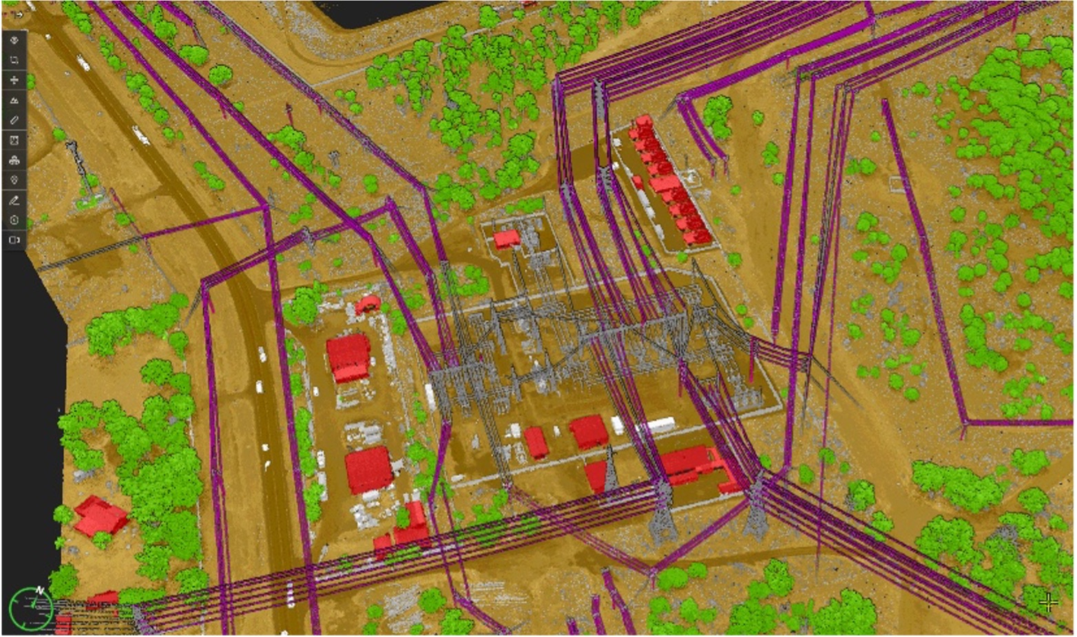
Speed Demonstrated: 1 Square Mile Processed in 30 Minutes
At a recent industry event, Pointerra3D demonstrated the disruptive potential of this unified workflow. Multiple sensor manufacturers flew the same 1-square-mile test area, collecting lidar via a Harris Aerial/RiEGL system and imagery from Wingtra. Using nothing more than a laptop and conference Wi-Fi, Pointerra3D processed the entire mission – upload, calibration, classification, feature extraction (including poles and wires), orthophoto creation, and digital delivery – in roughly 30 minutes of manual time.
This performance showcases several unique advantages of Pointerra3D: massive compute availability via AWS scaling, the ability to visualize, QA, and refine results instantly in a browser, single-platform processing with no exporting between tools, and cloud-native collaboration that allows teams anywhere to access final deliverables immediately.
In traditional workflows, the same job might require multiple software products, multiple transfers of large files, and well over a day of combined processing and QA. Pointerra3D reduces that entire pipeline to minutes—a true Game Changer by any definition.
A Platform Built for the Future of Surveying
Survey and mapping teams face rising workloads, shrinking margins, and tighter delivery expectations. Clients expect faster results, richer analytics, and more transparent reporting. Field hardware continues to improve rapidly, generating denser datasets with greater frequency. And the industry increasingly demands integrated digital twins, long-term asset monitoring, environmental intelligence, and real-time performance metrics.
The Digital Surveyor Bundle positions Pointerra3D at the center of this future, giving survey professionals the speed and scale to keep up with modern sensors, the automation needed to reduce manual labor, the accuracy required for engineering-grade deliverables, the flexibility to process any dataset at any time, the collaboration tools to align entire organizations, and the cost transparency to support business growth.
Pointerra3D doesn’t simply make surveying faster, it makes it more strategic, more reliable, more collaborative, and far more profitable.
Recognition That Signals Industry Direction
The Geo Week Game Changers award represents not just recognition of what Pointerra3D has already accomplished, but a signal of where the industry is heading.
As geospatial professionals increasingly demand cloud-native workflows, integrated analytics, scalable processing, collaborative environments, and end-to-end automation, Pointerra3D stands out as a platform capable of meeting those expectations today.
The Digital Surveyor Bundle ensures teams of all sizes can adopt this future immediately, with the flexibility to scale to any dataset, any sensor, and any workflow challenge. It combines the strength of Pointerra3D Core with the freedom and scalability of Processing Units, a model that mirrors the most successful cloud computing ecosystems in the world.
In the simplest terms, Pointerra3D makes complex data simple, slow workflows fast, and disconnected processes unified. It is, unmistakably, a true Game Changer for the global surveying and mapping community.


