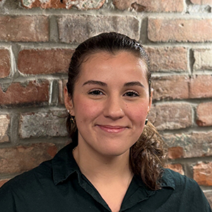
It’s raining in Orangeburg, South Carolina, and a crew from the Department of Public Utility is out in the dark because somewhere beneath the wet pavement is a valve they need to shut off. Years ago, such a situation would have meant a long search with hours spent flipping through paper records, guessing at locations, hoping someone remembered where the thing was buried.
Not anymore. A worker pulls out a phone, opens an app, and navigates straight to it. That quiet, unglamorous, and ordinary moment is precisely what Yamira Nevarez calls success.
From an Island to a Small Town
She arrived in Orangeburg in 2017, and the place couldn’t have felt more different from where she’d come from. Nevarez is from Puerto Rico. She’d spent thirteen years at the Puerto Rico Planning Board, the first Esri customer on the island, climbing from GIS analyst to director and eventually to chief information officer, managing IT for two agencies and shaping GIS legislation for an entire country of 3.5 million people. Everything moved fast there, and everything was needed by EOD (yesterday).
Orangeburg is not Puerto Rico. It’s small, rural, and unhurried. The Department of Public Utility served a community of modest size across four divisions of water, gas, sewer, and electricity, and when Nevarez walked through the door, she was the only person with formal GIS training in the entire organization. Each division had one person assigned to GIS duties, but that person wasn’t a GIS professional. They were someone handed the job of drawing points and lines on a screen, learning as they went. Out in the field, crews still worked from paper. The mapping software they had was an old, customized desktop application in an outdated programming language. The Esri license the utility was paying for sat mostly untouched.
Yamira looked at all of this and saw something that the people around her had trouble seeing: the possibility of a more efficient and standardized process.
Building From Scratch
The first thing she did was install ArcGIS Enterprise. DPU’s policies required that all data be kept on-premise, meaning no cloud storage was allowed for a utility where infrastructure security was paramount; therefore, Nevarez, who had never installed the architecture herself, taught herself how to do it. She built the entire system from scratch on servers sitting in the building.
Then she made a map. She pulled data from all four divisions and put it into a single web map that anyone in the organization could open. It may sound simple, but it wasn’t. Before that map, if a customer called to ask whether DPU could provide service at their address, customer service had to phone the division, someone had to dig through records, and an answer would come back… eventually. Now, a rep could type in an address and know in seconds.
The map was only the beginning, and Nevarez knew it. She’d learned a long time ago, back in Puerto Rico, that you can’t just throw technology at people and walk away. GIS and IT people, she says, sometimes forget that they’re in customer service, and the engineers and field crews are the customers. So, Nevarez started talking to them.
Earning Trust One Project at a Time
She started with the tree-trimming crew. Their manager had no data at all, because everything was on paper. He needed to know how many miles of line his crew had to clear each year so he could estimate costs, and he had no way to figure it out. Nevarez built him a solution using Esri’s Workforce app and dashboards. He could select an area on the map, see the total mileage, and get a number he could work with. It was practical, it solved his problem, and it cost nothing extra because the tools were already in the license they were paying for.
Word spread. People started telling each other, “Go to Yamira. She can help you.” And she did. She answered every phone call. If someone asked her the same question five times with the same attitude, she answered it five times. She went out to the field with the crews, she built solutions one at a time, and she supported every single one.
The electric division was the hardest. They were the most behind technologically, in part because older staff had resisted change for years. Nevarez didn’t push; instead, she partnered. She worked alongside them, and over time, even the skeptics came around. She says her best customers always turned out to be the oldest ones, the field workers in their sixties and seventies who resisted at first and then, once they got it, became her most loyal advocates. One of them told her, “Before, I hated this. But now I love it. I just finish my work in the field, and everything’s already digital in my email. I submit it, and I’m done.” No more paper. No more carrying forms to a supervisor. No more shuffling documents across desks.
Fixing the Data Beneath the Map
Then there was the data itself. When Nevarez dug into DPU’s spatial records, she found problems. The GPS data being collected wasn’t as accurate as it should be. Field crews were treating data collection like a race. Grab the GPS, point it, and move on. DPU was hitting its own underground lines, and third parties were hitting them too. So Nevarez called a meeting with all the division directors and told them, plainly, that they weren’t doing their job. She retrained the crews on proper GPS technique, set accuracy standards, and began the slow, unglamorous work of going back into the field to re-collect and refine legacy data that had been digitized from old paper records.
The difference showed up in the field. Directors started telling her that a crew had an issue, and the guy found the valve and fixed it easily. Before, that same crew might have spent an hour searching. DPU bought small GPS units for field crews so they could navigate directly to assets using the maps Nevarez had built. There’s still work to do, she’s quick to point out. Not every division is moving at the same speed, but they are moving.
Putting Everything in One Place
She also reorganized how the utility kept its records. Before Nevarez, documentation was scattered — paper files here, a report there, a CAD drawing somewhere else. She connected everything to DPU’s system of record. Now, when someone wants to see everything that happened at a particular address it’s all in one place, no more hunting.
What Success Really Looks Like
Today, DPU has gone from fewer than ten desktop GIS users to more than 300. Nevarez started as the lone GIS administrator and now leads a team as the utility’s Business Systems Supervisor, a role she accepted on the condition that GIS stayed under her office so she could keep driving the work forward. The project even earned a National Special Achievement in GIS award.
Ask her about any of that, though, and she shrugs. Installing a system? That’s not success. Winning an award? That’s not success either. Success is the guy in the rain who found the valve.
“When you keep adding all those little things up,” she says, “that’s success. It’s just making the life of my user easier.”
A Message for Small Agencies
She’s thought a lot about what she wishes other small agencies understood. In government, she says, you never have all the resources, never all the money. You work with what you have. And the biggest trap isn’t the lack of budget; it’s the belief that you need one to get started.
“When I got here,” she remembers, “they thought because they were small, they couldn’t think big.” She pauses. “You don’t need a million dollars. You just need a person with the right state of mind.”
She didn’t know how to do everything they asked her for, but she never said no. She said, “Let me see what I can do.” Then she did it — slowly, steadily, one project and one person at a time, until the whole utility was running on maps and a crew in the rain could find what they needed without a single piece of paper.


