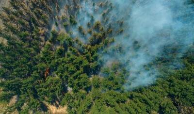
The entire planet is seeing an increase both in the sheer number of extreme weather events, or natural disasters, as well as the scope of these events as a result – directly or indirectly – of climate change. Everything from flooding to wildfires to hurricanes to heat waves have put people in every corner of the planet in danger as a result of these events, and as a result governments of all levels are looking for ways to build better response systems. Geospatial data can play a major role in this work, providing accurate views from above – whether that be via drones, crewed aircraft, or even satellites in space – with historical data which can help quickly identify areas most affected by a given disaster.
This is one of the most important global applications of geospatial work, and something that we have covered extensively here at Geo Week News. From highlighting companies who provide crucial data to local governments, to broader looks at how certain tools can help in the aftermath of extreme weather events, we have had plenty of coverage running the gamut. Below, you can find a handful of relatively recent stories from Geo Week News highlighting the ways geospatial data and workers have been at the forefront of responding to disasters around the world.
Aerial Imagery's Role for Governments Responding to Natural Disasters
We start with a story from just this week in which Geo Week News spoke with Nearmap’s Shelly Carroll, who detailed the ways aerial imagery is used in disaster response. It’s a wide-ranging conversation touching on a number of things, including the strategies Nearmap uses to ensure quick response for local governments to get hands on this crucial data, and how this type of imagery compares to data coming from satellites. Generally speaking it’s far too difficult to get a full scope of a disaster’s effects in the immediate aftermath, making imagery coming from above – as well as some AI capabilities to help quickly detect areas of interest – a crucial piece to a modern government’s response strategy.
Keeping the Lights On
Next up we have more of a personal essay from our own Carla Lauter, who shared some idle thoughts she had on this very topic after an unexpected late-March snow and ice storm in Maine. The storm knocked out power for hundreds of thousands throughout the state, something that has become too common in Maine. Utility companies have had to fight with an increasing number of these extreme storms, and Lauter writes about the ways that lidar has been, and can continue to be used, to help better prepare local grids for these issues.
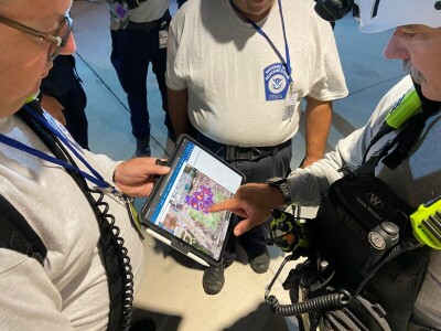
How Esri's ArcGIS powers key collaboration in search and rescue operations
Many of our looks at the geospatial industry’s role in disaster response is around data collection – typically from the air – but having a place to organize that data in a visually, spatially conscience way is just as important. That’s where Esri comes in. This article looks at the ways GIS is used in search and rescue efforts. This isn’t exclusively used after natural disasters and extreme weather events, but it’s not hard to see the utility in those scenarios, and Esri is at the core of what is known as the Search and Rescue Common Operating Platform, more commonly known as SARCOP.
Powering disaster preparation with AI and geospatial data
Geospatial data plays a key role in responding quickly and effectively after a disaster occurs, but it goes without saying that the goal for most governments is to be in position to mitigate effects of any future extreme weather event to whatever extent possible. Combining satellite imagery with artificial intelligence can help do exactly that, as demonstrated by Gramener with their Sunny Lives model. Created in partnership with SEEDS and Microsoft, the algorithm utilizes satellite imagery and has been used to identify different types of roofs in India. With this information, and combined with forecasting of typhoons, they can identify which areas will be most impacted by the weather and where evacuation efforts should initially be focused.
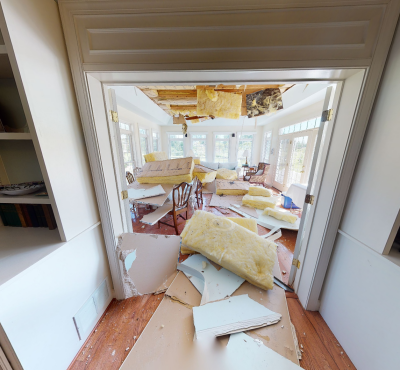
Matterport Donates Digital Twin Technology to Accelerate FEMA Appeals Process
Late in 2021, Kentucky was hit by a devastating string of tornadoes that wreaked massive amounts of havoc on the commonwealth and destroyed houses. Tornadoes are, of course, the kind of weather event that cannot easily be prepared for as they pop up relatively quickly, but the aftermath is – in best-case scenarios – destroyed homes. This article looks at how Matterport donated their scanning technology and software to quickly capture damage in a home to simplify and speed up the process of getting aid from FEMA.
Younger geospatial professionals recognize the importance of their work
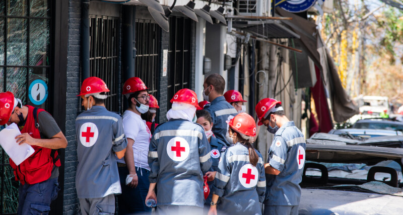
Finally, we have an inspiring look at some of the youngest and brightest minds in the geospatial industry and what they see as the importance of their work. This article isn’t entirely about responses to disasters, but it is a broader look at how the geospatial community makes the world a better place, coming right from the mouths of the future of the industry. Included in the work is a specific call-out for OpenStreetMap is used in post-disaster scenarios, such as the aftermath of the 2023 earthquake in Syria.