

Sponsored by Esri
While GIS is an extremely valuable and profitable tool for a wide variety of industries, perhaps its most important function can be in the life-or-death scenarios in search and rescue missions. Search and rescue is, as Jared Doke and Paul Doherty of the National Alliance for Public Safety GIS (NAPSG) Foundation and FEMA, respectively, have put it, inherently spatial. In order for these missions to be as efficient and effective as possible, teams need to know what areas are most in need of help, which have already been swept, and a whole lot of other information around location. Given climate change’s effects on extreme weather events, as well as aging infrastructure around the United States, having this kind of information available for those who need it is only going to become more valuable in the coming years.
Often when we think about search and rescue missions, many of us immediately think about remote areas like a large stretch of woods. However, increasingly there is focus being placed on Urban Search and Rescue, focusing on populated areas following disasters, natural or otherwise. In 1989, the National Urban Search and Rescue (US&R) Response System was established as a framework for organizing first responders as integrated federal disaster task forces. The system was first focused on responding to building collapse and earthquakes, with a couple of their initial operations coming after tragedies in Oklahoma City and New York City on 9/11. Eventually, their mission expanded to include wide area search and water operations to provide assistance when demand exceeds the availability of state and local search and rescue resources. Today, the system consists of 28 FEMA task forces around the country to go with a strong network of state and local US&R teams.
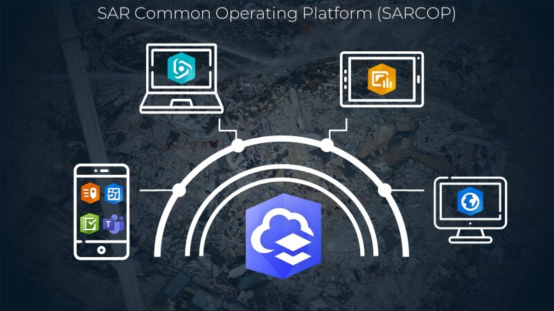
It’s an organization that has strived for continuous improvement, and a big piece of that development has been the introduction of GIS tools to streamline workflows with their Search and Rescue Common Operating Platform, more commonly known as SARCOP. A constantly-evolving set of field apps, the platform allows for shared situational awareness, field data collection, and operational planning. Crucially, SARCOP is built on the ArcGIS platform, utilizing a number of apps offered by the Esri solution including QuickCapture, Survey123, and Field Maps, and it’s used by all 28 FEMA US&R teams as well as a number of state and local teams.
The benefits of this platform are numerous, of course starting with the quick, in-the-field access to accurate and up-to-date location information. Every second and every detail counts in these missions, and team members need this information to maximize their efforts in the field. But on top of that, it also provides a perfect platform for collaboration. In fact Doke, who is presenting on this topic at February’s Geo Week event in Denver, notes that they utilize partnered collaborations with 28 separate trusted interagency partners, and they have been told that is the most in Esri’s Partnered Collaboration program. The simple, web-based platform ensures even non-technical users can maximize its use while allowing for maximum information sharing between those in the field, at a command center, and even those states away assisting remotely. One of the big issues that can come up in many search and rescue efforts is a lack of communication between different teams within a mission, a barrier solved for with SARCOP.
In addition to the collaboration, or more accurately as another piece of the intertwined efforts, SARCOP also serves as a platform to share imagery, allowing for more work to be done remotely with remote sensing imagery acquired from UAVs. This work, which is provided by partnering organizations like the Center for Robot-Assisted Search and Rescue (CRASAR), Civil Air Patrol (CAP), and the Missouri Task Force One Disaster Situational Assessment & Reconnaissance (DSAR) teams, allows for images to be captured in potentially dangerous areas, or to provide early looks at potential search areas to which teams can be sent for closer looks and rescue efforts. With these images uploaded into SARCOP with location accuracy, mission planning becomes that much more efficient, which in turn leads to more successful missions.

This imagery can also provide valuable information from a community recovery standpoint. Of course, the mission of US&R is primarily saving lives, and the priority will always be placed on that piece of the mission. However, as a secondary function, imagery from drones flying over areas affected by a disaster can provide preliminary information about observed damage to houses and buildings. This, in turn, gives a jump start to property assessments, which ultimately leads to those affected by a disaster receiving FEMA support more quickly.
There have been two recent events in which US&R has successfully leveraged SARCOP for their search and rescue missions to quickly highlight, both taking place in Florida. First, in 2021, teams responded to the Champlain Tower Collapse in Surfside, Florida. As part of that mission, CRASAR flew drones over the rubble multiple times per day, keeping up-to-date 2D orthomosaics as well as 3D models within SARCOP, providing key information to identify areas where victims were most likely to be found. Similarly, drone imagery was utilized within SARCOP following Hurricane Ian in 2022. There, drones were able to find boats washed up by the storm and determine whether or not they were likely to be residential vessels with people inside. In addition, the National Geospatial-Intelligence Agency (NGA) used their imagery exploitation techniques to support this mission via the SARCOP. That information, delivered quickly with accurate location data, allows teams on the ground to be much more targeted and efficient with their missions.
Procedures around search and rescue should always be re-examined and updated as new tools become available, as there’s no such thing as a perfect solution for work this important. SARCOP, powered by ArcGIS, has filled a number of key gaps, though. The ability to allow this kind of real-time, accurate collaboration – including from those working remotely like NAPSG Foundation to open up capacity for on-the-ground GIS specialists to perform crucial tasks – can be the difference maker for a successful search and rescue mission.
Find out more about your local search and rescue team, US&R Task Force, or local fire department. See if they could use some help! If you are already supporting search and rescue – join the National Search and Rescue Geospatial Coordination (NSARGC) Community, and review available Esri capabilities here.


