
NORCROSS, GA, FEBRUARY 23, 2015 – At ILMF in Denver, Colo., Leica Geosystems Inc. and Hydrography AB today announced that Geomatics Data Solutions based in San Diego, CA, and Surrey, BC, Canada, has expanded its bathymetric LIDAR services with the purchase of the CHIROPTERA II, an innovative LIDAR solution for topographic mapping and shallow water surveying in depths of up to 15 meters (50 feet). The investment creates new opportunities for clients seeking to benefit from reliable, dense and highly accurate LIDAR data in projects such as environmental and coastal monitoring, infrastructure planning, oil and gas exploration and other near-shore applications.
CHIROPTERA II simultaneously captures the full waveform in both the 35 kHz bathymetric channel and the 500 kHz topographic channel to provide high-detail maps. The latest version incorporates the industry-leading 80-megapixel four-band Leica RCD30 medium-format camera, NovAtel SPAN GNSS-IMU subsystem, Leica MissionPro mission planning software and Leica FlightPro flight navigation software. The scanner package allows installation in the Leica PAV100 stabilized mount, providing perfect stabilization and reducing the number of flight lines needed, especially in turbulent weather.
Geomatics Data Solutions, a woman-owned small business that specializes in providing data acquisition and processing services for marine and coastal environments, has an extensive track record of collecting, processing and analyzing LIDAR bathymetry and multibeam data as well as cable route charting. Owner and hydropher Carol Lockhart is excited about the potential for CHIROPTERA II to transform the market. “Earlier bathymetric LIDAR sensors were primarily research systems and tended to be unreliable. Additionally, high data densities were difficult to achieve beyond a certain depth, so there was often a gap between LIDAR and acoustic data,” she said. “The CHIROPTERA II is a much more mature sensor. It’s both stable and reliable, and the algorithms for picking the depth and developing the intensity and being able to extract data from turbid waters and darker seabeds are much more advanced. As a result, it provides a much more efficient and effective way to capture bathymetric data.”
The high-density data reveals small objects underwater as well as fine details of breakwaters and jetties, Lockhart said. The system also has the ability to automatically distinguish between land and water. “When you’re crossing from land to water on every single line, that capability saves a lot of time in processing and improves the accuracy of the data,” she said.
Lockhart is already seeing an increase in demand for bathymetric LIDAR because of these innovations and expects this trend to continue. (To learn more, sign up for the webinar “Bathymetric LIDAR: How Better Data is Opening New Markets,” presented by Carol Lockhart with Anders Ekelund of Airborne Hydrography AB, March 24, 2 pm EDT. Register at http://leica.gs/lm91g.)
“With their commitment to innovation, extensive expertise and reputation for exceeding client expectations, Geomatics Data Solutions is well positioned to serve the bathymetric LIDAR market,” said Ron Roth, Product Manager – Airborne LIDAR for Leica Geosystems Geospatial Solutions Division. “We are pleased to have the opportunity to work with Lockhart and her team as they move the industry forward.”
For more information about airborne bathymetric and topographic LIDAR solutions, visit www.airbornehydro.com/chiroptera-ii.
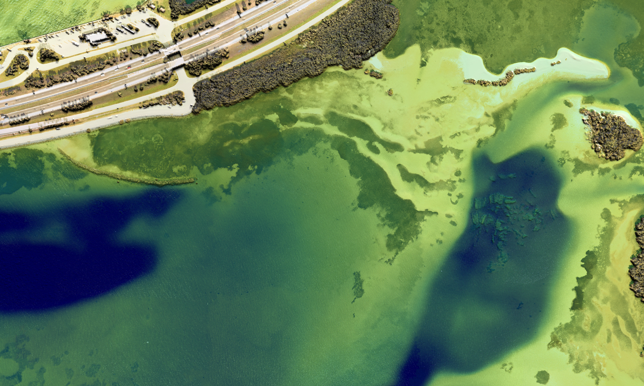
Image: Sample imagery collected with the CHIROPTERA II off the coast of Florida. Image courtesy of Geomatics Data Solutions.
Geomatics Data Solutions, Inc.
With over 50 years combined experience developing spatial work flows and processing marine and terrestrial survey data, Geomatics Data Solutions (www.geomaticsdatasolutions.com) provides high-quality data collection, processing and consultant survey services for three main business lines: LIDAR bathymetry, multibeam (plus other acoustic sensors) and cable route charting. Geomatics Data Solutions believes in increasing efficiency through appropriate automation and streamlining of processes. This approach allows the firm to increase productivity to meet tight schedules, while consistently maintaining its commitment to high quality and reducing operating costs.
Leica Geosystems – when it has to be right
With close to 200 years of pioneering solutions to measure the world, Leica Geosystems products and services are trusted by professionals worldwide to help them capture, analyze, and present spatial information. Leica Geosystems is best known for its broad array of products that capture accurately, model quickly, analyze easily, and visualize and present spatial information.
Those who use Leica Geosystems products every day trust them for their dependability, the value they deliver, and the superior customer support. Based in Heerbrugg, Switzerland, Leica Geosystems is a global company with tens of thousands of customers supported by more than 3,500 employees in 28 countries and hundreds of partners located in more than 120 countries around the world. Leica Geosystems is part of Hexagon, a leading global provider of design, measurement and visualization technologies that enable customers to design, measure and position objects, and process and present data.


