
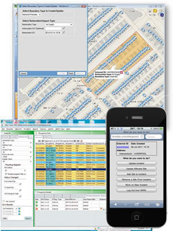
Outage, incident management software’s graphical display of network based on asset location
Trimble Navigation Ltd. Thursday released a new version of its eRespond software for water and wastewater utilities with an improved mapping user interface to better manage incidents and outages in network operations and field work.
Sunnyvale, Calif.-based, publicly traded (Nasdaq: TRMB) Trimble, with $2 billion in 2012 revenue, integrates advanced positioning and mapping technologies with software and hardware to automate utility mapping, design and operations.
eRespond version 2013 includes a redesigned spatial map-based graphical user interface including GeoSchematic, the graphical display of the network based on the location of the assets.
The new version also has an enhanced outage location capability using information from calls, smart metering/networks information and supervisory control and data acquisition (SCADA) solutions to identify outages on the network and customers affected.
Trimble said the software is specifically designed to aid utilities in reducing leakage and non-revenue water (NRW) and improving field and office worker productivity by identifying incidents on the network and shortening the repair time.
eRespond can be used in the field or in the office to identify interruptions and restoration stages and update affected network devices such as fire hydrants, valves, and meters, and support regulatory reporting.
The Trimble eRespond version 2013 is available now through Trimble’s Water Business, which specializes in field and office solutions for GIS mapping and work management, field data collection, design and inspection, outage management, and vehicle tracking for water and wastewater utilities.


