
Raymond O’Connor recognized by Geospatial World magazine
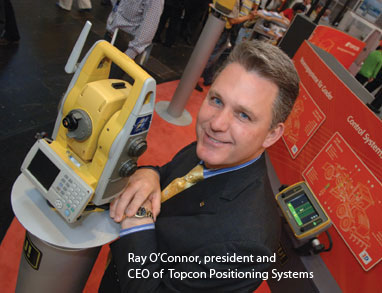
Raymond O’Connor, CEO of Topcon Positioning Systems Inc. (TPS), has been named Geospatial Business Leader of the Year 2012 by Geospatial World magazine.
The trade publication held its annual Geospatial World Leadership awards ceremony this week in Rotterdam, Netherlands.
O’Connor was heralded as a world champion of surveying and positioning technologies with 20 years of industry experience and credited with transforming Topcon into an “acknowledged market leader” in surveying technologies related to civil engineering, agricultural, mapping, and measurement applications.
Livermore, Calif.-based TPS is a subsidiary of Japan-based, $1 billion Topcon Corporation and the world’s largest manufacturer of precision GPS and GNSS systems, commercial lasers, and optical instruments for the global surveying, civil engineering, asset management, mapping, construction and agriculture industries.
Other award winners include:
Geospatial Technology Company of the Year 2012: Trimble Navigation, Ltd. The Sunnyvale, Calif.-based, publicly traded (Nasdaq: TRMB) company, with $2 billion in 2012 revenue provides hardware, such as GPS, lasers and optics, and user-specific software focused on applications in surveying, construction, agriculture, fleet and asset management, public safety and mapping. Its portfolio of UAVs in combination with low-altitude photogrammetry is part of an emerging technology providing for flexible, rapid aerial imagery acquisition of high-density geospatial data.
Geospatial Content Company of the Year 2012: The OpenStreetMap Foundation is a nonprofit supporting the OpenStreetMap Project, among the world’s largest crowdsourcing project, which develops, maintains and makes available, voluminous and constantly updated geospatial data from around the world.
Strategic Merger of the Year 2012: The DigitalGlobe – GeoEye merger has not only strengthened the earth observation industry but has and will continue to provide a significantly larger pool of satellite resources to the geospatial community adding value to geospatial industry. This merger is another giant step that keeps with DigitalGlobe’s vision of becoming the ‘indispensable source of information about our changing planet by 2020.’
Geospatial Solutions Company of the Year 2012: Critigen LLC is a full-lifecycle spatial systems integrator driving business performance through geospatial IT solutions and managed IT services including ERP, asset management and other GIS enabling all types of field users with mobile geospatial information and solutions.
Geospatial Ambassador: Juliana Rotich is the executive director of Ushahidi, a web-based reporting system using crowdsourced data to formulate visual map information of a crisis on a real-time basis. Rotich manages projects and aids in the development and testing of the Ushahidi platform. She also blogs at ‘Afromusing’ blog, typically with a focus on African tech and renewable energy. She is a budding African Futurist and a TED Senior Fellow.
Lifetime Achievement: Professor Gottfried Konecny, who has been associated with photogrammetry and geoinformation since 1945 when he began his career in the Survey Office at Troppau in Czechoslovakia. He setup the Department of Surveying Engineering at University of New Brunswick, Canada offering the first English speaking undergraduate and graduate degree program in Canada for the subjects of Surveying, Geodesy, Photogrammetry and Cartography where he continues to be the Adjunct Professor since 1971. He then, took over as the Director of Institute for Photogrammetry and Engineering Surveys, University of Hannover, F.R. Germany, responsible for teaching, research and consulting activities since 1971.
Geospatial Entrepreneur of the Year 2012: Melker Schorling – recognized as one of the champions of geospatial technology in the world and under his able leadership of over a decade, Hexagon has been shaping change. Hexagon Geosystems, Hexagon Metrology and Hexagon Technology have grown, both organically and inorganically. His vision, entrepreneurial skills, belief, and commitment towards strong leadership has resulted in the Hexagon group positioning itself as the largest geospatial company in the world.
National Mapping Organization of the Year 2012: National Administration of Surveying, Mapping and GeoInformation (NASG) China is responsible for policy, regulatory and service delivery of the country’s geospatial information. The NASG is among the first of National Mapping Organisations to take charge of rendering surveying and mapping services for the public and emergency management, and to organize and guide social services based on fundamental geographic information and data.
Geospatial Business Hub of the Year 2012: The City of Hyderabad, India. A global center of information technology, for which it has also been often called Cyberabad, and it contributes to 22 percent of the NASSCOM’s total membership. The vision of the administrators and the policies they framed for the industrial development of Hyderabad, have very effectively boosted the growth of the geospatial industry by providing an apt business environment that has fostered some of the global geospatial technology companies like Infotech Enterprises, Avineon India, IIC Technologies, Hitachi Consulting and many more that contribute to the major share of the geospatial business in India and adding to the development of the global geospatial industry.


