

Earlier this month, underground utility locating technology provider Reveal announced their latest offering, Underdots. This is a new data-as-a-service product from the New Zealand-based company which they claim “massively speeds up the analysis of utility locating data.” Underdots is an online data processing service that creates a point-cloud visualization from multi-channel ground penetrating radar (GPR), “in a matter of hours,” according to the company’s release of the news.
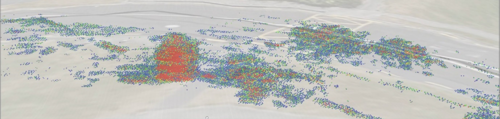
Underdots takes data from a number of the most popular multi-channel GPR models to create an intuitive clustered dot visualization within the larger Reveal platform, which can be shown alongside any other documentation or utility maps a project manager may have on hand. Within a 3D GIS environment, users can see the data plotted with the intensity and depth of radar reflections shown to help detect the presence – or absence – of underground utilities and other subsurface assets over large areas. To visualize their data, users upload the raw GPR data from their units to the Underdots cloud service, and the data is automatically processed and added to a GIS project with a publicly available or customer-supplied elevation model applied.
In a statement, Reveal CTO Tim Rastall said, "Mass radar data collection tools have rapidly improved over the past 10 years, but interpretation and visualization of the raw radar data has remained expensive and time-consuming. Underdots leverages the fast cloud computational resources we have available to process raw radar data into a format that is useful and can provide immediate actionable insights for designers and consulting engineers at the design and planning phase of their projects.”
Underdots is just the latest subsurface product and service being offered by Reveal, which has been in operation since 2012. In addition to this data-as-a-service product, Reveal also has their own in-house team of subsurface specialists who will collect data for a project tailored to specific projects’ needs. They offer, among other services, utility mapping, mark-outs, and concrete scanning. The company also has their own digital platform with which users can visualize their subsurface assets. With the platform, projects can have a “single source of truth” that houses all of the crucial information within one place, and allows for real-time updating of records.
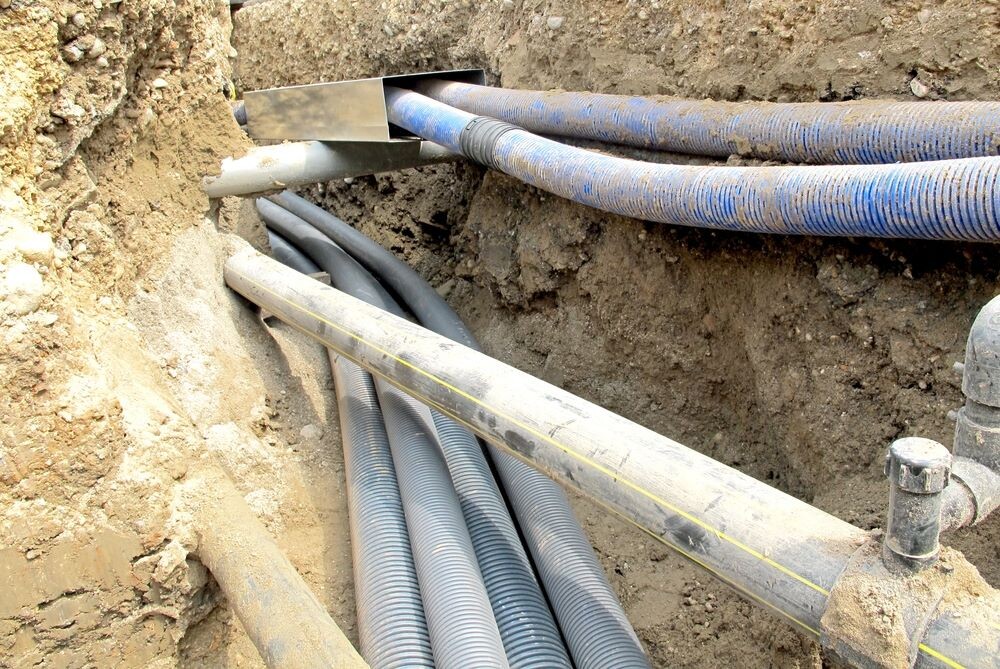
A lack of concrete knowledge of what is happening below the surface during construction and other projects which require digging is the source of a tremendous amount of danger. In many cases, records of underground utilities are out of date or just plain wrong, leading to strikes of subsurface assets which can put both field crews and civilians in the surrounding area at risk. As such, we’ve seen a greater emphasis on using technology like GPR to get a clearer picture of what isn’t visible to the eye.
One issue with this, however, is that analyzing this data is often easier said than done, requiring both software to take in and process the data as well as expertise to make the most out of the information. Underdots is working to solve that exact problem, giving an intuitive method to visualize this data and compare to previous records. For example, in some cases the point clouds may show that there is an asset in a place where records indicate there shouldn’t be, allowing workers to tread more carefully and hopefully avoid the costly and dangerous strikes.
“The Underdots visualization is great for confirming the location of utilities, but more often we are finding evidence of utilities in areas where the plans say there shouldn’t be anything at all. Underdots can help prioritize the investigations budget for further invasive potholing or trenches, saving thousands of dollars in the process,” Rastall said.
Prior to this wide release, Reveal had trialed the use of Underdots with “several major infrastructure projects in New Zealand and Australia using Reveal’s own data collection service,” but now the service is available for any utility locator or contractor with “a compatible radar.”


