

It’s certainly no secret that the construction industry is, generally speaking, looked upon as a sector that is apprehensive to adding digital tools to their workflow, an “old-fashioned” business that has trouble looking forward. Some of this is absolutely overblown – there have been dynamic technological developments in recent years – and there are plenty of valid reasons for AEC companies to be more risk-averse than their counterparts in other industries, but it’s a reputation with which they deal frequently. One area, however, where this seems to be less of an issue is with respect to underground detection, mapping what is happening below the surface. It makes sense that stakeholders would be more willing to go all-in, so to speak, on this area, given what we’ve talked about before about how a lack of knowledge of subterranean layouts can lead to dangerous situations for workers and surrounding communities, along with potentially costly delays.
In Israel, there is a relatively young company, Exodigo, looking to help companies and local municipalities more easily and accurately capture what’s happening underground. The company’s Chief Business Officer, Aurelia Setton, was kind enough to speak with Geo Week News to talk about how the company delivers accurate maps for their customers, and some other areas they can cover beyond underground infrastructure.
Exodigo was founded with a base of knowledge of underground detection, with the founders meeting as intelligence analysts in the Israeli army. To speak at the highest and most general level, the company utilizes a multi-sensing approach to scan the underground with a number of different methods, and then feeds all of that data into an AI system which can produce an accurate map of anything below the surface that could potentially pose a risk to a project. They’ve worked largely in Israel and the United States – including on projects for Caltrans – and are starting to build their footprint in Europe as well.
How does their underground detection method work?
In our conversation with Setton, it made the most sense to start with simply how their process works, specifically with what methods exactly they are using to detect any subterranean objects which could pose a risk to a construction project. As Setton put it, Exodigo uses “all the top existing radars that exist, and that can actually work in the kind of ground we’re working on.” Different projects call for different methods – for example, while most of their projects are completed with a cart equipped with a number of different sensors, they also use drones at times for more rural areas – but generally they are using a collection of sensors that includes ground-penetrating radar (GPR), electromagnetic sensors, metal detectors, and more. They also utilize existing records, though as anyone who works in this area often knows those records are, more often than not, unreliable if not totally inaccurate and out of date.
Once all of that data is collected with the various sensors deployed by Exodigo, whether collected via cart or drone, or a combination of the two, there is still the data processing to create an accurate map. This can be a time-consuming effort for a human, even assuming they have the training to bring all of the information together. Instead, Exodigo can turn around many projects in just a day after scanning thanks to their AI system, which can easily take in all of that information, determine what is important within, and create the map needed by the project stakeholders.
The Advantages of Exodigo’s Approach
There are a couple of key advantages which are presented with this approach, starting simply with time. As Setton explains, they key difference with Exodigo’s system is that they do everything up front. She notes that while the status quo is not bad, “they’re usually done in a piecemeal approach one after the other, and usually people start with records that are usually inaccurate.” And in addition to often simply being a quicker process, Exodigo allows project managers to start with a more accurate map compared to one that is built upon existing records which, again, are typically not up-to-date and exact.
The AI element also adds a key layer of safeguarding by, as Setton puts it, “removing human biases.” She further explains that humans typically use “visual hints,” and she points to one example where, if you see two manholes, you assume there is a line between them, though it’s not always the case. On the other hand, with Exodigo’s approach, “when we go with an AI approach and basically a multi sensing approach, if the line stops in the middle because at some point, it was an electricity line that was stopped and there used to be a light pole, and now they're no more because the road has expanded, we will see that.” They do incorporate human intelligence to make sure all the maps make sense, but that comes after the AI does its work, not before.
Other Uses for the Approach
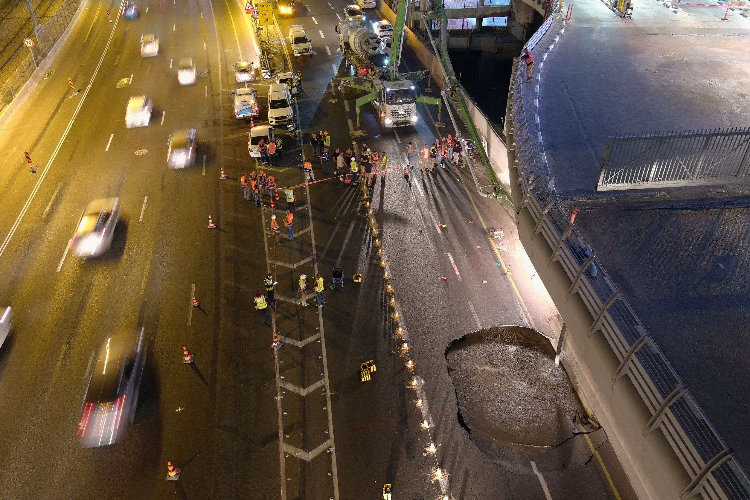
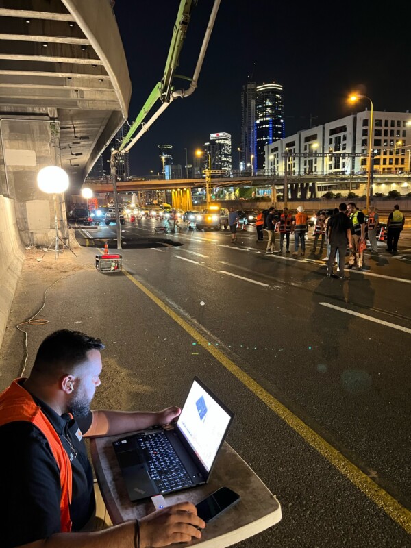
It’s no surprise that Exodigo is mainly working with construction companies and local governments with this technology, but it’s not the only way it can be used. One clear example happened recently in Tel Aviv when a sinkhole opened on one of the city’s main roadways. Exodigo’s offices were not far from the scene, and their multi-sensing approach was used to determine other high-risk areas on that stretch of road. While this use case isn’t yet commercially available, the company is working to further development their ability to test for areas with higher risk for sinkholes. They can also be used for archeological purposes, with Setton noting they have performed drone tests to identify arrowheads underground in the United States.
★★★
Construction companies are always looking for ways to keep their workers as safe as possible, and also to avoid costly delays in their projects. Striking undetected infrastructure below the surface poses problems on both of those fronts, and Exodigo’s approach combining multi-sensing detection strategies with AI specializes in this. And as discussed above, this is an area where those in the industry are willing to take a risk for new approaches.


