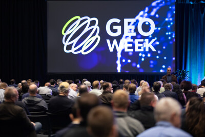
At Geo Week 2026, attendees can look forward to Reality Capture Network (RCN) sessions that will showcase how reality capture has evolved from a collection tool into a strategic discipline that's fundamentally changing how industries approach planning, construction, and long-term asset management.
Throughout the event, RCN sessions will examine how reality capture technologies support the complete lifecycle of built and natural environments. From the hidden layers beneath our feet to ancient cities concealed under rainforest canopies, these sessions trace how data moves from initial capture through verification, integration, and reuse across a large span of time.
A theme that remains prevalent in every session is integration. Not just the technical challenge of combining sensors, but the broader challenge of aligning data across project phases, disciplines, and decision-making contexts. It's a shift from asking "What can this tool capture?" to "How does this data serve us over time?"
The program spans topics from subsurface mapping and major infrastructure to archaeology, facility operations, AI-powered analysis, and immersive XR environments. Each session contributes to a larger picture of reality capture as a maturing field influenced equally by standardization, operational frameworks, and organizational requirements as by technological advancement. Rather than emphasizing any single technology or sector, the sessions collectively examine how varied instruments and methodologies are being coordinated to deliver precision and sustained value across multiple industries.
Here are three sessions that exemplify this evolution:
Finding Lost Civilizations—How Lidar Uncovered Ancient Cities in the Amazon
The story takes a dramatic turn in the Amazon rainforest, where lidar technology helped researchers rewrite archaeological history. Using NASA-collected data, scientists identified previously unknown geoglyphs hidden beneath dense canopy, evidence of ancient civilizations that had escaped detection for centuries.
However, the discovery was only the beginning. Presenters walk through what came next: field expeditions to verify what the sensors suggested, ground control measurements to confirm accuracy, and the challenge of sharing massive, complex datasets with both specialized researchers and curious public audiences through cloud-based visualization platforms. It's a reminder that reality capture isn't just about the initial scan; it's about building confidence in what the data reveals and making those revelations accessible to communities far beyond the initial research team.
Integration of Advanced Mapping Technologies and Lifecycle Data Workflows
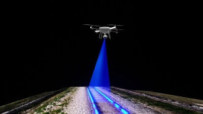
Infrastructure projects tell perhaps the most complex integration stories. A highway corridor, a rail line, or a utility network might be captured using airborne lidar over broad areas, mobile mapping along the route, terrestrial scanning at key structures, and drone surveys for hard-to-reach features. Each method has strengths, but the real challenge is weaving them into a single coherent dataset that serves transportation planners, utility operators, and maintenance crews - not just for a year, but for the operational lifetime of the asset.
This session examines how teams are tackling this challenge through automation, standardized collection frequencies, and increasingly sophisticated pipelines that channel data into GIS, BIM, and asset management platforms. Discussion moves from corridor mapping for transit and utility systems through to the practical complexities of ensuring that every scan, every model, and every measurement feeds into decisions being made today and data needs that won't emerge until years down the line.
Explore the Convergence of Reality Capture, AI, and Geospatial Innovation
The convergence of reality capture with artificial intelligence marks a turning point in how we interact with spatial data. It's one thing to capture a utility corridor in exquisite 3D detail; it's another to navigate that data efficiently when you're managing thousands of assets across a network.
This session explores how AI is being applied to scan-to-BIM workflows, enabling what some now call "survey information modeling." Presenters showcase systems that let users query vast 3D utility datasets through natural interaction rather than manual navigation. They also demonstrate how Gaussian splats and georeferenced photogrammetry are enabling web-based digital twins that can be accessed anywhere, supporting autonomous monitoring workflows that alert teams to changes without requiring constant human oversight. It's a vision of reality capture where the data doesn't just document the world; it actively helps us understand and respond to it.
Together, these sessions and others throughout the RCN program paint a picture of reality capture as a discipline where success depends not just on sensor capabilities but on how thoughtfully we integrate tools, validate results, structure workflows, and design systems that keep data valuable long after the initial project concludes.
If you haven’t yet, you still have time to register for Geo Week! Don’t miss great sessions like the ones above and register at the link here.