
Optech and U of Southern Mississippi collaborate for USACE, US Navy
TORONTO, Canada – Optech announced this week the release of the new airborne Optech CZMIL Coastal Zone Mapping and Imaging Lidar system.
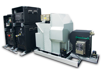
Optech described it as “an innovative airborne coastal zone mapping system that produces simultaneous high-resolution 3D data and imagery of the beach and shallow water seafloor, including coastal topography, benthic classification and water column characterization.” CZMIL has been designed to perform particularly well in shallow, turbid waters, according to a release. Its bathymetric lidar is integrated with a hyperspectral imaging system and digital metric camera. Optech said its workflow is “highly automated” and includes “a powerful integrated end-to-end software suite, handling all three sensors simultaneously—from mission planning to the production of fused lidar and imagery data sets.”
Optech CZMIL was designed by Optech for the U.S. Government under the auspices of the U.S. Army Corps of Engineers (USACE) and the Joint Airborne Lidar Bathymetry Technical Center of Expertise (JALBTCX). See more information here. It was built and tested by Optech with the assistance of the University of Southern Mississippi (USM).
“I am very excited to be fielding CZMIL in support of the USACE National Coastal Mapping Program and the NAVOCEANO Airborne Hydrography Program,” said Jennifer Wozencraft, director, Joint Airborne Lidar Bathymetry Technical Center of Expertise, and program manager for the CZMIL development, in a statement. “We’ll be able to get our work done faster due to improved operational efficiency and sensor ruggedness and work in more areas because of improved system sensitivity for turbid water and breaking wave environments. We look forward to delivering more accurate, higher-resolution elevation data and products to our customers and expanding our product offering into coastal environmental characterization through fusion processing of the lidar and hyperspectral imagery. We have an exhilarating year ahead of us working with Optech to transition the system from a development program to an operational capability.”
“Optech is proud to introduce our latest full environmental bathymetric system in support of our government and commercial customer needs. The initial results from flight testings are truly outstanding and provide resolution and depth penetration in shallow turbid waters never achieved before. With CZMIL, Optech builds on its long tradition and heritage of introducing game-changing systems in support of our customers’ requirements,“ said Maxime Elbaz, president of Optech, in a statement. “Optech CZMIL is the culmination of the transition from lidar instruments to sensor fusion—lidar, camera and hyperspectral sensor—coupled with a highly integrated single workflow from flight planning to the output of fused data sets. We already have a solid backlog of orders and expect Optech CZMIL to make a significant impact in the coastal surveying market.”
Optech CZMIL systems are being delivered to the US Army Corps of Engineers in May 2012 and to the US Navy in July 2012.


