
GNSS receiver and software provider Emlid announced three new GNSS receivers for the quickly expanding GNSS market. With more industries and non-surveyor teams relying on high-precision positioning, Emlid introduces a new generation of GNSS receivers that improve every hardware part, including GNSS, IMU, radio, connectivity, and design. These new products are proof of Emlid’s mission to provide reliable, high-accuracy tools to a broad audience, from professional surveyors to teams in construction, utilities, agriculture, environmental management, and infrastructure maintenance.
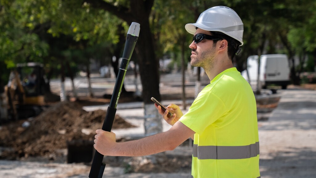 The RX2 is an RTK rover designed for GIS professionals and field teams looking for a light-weight, plug-and-play rover for everyday tasks, especially for construction sites, utilities, and asset mapping. The RX2 builds on the capacities of the previous Reach RX, with new included features including all-band RTK support for greater reliability under canopy or in urban areas, second generation IMU tilt compensation for accurate, level-free measurements, and a quick release mount for a fast and reliable field setup.
The RX2 comes with Emlid Flow, an app for iOS and Android that creates an end-to-end solution for a variety of field tasks. The cloud-based Emlid Flow 360 syncs the field data to give office workers the latest updates and real-time visibility. The RX2 is easy to integrate with 3D mobile scanning apps such as PIX4Dcatch, a mobile application that turns a smartphone or tablet into a 3D scanning tool, creating georeferenced 3D models from images and lidar data.
Reach RS4 receiver
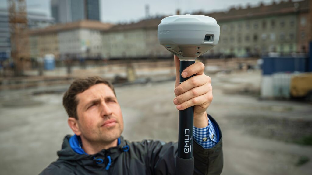
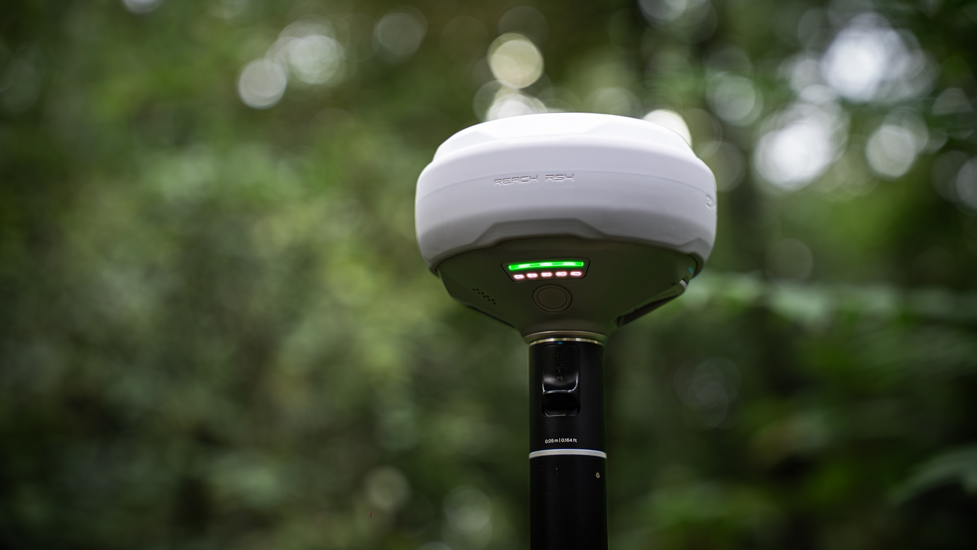 The RS4 is a robust GNSS receiver offering an upgraded tilt experience, improved satellite tracking, and flexible radio options. A high-end, all-terrain receiver delivering reliable precision in any condition, and offering the flexibility to work both as a base and a rover. It is built for professional fieldwork in surveying, construction, drone mapping, and more. Key features include all-band RTK reception across all satellites made possible with a antenna and GNSS chip that supports L1, L2, L5, and L6 bands across all satellite constellations, an integrated antenna system, and an Emlid multi-band radio system up to 2W.
The RSP4 Pro builds on the RS4 platform, with added vision capabilities in the form of factory-calibrated full HD cameras. It is built for large-scale, data-intensive, and hazardous projects where every minute and safety matters, and provides image-based measurement and augmented reality to accelerate mapping, inspection, and monitoring workflows.
AR stakeout capabilities
The Reach RS4 Pro camera system overlays a design on a live camera feed to help the user find stake points faster. Instead of relying on abstract coordinates, the user navigates visually, while the front camera updates in real-time and provides clear distance, direction, and approach cues. The interface snaps to a bottom-camera-powered auto bullseye, centering the target for placement.
Introducing a video-based measurement workflow for achieving centimeter-level precision for points that are difficult to access, the Reach RS4 Pro lets users record a video of an area, which the device then processes by dividing it into frames. By the detecting the same point in multiple images captured from different angles, the system accurately calculates its 3D position using photogrammetry. The user can review all calculated positions to ensure they have been detected correctly in each frame.


