
Anglian Water is the largest water and water recycling company by geographic area in England and Wales, serving much of the Eastern portion of the United Kingdom. Recently, the utility company created a geospatial tool in order to get a real-time picture of sewer risk and identify specific hotspots to prioritize where work is most urgently needed.
According to a recent release about the risk tool’s success, Anglian Water indicates that in the first six months of using it they have seen a 51 percent reduction in blockages with 112 kilometers of sewers cleaned and eight tonnes of debris removed. Additionally, they say the resulting reduction in customer service issues relating to blockages has yielded more than £1 million in savings. Finally, they point to a reduction in engineer callouts since the introduction of the tool, which they say “saves time and reduces carbon emissions from unnecessary travel.”
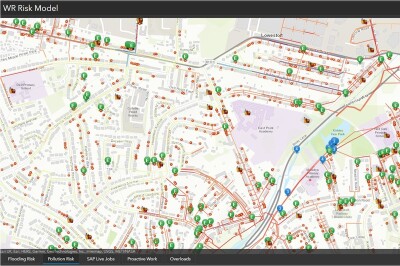
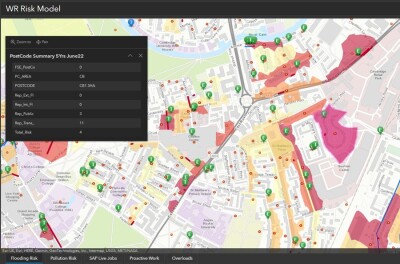
The company created this mapping system by utilizing geospatial technology from Esri UK. They have mapped scores applying to sewers across their vast area of coverage, considering risk factors such as location, material, size, proximity to the water course, and historic pollution. The result is a dashboard which shows areas with the highest level of sewer risk, giving workers an idea of where they should target intervention methods. They say the system, as of June 19 of this year, has been used to find and clear over 1,000 blockages and discover more than 1,700 structural defects, including broken pipes and tree root intrusions.
Anglian Water manages about 77,000 kilometers of sewers throughout their area of service, serving a total of around seven million people within the driest region in the UK. In the aforementioned release, they say this tool “was developed to replace reactive and unconnected processes and systems and support better decision-making.” The risk tool was designed for wide use among all staff as well as external contractors, and they say that since its introduction the number of geospatial software users has almost doubled.
They also believe that user base could continue to grow and evolve as they add new capabilities to the existing tool. Specifically, Anglian Water points towards adding new sensor data to the risk tool, integrating flow sensor data from across their entire network. Combining that data with their tool could provide key insights, particularly after extreme weather events, and they could then further add to their network by sharing the data with third parties like the national Environmental Agency and other local authorities. They say the tool has already continued to learn and improve, including a recent initiative to identify areas with high risk of blockages. With that information, outreach is then planned for residents and food establishments in the areas to discuss disposal methods for fats, oils, and greases.
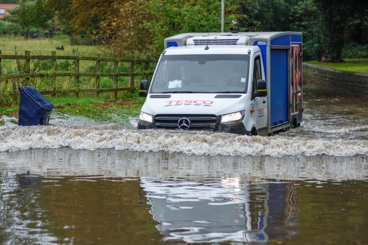
The type of work being done by Anglian Water and other water companies around the world has of course always been crucial, providing the most important resource for humans on a consistent basis. The challenges around that task, however, are only going to become more pronounced in the coming years due to effects from climate change resulting in more of these extreme weather events. Things like flooding and droughts have profound effects on clean water access, and it’s crucial for companies to be able to respond as quickly as possible with the maximum amount of information. Tools like this one created with technology from Esri UK are a massive step in that direction, and they should only become more powerful as the need becomes greater.
Michael Wingell, Geospatial Strategy Manager with Anglian Water, says the usage of Esri UK’s GIS technology gave them the ability to shift from a reactive to proactive business model. He continued, “This new way of working helps prioritize work and investment across the network. Every blockage cleared means a reduction in the number of flooding or pollution incidents, saving both time and money and having less environmental impact.”
Learn more about the risk tool here.


