

The upcoming modernization of the National Spatial Reference System (NSRS) represents one of the most significant changes to the geospatial framework in decades—a shift that was top of mind for many attendees at Geo Week, as evidenced by high engagement in both of the sessions focused on this topic. While the NSRS update will ultimately improve accuracy, efficiency, and interoperability across mapping, surveying, and positioning applications, it also brings uncertainty for those who are concerned with how to update their datums without disruption to their work. As the industry navigates this major shift, discussions at a Geo Week panel underscored both the excitement and apprehension surrounding the future of geospatial positioning.
The panel was lead by Dr. Qassim Abdullah, and featured short presentations from industry, NGS, academia, software manufacturers and the USGS – touching on important resources and progress.
Galen Scott from NGS emphasized that the modernization is driven by the need to support a spatially enabled society, where consistent and accurate spatial reference systems are essential for a wide range of applications, from autonomous vehicles to smart infrastructure. By 2026, the current coordinate systems will shift, with latitude, longitude, and elevation values differing by up to two meters, and in some cases, up to four meters. This shift underscores the importance of updating the NSRS to maintain the reliability and accuracy of geospatial data, especially when it comes to future applications.
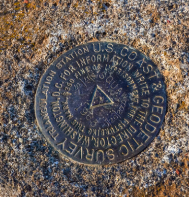 “Historically, we have referenced those datums through survey marks, through passive marks in the ground – we’ve been doing that for 200 years. One of the issues with that is that once you put that mark in the ground, you don’t know how it is moving unless you re-survey it periodically… which can allow things to get inconsistent,” said Scott.
The modernization of NSRS introduces significant changes aimed at improving positioning accuracy, consistency, and efficiency. One of the most fundamental updates is the replacement of the North American Datum of 1983 (NAD83) and the North American Vertical Datum of 1988 (NAVD88) with new, more precise reference frames. These changes will correct distortions and inconsistencies in coordinate positioning and vertical elevations, providing a more reliable foundation for geospatial applications.
Instead of relying on a single national datum, the modernized NSRS will incorporate four terrestrial reference frames, each designed to account for the movement of the Earth’s crust. These include the North American Terrestrial Reference Frame (NATRF2022), Pacific Terrestrial Reference Frame (PATRF2022), Caribbean Terrestrial Reference Frame (CATRF2022), and Mariana Terrestrial Reference Frame (MATRF2022). This shift acknowledges that different regions experience varying degrees of crustal motion and will allow for more accurate and regionally appropriate positioning.
Another major change is the transition from NAVD 88 to the new North American-Pacific Geopotential Datum of 2022 (NAPGD2022). Unlike its predecessor, which relied on aging and often unstable physical benchmarks, NAPGD2022 will use a gravimetric geoid model to determine elevations. This approach will improve vertical accuracy and eliminate the issues associated with shifting and deteriorating benchmarks, ensuring a more stable and precise elevation reference system.
The modernized NSRS will also be closely integrated with Global Navigation Satellite Systems (GNSS), such as GPS, allowing users to obtain highly accurate coordinates directly from GNSS observations. This shift will reduce reliance on traditional ground control points and streamline positioning workflows across industries. Additionally, the system will incorporate time-dependent positioning, accounting for natural geophysical changes like crustal movement and subsidence, which can impact long-term positioning accuracy.
This modernization will have far-reaching implications across surveying, mapping, construction, and many other industries that rely on accurate positioning data. While these changes promise improved accuracy and efficiency, they also require widespread adaptation, including updates to software, workflows, and data processing methods. As the industry prepares for this transition, understanding and implementing these updates will be crucial to fully leveraging the benefits of the modernized NSRS.
Tools and resources
Recognizing the significant impact of this modernization, the speakers emphasized the need for a collaborative effort involving all stakeholders, including government agencies, academia, and the private sector. Brian Shaw from NGS highlighted the various tools and resources being developed to support the transition.
To help users understand and implement the changes, transformation tools and software updates are being developed. The NCAT (NOAA’s Coordinate Conversion and Transformation Tool) will support conversions between old and new reference frames, helping users adjust their existing datasets. Additionally, software providers are working on integrating the modernized NSRS into GIS, CAD, and surveying applications, ensuring smooth compatibility across platforms.
One of the other tools mentioned across the panel was the Online Positioning User Service (OPUS), which is being enhanced to accommodate the new reference frames. OPUS allows users to submit GNSS data and receive precise coordinates based on the latest geodetic models. Updates to OPUS will enable users to seamlessly transition from NAD 83 and NAVD 88 to the new terrestrial reference frames and NAPGD2022, ensuring compatibility with modernized positioning systems.
Educational resources and training programs are also being expanded to assist geospatial professionals with the transition. NOAA’s National Geodetic Survey (NGS) is offering webinars, technical guidance, and documentation to explain the new system, its benefits, and best practices for implementation. Industry organizations and professional associations are also playing a role in disseminating information and providing hands-on training.
Preparing for a spatially enabled society
The academic institutions are collaborating with NGS and the broader geospatial community to support the modernization effort, leveraging their expertise and resources to facilitate the transition. By focusing on education, research, stakeholder engagement, and collaboration, academia is playing a crucial role in preparing the geospatial community for the NSRS modernization and ensuring a successful transition.
Chris Parrish from Oregon State University and the Geospatial Center for the Arctic and Pacific (GCAP) discussed the critical role of academia in this process. GCAP is actively engaged in research, education, and stakeholder engagement to help prepare the geospatial community for modernization, with a focus on enhancing geodetic infrastructure in the Pacific Northwest and Alaska. Parrish highlighted the research that GCAP is conducting, particularly in the Pacific Northwest and Alaska, to enhance the geodetic infrastructure and support the modernization efforts.
On the industry side, Linda Foster from Esri highlighted the benefits of improved data sharing, spatial data quality, and digital redundancy that the modernized NSRS will bring. Esri is working closely with NGS to provide tools and support for the transition, recognizing the importance of metadata and data sustainability in ensuring the long-term value of geospatial data.
The session also addressed the challenges faced by government agencies, such as the USGS National Geospatial Program, in preparing for the modernization. Through a light-hearted presentation that incorporated humorous AI-generated images, Jason Stoker emphasized the both the challenge and opportunities users to access adequate software, models, resources, and funding to effectively manage the transition, as well as the critical role of metadata in understanding the lineage and accuracy of existing data. Stoker also spent some time discussing the overall sentiment of people facing these changes; emphasizing that those experiencing anxiety about the upcmoing change were not alone.
“I’m hoping if I’m successful with my presentation, I’ll make you feel a lot better about your place in this modernization process,” he said.
Overall, the conference session provided a comprehensive overview of the NSRS modernization, showcasing the collaborative efforts and the significant benefits that this transformation will bring to the geospatial industry. As the transition progresses, it is clear that all stakeholders must work together to ensure a successful implementation and the continued reliability and accuracy of geospatial data.


