One of the most important topics for the surveying and broader geospatial communities today is the modernization of the National Spatial Reference System. A project that has been ongoing for the National Geodetic Survey (NGS) for well over a decade at this point, this modernization effort is expected to be completed in 2026, meaning that those who will be affected would be wise to start preparing for the changes now.
Over the course of the last year, Geo Week News has been covering this effort extensively, speaking with representatives from NGS as well as the Geospatial Center for the Arctic and Pacific (GCAP), who received a grant to assist with some of this work. Our coverage, which you can find in full here, has included looks into how GNSS plays heavily into this new system, how bathymetric surveying, in particular, will be impacted, efforts around industry outreach, and more.
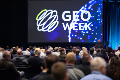
Given the importance of this topic, it should come as little surprise that the Geo Week conference and exhibition, which is currently taking place in Denver, Colorado, featured this effort substantially. In addition to NGS having a booth – #1622 – on the floor where experts are available to answer questions and concerns about the effort, the conference program includes multiple sessions featuring experts from NGS and other supporting organizations.
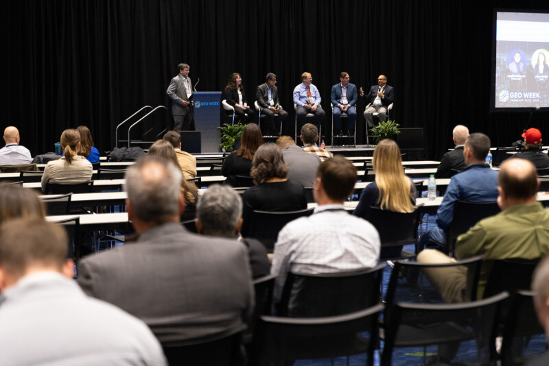
That includes one session held on Monday entitled Working Together to Put the Modernized National Spatial Reference System into Practice. This session, which aims to give perspective on how various professional organizations are thinking about this change, was moderated by NGS Constituent Resources Manager - Geodetic Services Division, Galen Scott, and included the following speakers.
Qassim Abdullah | Woolpert
Michael Olsen | Oregon State University
Linda Foster | Esri
John Nolte | Denver Water
Balaji Ramachandran | Nicholls State University
The hour-long discussion touched on a number of topics, giving each speaker coming from a variety of backgrounds a chance to talk openly about how their individual niches are expected to be impacted by this change and how they are approaching the modernization. In addition to discussing how this change is going to positively impact their work, they also talked through some of the potential challenges they see on the horizon as they make this transition, and how each of these organizations within the community can collaborate to ensure everyone gains as much value from the shift as possible.
Scott set the stage for the panel by touching on just how big of a deal this modernization project has the potential to be. He told the crowd that humans have always looked for what lies ahead on the horizon, and this new datum will give more accurate information about location than ever before.
“Technologies rely on this question of where more than ever before,” Scott said. “This science and this infrastructure that supports our ability to understand where is more important than ever.”
He referred to this panel discussion, featuring representatives from some of the major professional organizations from across the industry, as a “potluck dinner,” with everyone bringing their own perspectives to the conversation to create a great meal.
Following Scott’s opening, each of the panelists discussed the organizations they represent and how they play into this conversation. Foster, for instance, was representing the National Society of Professional Surveyors (NSPS) and shared an ArcGIS StoryMap she’s shared with her members to keep them up-to-speed. She noted that it is a “living” link that will continue to be updated as more progress is made in the modernization.
Abdullah was there to represent the ASPRS, mentioning an article the group put together about this project, and talked about the role that those in the industry need to take to really maximize the work being done by NGS. He said, “NGS can do the science, but it’s really up to us to take it further.”
Olsen, in addition to his work as a professor with Oregon State was there to represent Utility Engineering and Surveying Institute (UESI), bringing the engineering perspective the conversation. He mentioned that the word is starting to get out about this work throughout the geospatial community, but engineers are still unaware and confused about what’s happening.
“Every time we go and talk about this at some of the more general engineering meetings, they look at us crazy when we talk about the losing a foot,” Olsen said, in reference to the changes coming as a result of this modernization.
Representing the Geospatial Professional Network, formerly URISA, Nolte talked about the group’s work around education and advocacy, and trying to spread the word about this change coming throughout their network.
“It's really just trying to educate and get the word out on what the importance of this modernization is, and how to get that to the next step,” he said. “We're getting more input from the communities, more collaboration with the different groups.”
Finally, Ramachandran was there to represent the Surveying and Geomatics Educators Society (SaGES), and specifically the role that educators play in making sure the industry is ready. He discussed the importance of people in his role working this into the curriculum to ensure that students are ready to enter the workforce right away.
“What I hear from practitioners is, We don’t want button pushers. At Nicholls State, we have already started incorporating some of this in their junior, senior year. So when they go out in the real world and the rubber hits the road, they’re prepared for the workforce.”
In addition to these individual assessments on how each individual group is handling this change, they talked about some of the benefits and challenges that will come from this in their areas. Some of the themes in this portion of the conversation was how much this will revolutionize anything to do with automation, particularly in the AEC space. The panel hammered home the point that the motivation to embrace these changes will be financial; the companies who embrace the changes will be better prepared for the automation that is coming, and will ultimately be able to outbid and outperform their competition.
This is just one of the sessions at Geo Week focusing on the modernization of the National Spatial Reference System. On Tuesday, the keynote address – taking place at 9:00 AM (Mountain Time) – that talks about the Francis Scott Key Bridge tragedy of last March will talk about how the NSRS plays into that kind of work. Later in the day, attendees can learn more about the science behind these changes in a session entitled Preparing for the Modernization of the National Spatial Reference System, taking place from 11:00 AM to 12:30 PM.


