

One of my favorite parts of covering this industry is seeing the evolution of technology. That’s not necessarily having to do with the improvements of specific tools, though that’s certainly interesting in its own right, but here I’m talking about the evolution of how and where it’s used.
I think about laser scanning, which of course is used primarily by surveyors, though of course we’ve seen this technology incorporated heavily into construction workflows, and most autonomous vehicle manufacturers incorporate it with their designs. As the technology improves and becomes further democratized, more industries and users can take advantage of it for their own purposes, and it’s always an interesting process to watch play out.
Among my favorite sessions Geo Week 2023, held in February, was one highlighting different and unique use cases of lidar. We’ve also covered some different uses here at Geo Week News, such as its usage in support of the always-popular Fat Bear Week. That one was extra cool from my perspective with the possibility of its implementation leading to new, safer ways to do crucial work of monitoring wildlife in areas most affected by climate change.
You can even look at a company like Nuview, who are planning to scan the entire Earth with lidar using satellite constellations. They aren’t the first to use lidar-enabled satellites, but it’s the most ambitious plan around it that I’m familiar with.
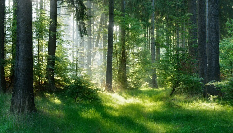
Thinking about the usage of laser scanning in the world of forestry, it feels like we’re at an inflection point where it’s leaving the space of being a unique use case and moving towards being a standard tool in the industry. Speaking to people over the last year, it’s come up on a fairly consistent basis.
To wit: A group of scientists in the UK, including Dr. Kim Calders, used laser scanners to determine the carbon biomass of a forest near Oxford was underestimated by as much as 77 percent; Nejc Dougan of Flai, a company who uses AI to efficiently classify point clouds, noted that forestry is an industry he is seeing more in his space; and Trimble recently opened up their first forestry-focused Trimble Technology Lab, which are created to give university students access to technology they’ll be using in the field post-graduation.
There isn’t just one way that this technology is being used in the forestry field. Different use cases call for different collection techniques, with all of TLS, mobile, and UAV scanning having their place. A TLS will, of course, provide the most accurate information, but it can be difficult to lug them out to some locations, and the terrain isn’t always the most friendly to set them up. Mobile scanning is easier to use, but if you need highly accurate point clouds it might not get the desired results. UAVs can get to hard-to-reach-places, but a forest obviously leads to obstacles in flights.
In terms of the actual usage, it can be used from everything to calculating carbon biomass as mentioned above, to accurately mapping a forest down to individual branches on individual trees, and planning development in areas around forests. GeoSLAM has a good blog post talking about some of this usage.
To me, though, it’s that carbon calculation and just generally environmentally-friendly uses that excite me the most. Obviously, our environment and climate is among the most pressing issues throughout the planet right now, and as we’ve discussed lidar has the potential to play a big role in clawing back some of the missteps we’ve made in the past. Forests are at the center of so many environmental problems – and solutions – so it makes sense that one of our strongest and most versatile tools is starting to become mainstream in the industry, already seeing positive results.


