

Sponsored by Presagis
The value of being able to visualize projects and entities in 3D while having the ability to run simulations, generate analytics or perform analysis through connected digital twins has long been apparent. However, adoption of these tools in a variety of industries has lagged due to a variety of factors. One of the biggest causes is simply that, to actually create the models, is easier said than done. This is particularly true for those who want to create models and run simulations for large-scale projects covering, for example, entire municipalities, cities, or even nations. The creation of these large-scale digital twins traditionally takes considerable time, not including the time and expertise it takes to actually pull out and analyze the vast amounts of data gleaned from them.
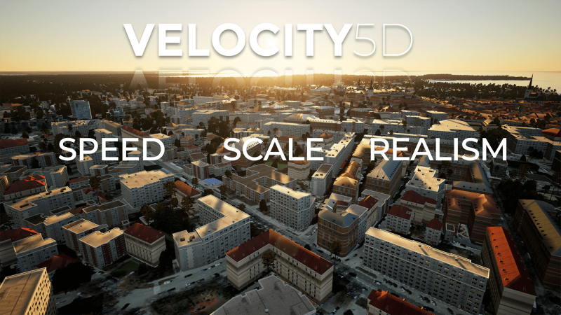
Looking to address this particular challenge, late last year Presagis released their cloud-based subscription service, VELOCITY 5D (V5D), aimed at easy creation of these large-scale digital twins. VELOCITY 5D transforms diverse GIS data streams into information-rich models that include five dimensions: length, position, depth, time, and context, the latter of which comes through with connected sensors powering simulations. The company is confident that V5D addresses those needs to the degree the market is looking for and is backing that up with the offer of a 30-day truly free trial with no credit card information needed at sign-up.
Essentially, VELOCITY 5D is the platform on which professionals from any relevant industry can rapidly create geospatial 3D digital twins at scale, all the way up to a nation-wide digital twin. Its simulation capabilities can ensure decisions are made with the maximum amount of information available. What is typically a highly technical process that takes considerable amounts of time and requires high levels of expertise can be completed within V5D in hours, not weeks. Users are able to bring in their own GIS data, but can also access satellite imagery data which can be found on the platform, including from an archive of Airbus' OneAtlas libary, with the possibility of requesting new satellite imagery.
Crucially, the resulting digital twins are also scalable and modular. V5D has been used for models as large as entire countries, but can also be utilized for assets as small as a single building, and everything in between. Additionally, Presagis employs MOSA, or the Modular Open Systems Approach, which “allows users to break the big problems into smaller ones.” The software development approach that Presagis utilizes is based on open APIs to support the hundreds of third-party vendors that use our tools, and to support a growing market that is increasingly asking for interoperability.”
The other important piece of VELOCITY 5D that provides added value from the models comes in after the creation, where the platform utilizes artificial intelligence (AI) and machine learning (ML) to maximize efficiency and return on investment. Algorithms created by the Presagis team can extract key information from these models, including identifying building footprints and vegetation, and automatically generate 3D content. The platform is also able to bring in new real-world data when available to ensure this single source of truth always contains up-to-date information. This digital twin functionality is there to support the rapid decision making that professionals need, and can be done with less time, effort and frustration.
It’s important to note, too, that while V5D is a relatively new product, it’s not untested. In fact, it has been used successfully at that nation-level scale in an Eastern-European Country. This was no small feat, creating a digital twin of a nation more than 25,000 square miles (and over 65,000 square kilometers) in area with a population of nearly three million. A national mapping agency needed to create a 3D digital twin of the entire country, bringing in a variety of geospatial data of different scales and formats. Blending that different information together is exactly what V5D is built upon, and the officials were hoping to find a repeatable workflow which could be used in the future to detect changes. With V5D, they were able to generate this country-scale digital twin within just three days – which was determined as the maximum time frame, as the agency figured 72 hours was how long they’d have to create a new digital twin in the aftermath of a disaster or other unplanned incident – using a terabyte’s worth of data, including from OpenStreetMap (OSM) vectors or from Satellite Imagery.
This type of rapid creation ability opens up the potential of simulation-ready models for even more industries and businesses for whom the lift may not have previously been worth it. Smart city technology is becoming more ubiquitous, but implementation is made much easier with a usable city-wide model that can incorporate the data coming in from much of this technology in real-time. Response to extreme weather events is made much more efficient with GIS data, and that’s even more true with a visualization and simulation tool which incorporates all of that data. And perhaps most logically, infrastructure has become a government spending priority in the United States thanks to recent legislation. Every corner of infrastructure improvement - from transportation to utilities to large compounds like maritime ports and airports - can take advantage of these easy-to-create models for things like asset tracking, security, impact tests for new builds, and preventative maintenance, among other use cases.
For many of these industries, and more, the creation of these digital twins at any scale can seem like an intimidating process, particularly for those looking for city- or nation-wide digital twins. And it’s important to remember that generation of the model is only the first step. The real work gets underway with the AI-powered simulations and making insights based on real-time information being fed into the digital twin. Many organizations just can’t and won’t look beyond that creation timeline required to get that key information. VELOCITY 5D eliminates those concerns with rapid, intuitive creation of digital twins which, powered by AI and ML, provide crucial, real-time information for all types of industries and organizations.
Interested in trying out Presagis’ V5D platform? Take advantage of their true 30-day free trial. No credit card information necessary!
Sign up now!


