Sponsored by DJI
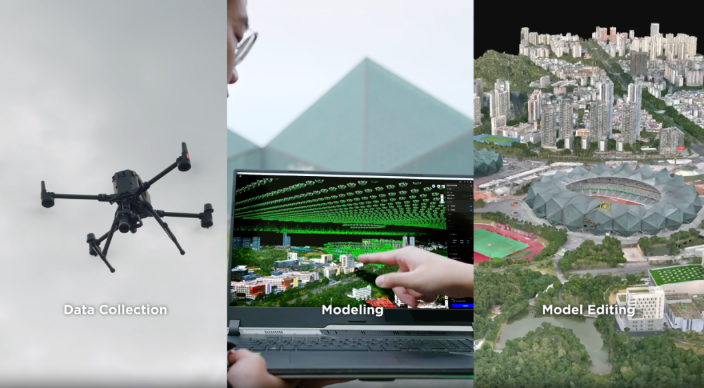
The use of drones for aerial surveying and creating 3D models of worksites, urban areas, and other applications has exploded in recent years as drones have become more accessible and necessary sensors have become both cheaper and smaller without sacrificing power. However, one of the issues with these workflows is that these models are not always created with all of the necessary data being captured, which can lead to more work and travel back to sites.
It is these problems that DJI is looking to solve with their latest release - DJI Modify. The company’s first intelligent 3D model editing software was released earlier this month and is designed to work alongside their enterprise drones and DJI Terra, their 3D modeling and mapping software. The result is a comprehensive solution for aerial surveying, modeling, and model editing, using the powers of artificial intelligence.
In speaking with the DJI team, it’s clear they’re looking to solve a problem that is experienced by surveyors and others capturing imaging via drones on a number of types of job sites. Specifically, they know that resulting 3D models can be difficult to work with and that these models generally have artifacts which can be difficult to work around.
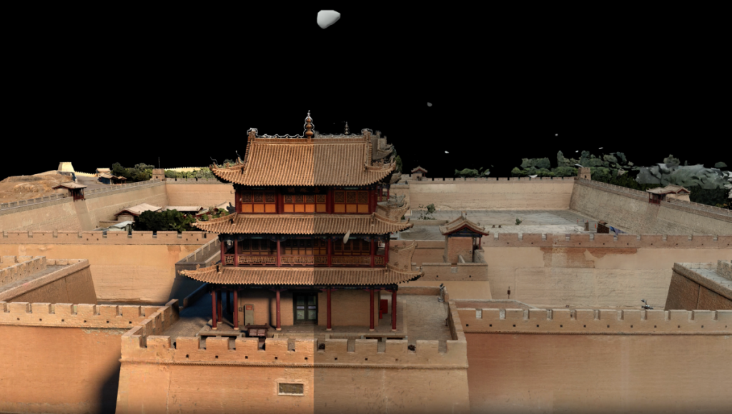
Grant Hosticka, Head of Solutions Engineering in North America for DJI, expanded on this to Geo Week News, saying, “With DJI's intelligent 3D model editing software, what was once a cumbersome process to repair issues like this, is now streamlined and intuitive. Other intelligent tools include removing floating parts caused by reflective surfaces or extensive captures. There’s also a flattening tool that instantly removes cars from parking lots and roads, as well as other objects unintentionally captured. Meanwhile a texture repair tool can fix reflective surfaces on skyscrapers or cars from a busy intersection. First, it removes the defect and uses machine learning to fill in the gap. Lastly, holes in 3D models can be caused by thin structures on the job site, such as street signs, or when there’s not enough overlapping captures. The fill holes tool will patch the holes using machine learning.”
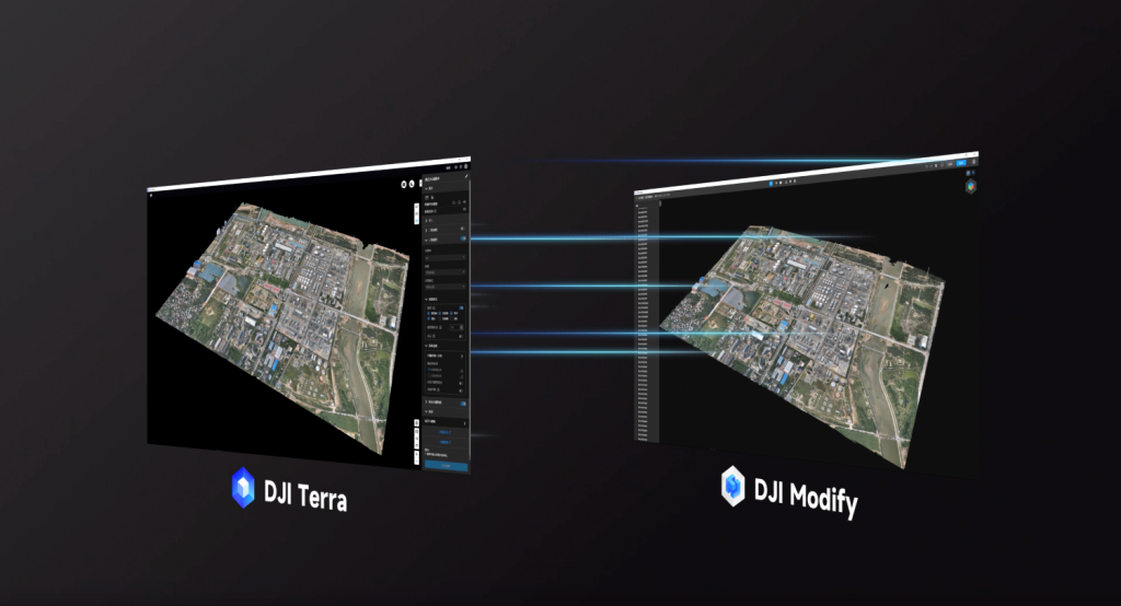
There are two key aspects that make DJI Modify a key addition to any surveyor’s workflow, starting with that seamless work alongside DJI Terra. The latter is a software solution which creates accurate and efficient 2D and 3D reconstructions of areas captured by DJI drones using either photogrammetry techniques or lidar. Users are able to enable DJI Modify within DJI Terra, and with one click can launch the former. DJI describes the workflow as being “like Photoshop for photo editing,” automatically generating DJI Terra files for model editing, including pre-identified objects and pre-processing of the model.
As for the actual model editing work, DJI worked to make that process as simple as possible. For example, in the case where floating parts show up in the data, users can easily draw a box around the areas with floating parts, and then with one click have them removed from the model. Furthermore, users can employ a similar process to flatten or erase things like vehicles from a scene, fill holes in a model – which can also be automatically detected by the software – and for creating and adjusting water surface within a model.
DJI believes there are a number of industries and types of professionals who can benefit from this type of tool. For example, land surveyors have increasingly started to incorporate drone photogrammetry into their work, particularly for projects that would have been unsafe – or even impossible – for human workers to complete otherwise. For them, Hosticka says, “many land surveyors have adopted photogrammetry using drones instead of sending a crew into hazardous areas, like rooftops, ledges, roadways, unstable soil, and steep embankments. While drones help surveyors collect data faster, sometimes with better accuracy, DJI Modify makes processing that data a simpler and more efficient process. Instead of spending time removing and fixing common defects in 3D models, they can focus more time on their analysis, assessment, and recommendation.”
He also points toward public safety professionals as those who can use DJI Modify to accelerate accident forensics. “When road accidents occur, public safety officers often need to document the scene. This critical step is known as accident reconstruction. Drones are increasingly being used for their accuracy and speed, allowing roads to be cleared sooner. DJI Terra streamlines this process even further by decreasing the amount of time spent editing the resulting 3D models.”
Want to give DJI Modify a try? For a limited time, DJI is offering a FREE six-month trial. Sign up below:
Sign up here!