Earlier this month, data integrity company Precisely announced the launch of their newest version of MapInfo Pro, the company’s desktop GIS application. The latest version, v2023, includes a series of improvements and additions to the platform, including new 3D visualization capabilities and new analytics workflows, among other changes. Map Info Pro v2023 is currently available in English, German, and French, and the company indicates 13 additional languages will be available by early 2024.
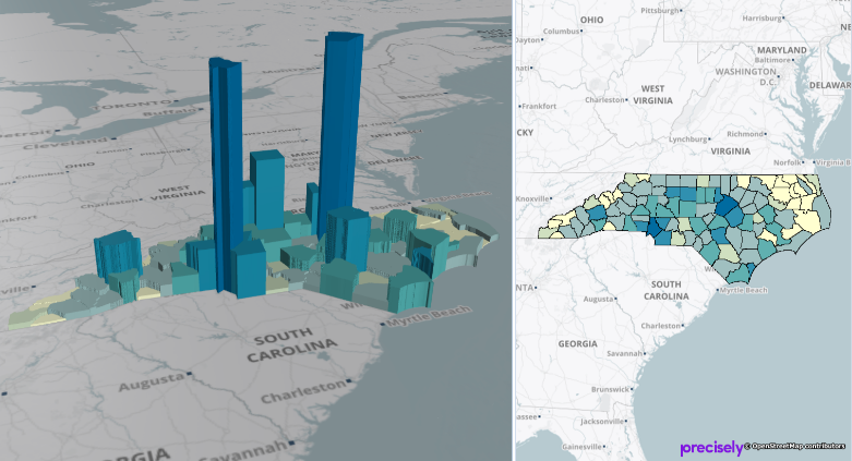
In their announcement of the news, the company – who is also a member of the Overture Maps Foundation – breaks down the enhancements from this latest version into three different buckets, starting with the 3D visualization capabilities. With the new enhancements, users of the platform will now be able to simultaneously display data side-by-side in both 2D and 3D to provide all of the necessary context for decision making.
Additionally, customers can now connect MapInfo Pro to Precisely Spectrum Spatial, the company’s location data manager and analysis tool, allowing for better data collaboration among stakeholders for a given project. With the connection, they say users can “maximize data collaboration across the business.” Finally, they note a series of other enhancements coming from community feedback, including customizable workspaces and user interface options.
“Understanding the 3D nature of your data is essential in mineral exploration, so we’re thrilled that this feature will now be available directly within the familiar interface of MapInfo Pro – and at a fraction of the cost of some of the more specialist standalone packages on the market,” said Caroline Hilton, Managing Director at Pelican GeoGraphics, a partner of Precisely. “Even at grass-roots level, geologists will be able to visualize their regional and project data in greater detail, draping aerial images, geological mapping, geophysics grids, and geochemistry data onto the landscape with ease.”
MapInfo Pro is boasted as an “all-in-one” GIS platform by Precisely, allowing users to manage, analyze, and visualize key data for mapping and map publishing. The software solution, which is available for a 30-day free trial, can be used for a number of different use cases. Users can get key location information and how that information interacts with other datasets, all viewable within a single map. They can also model different scenarios using maps and demographics, corporate data, and Precisely’s modeling tools to get up-to-date information about a potential location. The company also notes that the information gleaned from MapInfo Pro are built to be understood by non-experts as well as in-house experts, allowing more stakeholders to be involved in key decision-making processes.
Location data is crucial for many different industries, whether it be retail or hospitality looking to either relocate or add new storefronts, or urban planners looking to enhance areas of their city, among plenty of others. This data can also be extremely complicated with which to work given all of the overlapping information that needs to be tracked in order to make informed decisions. That’s why applications like MapInfo Pro are so valuable, making it relatively simple to overlay all of this information within a single map to ensure a chosen location is the right one. Making that mistake can be extremely costly to fix after the fact.
Looking specifically at these enhancements, it’s the 3D visualization capabilities which stand out the most. Viewing any information in three dimensions as opposed to two has always been preferable since that’s how we naturally perceive the world, but making that a reality has long been easier said than done. However, that’s been shifting in recent years, and it’s starting to become an expectation among professionals. Having this data available in three dimensions unlocks workflows in spaces like disaster management, coastal modeling, and urban planning which rely on realistic digital representations.
“Precisely remains committed to delivering a complete desktop GIS solution in MapInfo Pro, that is powerful, flexible, and easy to use,” said Clarence Hempfield, Senior Vice President – Location Intelligence at Precisely. “The latest release helps to unlock maximum levels of location-based context for our customers across an almost endless array of critical business scenarios.”