

Last week, Leica’s announcement of their Pegasus:Backpack ultra-mobile scanner overshadowed some other important news. Leica and Autodesk have announced a collaboration. In addition, Leica has announced a new program to give customers free access to pre-captured imagery for the next full year.
P16 and ReCap
First, Leica and Autodesk have worked to integrate their technologies. Users of the Leica P16 laser scanner will have the ability to import native point cloud data directly into Autodesk ReCap.
In a statement, Cathi Hayes, BIM strategy and business development director for Leica Geosystems NAFTA, explained that construction professionals and service providers can still Leica Cyclone software and CloudWorx plug-ins to process, manipulate, analyze, and share their point cloud data. However, she added, “Professionals whose primary goal is to import point clouds into Autodesk ReCap software, however, can now do so directly from the Leica ScanStation P16, allowing them to extend point cloud usage to more team members. The customer can save time and costs with this more streamlined and simpler process.”
BIM-to-Field Layout
Autodesk has also announced that users of Autodesk BIM software (AutoCAD, Revit, Navisworks), will be able to gather as-builts and perform QA in the field using the company’s BIM 360 layout iPad app, will see another Leica integration. The app will be able to communicate with and control Leica’s iCON robot 50 robotic total stations.
Get Hexagon Imagery from the Cloud
At HxGN Live last year, company CEO Ola Rollén spoke about what he called an iTunes for geospatial content. Hexagon would offer a service where geospatial professionals could download high-quality imagery gathered by Hexagon. This service would save those professionals the trouble of scanning a whole new area to gather spatial and contextual details. These professionals could buy the needed data at a cost less than the cost of performing the work themselves.
That service, called the Hexagon Imagery Program (HxIP), was announced at HxGN Live last week. If you own a Leica Nova MS60 Multistation, TS60 Total Station, Viva TS16 Total Station, or Zeno handheld, and you live in the US or Canada, Leica is offering you a year of free access to georeferenced imagery.
Once the period of introductory access is over, Leica will provide the data on a subscription basis to anyone. It will be accessible through Esri’s ArcGIS Marketplace, Hexagon Geospatial’s Power Portfolio, and Valtus Imagery Services.
The data is offered through the service at a 30cm resolution with set specification and accuracy standards. It has been captured using Leica’s own airborne sensors and will be refreshed regularly.
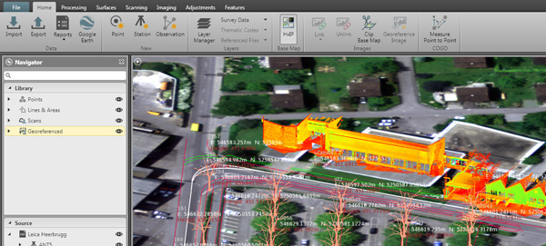
In a statement, Leica explained how the service works. “Through Leica Infinity software, users can access HxIP imagery to view field measured data and imported design data in the office. Users can also prepare job data with the HxIP imagery and then clip and store georeferenced images that can be exported to the new Leica Captivate field software for use as background imagery and basemaps on the newest robotic total stations. The imagery can also be live-streamed to the Leica Zeno 20 handheld.”
Leica calls this move the “first step toward bringing live-streamed intelligent cloud-based imagery into all field applications.”


