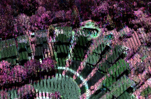
Image: Vegetation discrimination using the new Optech Titan multispectral lidar sensor.
Amsterdam — Optech will introduce the new Optech Titan multispectral lidar sensor to the survey and mapping industries at the European LiDAR Mapping forum in Amsterdam, December 8-10, 2014.
Titan, the latest in Optech’s line of airborne laser terrain mappers, touts a total of three individual laser beams, with separate wavelengths. Because it provides three light sources at different wavelengths, the sensor will be capable of active multispectral imaging, making it possible to perform multispectral imaging during nighttime hours as well as during the day.
In a statement, Optech explains that the increased number of wavelengths in the sensor will have the effect of “increasing the information content that can be derived from the target surface and allowing surveying professionals to address many more applications using a single-sensor solution.”
Michael Sitar, Optech’s Business Manager for Airborne Mapping Solutions, explains that “By combining multiple wavelengths, we not only improve current methods and results for existing applications, but also open up completely new opportunities and applications for lidar moving forward.”
The Titan’s possible applications include environmental modeling, topographic surveying, 3D land cover classification, vegetation mapping, shallow water bathymetry, and target recognition. Optech will be presenting two conference sessions at ELMF on the uses of the uses of multispectral lidar like Titan.
Showcase at The European Lidar Mapping Forum
Optech’s Titan will be featured at booth 313, as well as in two conference sessions.
Dr. Paul LaRocque, Optech’s VP of Advanced Technology, will present a paper called “A New Multi-Wavelength Lidar for 3D Land Classification & Coastal Bathymetry.” He’ll present the sensor’s first results and explain how multispectral lidar like Titan can automatically classify target materials with high accuracy by comparing the relative intensity returns from each separate channel. In addition, Optech’s Dr. Joong Yong Park will hold a technical workshop titled “How Can Airborne Bathymetric Lidar Systems Be Compared?”, which will explain how attendees can calculate the theoretical performance of a lidar using only its specs.
Titan Technical Details
As for technical details, the three laser beams have a combined ground sampling rate approaching 1 MHz. The sensor includes full gyro-stabilization compatibility, which aids in providing predictable point distribution, as well as a fully-programmable scanner, which provides point density increases at narrower FOVs.
Not focused strictly on active imaging, the sensor accommodates passive imagery using “fully embedded high-resolution metric mapping cameras” such as multispectral thermal, NIR, and RGB. Full-waveform recording for each wavelength is available for use when necessary.
The Titan includes Optech FMS, their full featured flight-management system, and their Lidar Mapping Suite, for production lidar processing and accuracy quantification. In order to make use of the Titan’s multispectral imaging capabilities, the software package will also include “an LMS software extension that provides enhanced map product deliverables for bathymetric and land cover classifications.”