October 8, 2014 — Optech is pleased to announce that our team of scientists and engineers has produced three papers offering practical insight regarding the collection and analysis of topographic and bathymetric lidar data. Optech Senior Scientist Dr. Viktor Feygels will present these papers at the SPIE Asia Pacific Remote Sensing conference in Beijing, China on October 13-16.
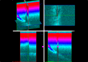
Researchers and surveyors who need better lidar data visualization will enjoy the presentation of a paper authored by Optech Software Manager Dr. Joong Yong Park titled “Visualization using 3D voxelization of full lidar waveforms,” which describes a new method of analysing and editing bathymetric lidar data processed in the Optech HydroFusion workflow. This visualization advancement allows easy analysis and editing of lidar data from full-waveform systems such as Optech Coastal Zone Mapping and Imaging Lidar (CZMIL) for both topographic and bathymetric applications. These include water column visualization, bottom classification, oil slick detection, and submerged object location. The presentation will take place during Session 6, Laser Ranging and Lidar Mapping I, between 10:30 AM – 12:10 PM on October 15.
Meanwhile, attendees interested in water column analysis will benefit from Session 7, Laser Ranging and Lidar Mapping II, between 1:30 PM – 3:30 PM on October 15, where Dr. Feygels will present “Estimation of inherent optical properties from bathymetric lidar” on behalf of Optech Research Engineer Minsu Kim. This presentation describes how the lidar waveform simulator used in Optech HydroFusion can be used to estimate the true water attenuation coefficient, enabling bathymetric lidar users to study not just the seafloor and submerged objects, but also the qualities of the water column itself.
Also during Session 7, Dr. Feygels will present his own paper, “Particularities of hydro lidar missions in the Asia-Pacific region,” which describes the water turbidity of the Asia-Pacific region and its suitability for study using the Optech CZMIL. Dr. Feygels will detail how to calculate the maximum depth penetration for CZMIL based on Secchi depth, while describing CZMIL’s performance in highly turbid waters like those in the Asia-Pacific region.
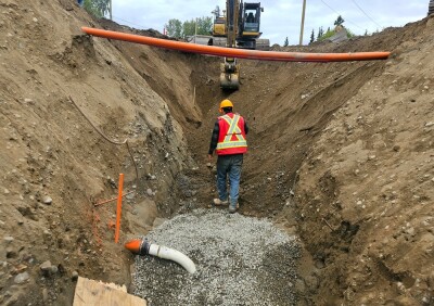
Interested attendees can head to Optech booth #18, where staff will be on-hand to discuss how CZMIL and its HydroFusion workflow offer up to 80 m depth penetration in clear waters and unparalleled penetration in turbid or muddy-bottomed regions. Staff also have details on how the new CZMIL Project Program is dramatically increasing access to CZMIL and HydroFusion, already validated and in use with several government agencies for critical projects, and making them available to smaller agencies for short- and medium-term projects.
About Optech
Optech is the world leader in high-accuracy lidar 3D survey systems, integrated cameras, and productivity-enhancing workflows. With operations and staff worldwide, Optech offers both standalone and fully integrated lidar and camera solutions in airborne mapping, airborne lidar bathymetry, mobile mapping, terrestrial laser scanning, mine cavity monitoring, and industrial process control, as well as space-proven sensors. Accuracy and productivity matter!
For further information, please contact your Regional Sales Manager or:
Wayne Szameitat
International Sales Manager, Optech
300 Interchange Way
Vaughan, Ontario, Canada L4K 5Z8
+1 905 660 0808
[email protected]