

Digital twins need to be monitored and maintained after their creation, which requires a way to re-access digital twin projects year after year to update or change them. This is a hard thing to do when using separate, analog data sources such as a hard drive. A better approach would be to scan once and get multiple jobs from the same dataset. This approach is followed by Jakarto, a Montreal-based company founded in 2017.
After a five-year R&D project of integrating various technologies and creating proprietary digital twin software, the company created software to do asset inventory both manually and in an automated way. The result, Jakartowns, is used mainly by municipalities for managing digital city twins.
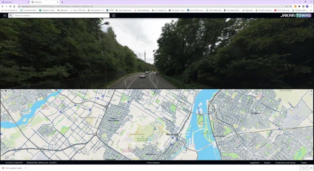
Digital Twin City Access
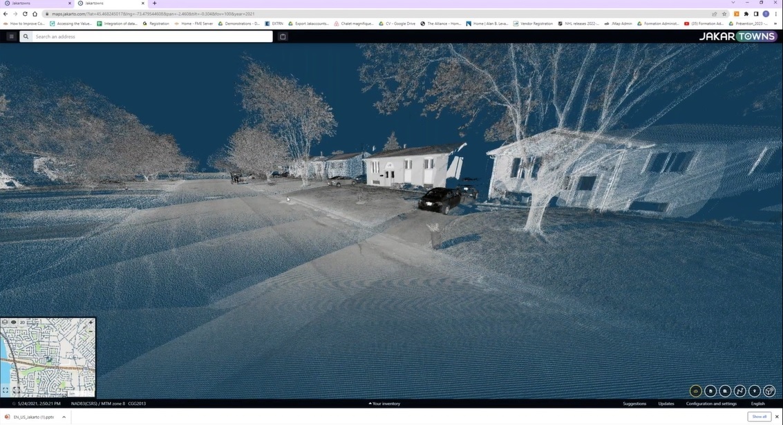
Jakartowns is a digital twin city web platform, offering a 3D, immersive view of point cloud data to analyze, measure, geocode and inventorize any object. The software takes advantage of the precision of the point cloud, and combined with GIS, CAD and BIM software, it gives access to a digital twin and asset data. Jakartowns serves as a cloud-based archiving solution where users can upload all of their point clouds and imagery, and stream that in various ways to GIS software, for example by exporting a scene, street, city, or county.
Automated Asset Inventory
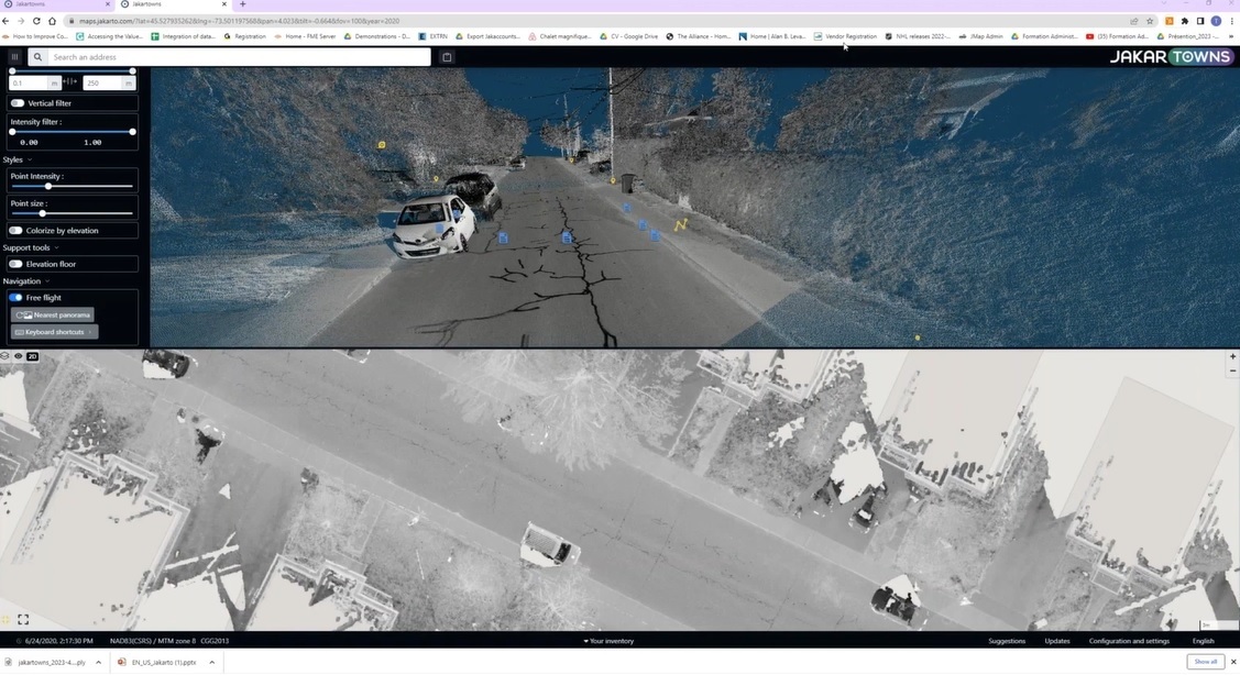
Once point cloud and/or imagery data is uploaded to the software, there are multiple routines available to the user aimed at easing the extraction of various assets. The first one is automated lidar data classification of ground-level (roads, curbs and sidewalks) and above-ground-level (vegetation, buildings, overhead networks and cars) objects, so the user can choose the classes they want to work with after performing such a classification. From there, additional types of asset inventory are available, including road sign inventory, tree inventory, and automated/ inspection inventory which is also the most often used algorithm.
It includes three levels: first, the poles’ position, height, diameter and inclination information are extracted. Next are aerial network components such as the cable, attachment points and cable span. Finally, by mixing tree and inventory information, insights on vegetation encroachment can be obtained to help overhead network operators help prepare for storms.
Pavement assessment is a new algorithm available in Jakartowns for analyzing the road surface in the 3D point clouds on cracks, potholes, markings and curbs and based on that, creating a metric based on the number of these called a Pavement Condition Index (PCI). This way, each street can be classified using this index, using a corresponding color code that is displayed on a 2D map.
Accurate, reliable and high-quality mobile scan data
The lidar data classification is done using a combination of AI and spatial analysis, taking place both in the point cloud and the imagery. This entire process is based on pre-trained information, from a mobile laser data collection perspective. Jakarto uses high-end Riegl scanners for its mobile data collection, which results in accurate, reliable and high-quality algorithms.
You can learn more about the process by viewing a recorded presentation titled "Accessing the Value from your Digital Twins Using Jakartowns", now available to watch on YouTube. This in-depth webinar was presented by industry experts Joshua France (RIEGL USA) and Thierry Baulu (Jakarto) in April 2023.


