The 3D Elevation Program (3DEP) has seen the USGS collecting detailed 3D point cloud data across the US, which would be challenge enough for any organization, but the USGS didn’t stop there. It has also been working to make that data available to the public. This mission that was seemingly put on hold when the USGS closed its CLICK website, but this month brings good news: in agreement with Amazon, USGS has just made its 3DEP lidar data available to the public.
Part of the reasoning for this change of approach is a dedication toward offering the public “new mechanisms” of access to the data that are “beyond simple downloads.” By working with Amazon to load this data set onto cloud servers, USGS is offering users “the option to work with massive lidar point cloud data sets without having to download them to local machines.”
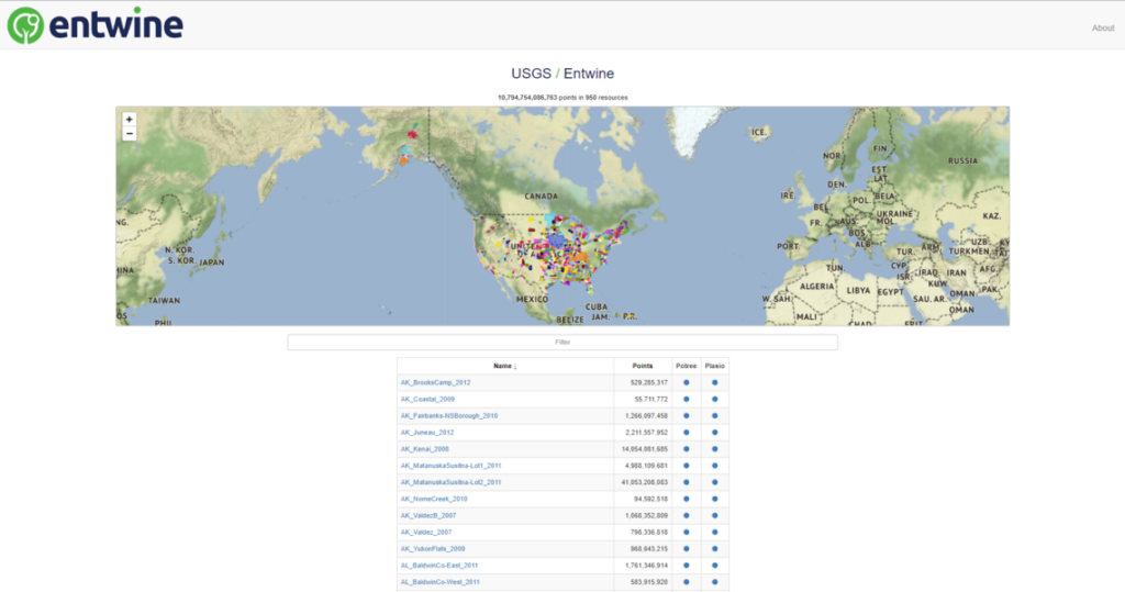
Let’s talk technical details. The USGS says that currently, there are “over 1.77 million ASPRS LAS tiles compressed using the LASzip compression encoding in the us-west-2 region, which equates to over 12 trillion lidar point cloud records available from over 1,254 projects across the United States.”
The data is available in two ways: A public-access resource in the Entwine Point Tiles format—a lossless, streamable octree based on LASzip (LAZ) encoding. The second is a requester pays bucket (which means exactly what you think it does) that offers access to fill-density raw LAZ data. File names are standardized across buckets.
Jason Stoker, chief elevation scientist for the USGS National Geospatial Program weighed in on the victory: “The ability to use cloud computing with free, open 3DEP data will foster amazing new applications and uses of these data that we could not have done before,“ he said. “Just being able to see an entire statewide project with hundreds of billions of points at one time from a browser is amazing, let alone the potential to process and analyze all these data together in new and innovative ways. We greatly appreciate AWS making a copy of our data available as a Public Dataset, and kudos to Hobu Inc. and USACE CRREL for processing and organizing these data in a way that enables access in an open source fashion. I can’t wait to see how people take advantage of this effort.”