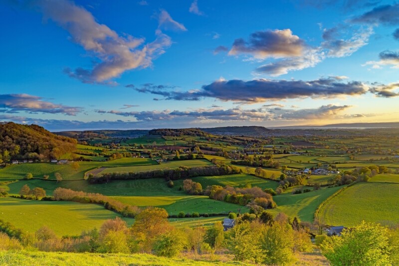
As communities across the world reckon with how humanity has affected the environment, attempted corrections are coming in many forms. A lot of this revolves around changing the way we work and live, whether it’s a greater embrace of public transportation, forgoing single-use items, or moving to digital workflows across many industries. The other side of this focus, though, comes in the form of rebuilding and restoring natural environments that have for too long been ignored or actively destroyed. The United Kingdom is one of the most nature-depleted countries in the world, and they are in the process of trying to reverse this trend.
While this is a massive undertaking that no one organization can completely achieve, the National Trust is among the nation’s largest landowners and has been working toward the restoration and creation of more wildlife habitats. Back in 2015, they set out a 10-year target to create or restore around 100 square miles (or 25,000 hectares) of wildlife habitats, a target that they announced this month was “comfortably exceeded.” A lot of work went into meeting these ambitious goals, but one of the most important aspects of completing this work was the use of GIS software from Esri UK.
The National Trust began using Esri’s software in 2014 as they were planning the start of this 10-year strategy the following year, and their usage shifted over that time, moving from a handful of desktop licenses to now using their ArcGIS Online SaaS software. Huw Davies, the National Trust’s Head of Data, told Geo Week News that their use of GIS in general dates back further, though.
“When I joined the organisation in 2011, we were already using GIS – but it was really thought of as an administrative tool to create maps for estate management and land transactions. The scope was very limited. Part of my role was to act as a 'Head of Profession' for the GIS community, which at that time was dispersed across seven regions and countries and operating fairly independently. By 2015 we had transformed ways of working with new role profiles, brought in Ian Dawes who developed a 'core data strategy,' and this combined with the new Esri technology enabled improved data quality and greater confidence in centralised data - a 'single source of truth' for the whole organisation (breaking out of regional silos).”
As anyone in the geospatial industry over the last decade can attest to, GIS software has evolved tremendously in that time. For an organization like the National Trust, which has over 2500 users of its platform between staff, volunteers, and partners, it is often easier said than done to keep everyone up-to-date with the evolution of the software. GIS product manager Ian Dawes told Geo Week News that they have shifted some of the ways they are approaching training.
“Training used to be much more classroom-based, which can prove costly and takes a long time to deliver across a large organisation,” he said. “We have moved to short 'how-to' guides and videos. Some staff prefer other approaches, so we also have regular drop-in web sessions for general enquiries and to cover specific focus areas."
Perhaps the biggest change for the National Trust with their use of GIS during this decade of work has been the aforementioned shift from desktop-based products to online. Dawes compared that shift to the one from on-prem databases to the cloud, and outlined their strategy to make this change for such a large and diverse user base.
“In common with a previous move from on-premise databases to cloud infrastructure, the biggest challenge in moving to a full SaaS solution was to make the change as invisible as possible to the end users. All the technical work to migrate datasets, replace database triggers and stored procedures with web-hooks and scheduled scripts took considerable development effort, but to the end user, the delivered products looked largely the same. The GIS Web Browser was a complete change. We had a phased release where the new browser was optionally available alongside the old version, then the new browser was the default option with access to the old version, then finally there was only the option of the new browser.”
The National Trust has outlined how important GIS was for this work, with GIS tools being used to plan, implement, and show evidence of the work they’ve completed over the last decade. Among those use cases were using Esri’s software to record existing natural habitats, plan out new projects, and report on progress against KPIs and better understand the spatial patterns of their work. Now, with the substantial decade-long goals met, what’s next? Well, another 10-year plan. In January, they launched their next 10-year strategy called People and Nature Thriving, which you can read more about here. As one would expect, technology will once again be used for much of this work, including the use of new AI tools.
"There are so many use cases [of AI], but a couple we're actively working on are modelling visits and visitors to our outdoor places, using machine learning models to predict based on a wide range of data sources,” Davies said. “Additionally, developing models and data to provide spatially optimised land use benefits, including carbon sequestration, nature restoration, and ecosystem services benefits for people. We're seeing an explosion in the quality and availability of Earth observation remote-sensed data, including lidar, radar, infrared, thermal, as well as low-cost aerial photography and photogrammetry from drones. We certainly can't sit back and rest on our laurels – the next 10 years of strategy delivery will look very different – but more opportunities than ever to deliver more impact at greater scale."