Earlier this week, we published an article talking about the difference for aerial mapping workflows between crewed and uncrewed aircraft platforms, specifically thinking about corridor mapping. The article focused largely on the differences between the two options, and more specifically on the idea that there isn’t really a better option between the two in general, but rather a need to consider the project before choosing the preferred option. What wasn’t really discussed, though, is that any of these projects are going to create a whole lot of data, and it’s the work that takes place after the data collection that turns those images or point clouds into actionable insights.
This, in turn, brought about thoughts back to the Esri User Conference, held last month in San Diego, California. As we discussed shortly after that event’s conclusion, one of the big takeaways was the continued merging of AEC and geospatial concepts, and specifically the increasing tie-in taking place between GIS and BIM workflows. Geospatial professionals are increasingly being required to at least understand some basic BIM fundamentals, and the same is true for AEC professionals with respect to GIS. The article above talks about how this merging is affecting infrastructure projects, but the same is true for massive datasets that come out of corridor mapping projects.
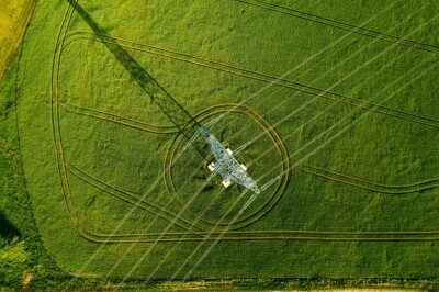
Of course, there is plenty of overlap between infrastructure projects and corridor mapping, and in fact the latter is often a component of the former. Corridor mapping involves the collection of a variety of spatial data across often long, linear features. That often includes transmission lines, road networks, pipelines, and railways, among other potential areas. These are often miles long – sometimes hundreds of miles – and the data can include any of lidar data, multispectral imagery, high-resolution imagery for photogrammetry, and GNSS data for georeferencing. Sometimes, it can include all of the above. It’s because of this complex data collection that GIS and BIM are used, often in concert, to manage and derive insights from said data.
The two tools provide different but complementary capabilities that are critical for these types of workflows. For GIS, these systems provide the geographic basis for these projects. After collecting the data, GIS software tools act as a foundation for visualizing, analyzing, and maintaining any and all of the spatial data mentioned above, paving the way for a variety of workflows. Within the GIS, professionals can take asset inventory, tracking the number of poles, lines, or otherwise, a process that today often includes artificial intelligence to significantly speed up the process. These systems can also provide the basis for change detection over time when data is georeferenced, and help with environmental impact analysis and right-of-way planning.
All of this is essentially table stakes for geospatial professionals, of course. What is becoming more common today, and the aspect of this work that many on the surveying side may be less familiar with, is BIM. As noted above, many of these corridor projects do involve infrastructure projects, or at least some sort of engineering and construction. So, after the work in GIS is completed to create that broad spatial understanding, BIM can be used to provide object-level detail and to model new or renovated components within the geographic context. This can be used before construction for design, during construction, or even after for maintenance of infrastructure along these corridors. Something we’ve talked a lot about this year is the growing partnership between Esri and Autodesk, a collaboration that really highlights the importance of this GIS plus BIM relationship, and this is a perfect example of how these two tools can relate so well with one another.
Let’s consider a hypothetical example to illustrate how this process works, thinking about a scenario where a utility company is looking to expand their territory and are adding a new 200-mile corridor of powerlines. Using crewed aircraft, they first collect aerial lidar and imagery to capture terrain, vegetation, and existing infrastructure across the proposed route. This data is imported into a GIS platform to analyze land use, identify potential conflicts with environmental or residential zones, and determine the optimal placement of towers. From there, detailed design work is completed in a BIM environment, modeling each tower, substation, and associated components with precise specifications. Together, the GIS and BIM datasets form a complete digital representation of the project, enabling better coordination across planning, construction, and long-term asset management.
To be clear, this workflow is not always completely smooth. There is work that needs to be done to ensure that the vast amount of data is not only stored and managed properly, but also formatted to be interoperable between the two systems. Partnerships like the one mentioned above between Esri and Autodesk go a long way toward addressing that issue. Generally speaking, the departments that work within GIS and BIM have traditionally been siloed as well, so cross-training and collaboration are an important investment on the front-end that will pay off in the long-term.
As we continue to see corridor mapping projects grow in both volume and complexity, it’s becoming increasingly clear that the work doesn’t stop once the data is collected. The value lies in how that data is organized, analyzed, and ultimately used to inform decisions. That’s where the combination of GIS and BIM becomes so critical. These tools are essential for turning massive, linear datasets into clean, safe, and durable infrastructure.