

The new Trimble X7 3D laser scanner includes a high performance camera, and target-less automatic registration.
Trimble took the opportunity at INTERGEO to make a major product announcement: a new professional-grade laser scanner called the Trimble X7. Loaded with many of the features we’ve heard were on their way from Trimble, The newly-announced Trimble X7 system is looking like a powerful entry for professionals in surveying, infrastructure, topographic and construction applications.
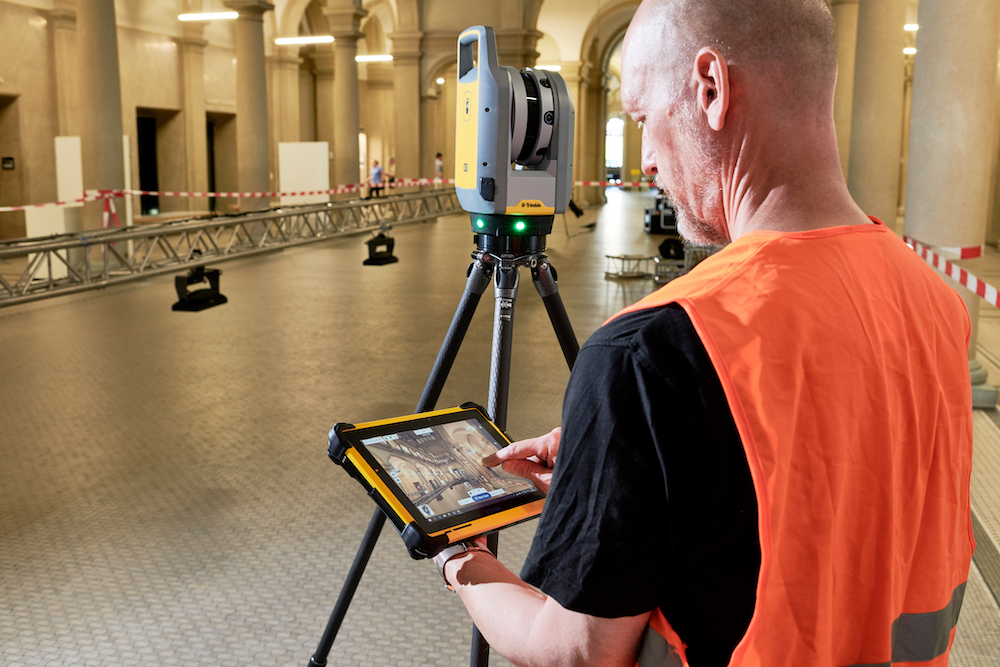
The compact laser scanner comes with the Trimble T10 ruggedized tablet for control and project visibility, along with a backpack and lightweight tripod for portability. Powered by the new Trimble Perspective software, platform seems to carry many advantages. The most talked-about feature may be the automatic registration, which is done without the need for targets, saving time and ensuring accuracy throughout, but it has many additional features that professionals are likely to find useful.
Compared to other scanners in the lineup, the X7 has been outfitted with several time-saving and automatic features, including automatic leveling, an automatic calibration function and full, in-field registration. The Perspective software also includes the ability to view 3D scans to ensure their completeness before leaving a jobsite and to add field notes within the scan.
According to Gregory Lepere, marketing director of optical and imaging for Trimble Geospatial, Trimble has endeavored to make the software as intuitive as possible.
“The X7 is a useful, everyday tool because it doesn’t require scanning expertise to operate. It opens the door for more construction, surveying, industrial and forensics professionals to confidently capture and deliver scan data and realize a faster return on investment.”
The X7 also includes high performance cameras to create panoramic images that can be integrated within projects. This allows for the export of a fully registered, photo-colorized point cloud before even returning to the office. The combination enables scans and images to be captured, fully registered together, refined, controlled and exported to a variety of established data format for Trimble and non-Trimble software.

The new Perspective software platform can export directly to other file formats.
For surveyors, the X7 seems to be a powerful tool inside of a rugged package. The scanner itself carries an IP55 rating for water and dust protection. It is also significantly lighter than previous models, weighing a total of 5.8kg (12.7 lbs), and a promotional video by Trimble shows it being able to be transported in a manageable, soft-sided backpack rather than a bulkier hard case. It also comes with a two-year warranty as a guarantee of its toughness.
The Trimble X7 is expected to be available in the first quarter of 2020 through Trimble’s authorized Distribution Networks. For more information about the X7, visit: Trimble Buildings and Geospatial.


