

In some shape or form, laser scanning to create three-dimensional models has been around for decades, with the first systems being invented in the 1960s. For engineering purposes and how we generally think about it today, it’s been about 30 years strong with these tools being one of the backbones of pre-construction planning phases, and more recently as a tool to be used during construction. That being said, usage of these scanning devices have largely been limited to a select group of firms who have both the financial wherewithal and the training capacity to take advantage. The good news: This is changing, specifically thinking about the subset of reality capture, everything from scanning large facilities and areas to singular objects within a site, is becoming much more democratized, allowing more firms and people in than ever before.
That’s not to say things are wholly accessible by any stretch, which is something we’ll get into a bit more in-depth later in the piece, but over the last few years massive strides have been made at a rapid pace. Newer methodologies like SLAM have become more mainstream, and a number of companies have released new hardware that aims to broaden the scope of who can complete some of these scanning jobs. With more intuitive, easy-to-use products becoming available at lower and lower price points, laser scanning projects are no longer just limited to large, well-trained firms, but open things up to younger and leaner organizations – and in some cases even non-professionals – to take advantage of the technology.
Reality capture prices come down to Earth
If you ask any project manager for what they consider when presented with the opportunity to utilize new technology in their workflows, particularly in the AEC industry, cost is going to be high on that list, if not at the very top. And thinking specifically about reality capture technology, for most organizations it was simply too expensive to seriously entertain adoption. This, again, limited the firms who were able to offer these services to the very large ones, keeping smaller companies out of the area up until very recently. Not only that, but it also limited the scope of work which would be done with laser scanning, as it simply wasn’t worth it to invest such high costs into frequent scans or scanning smaller areas and/or objects.
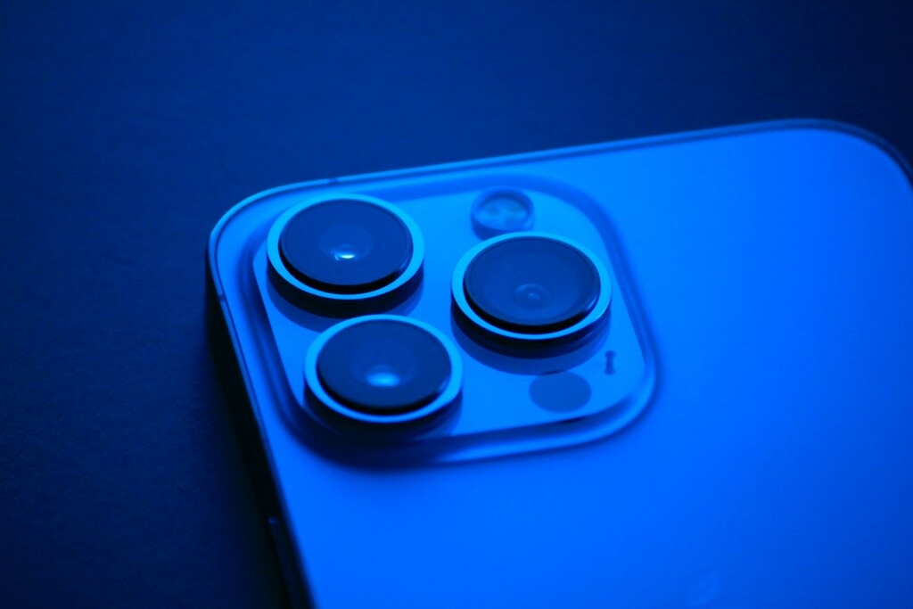
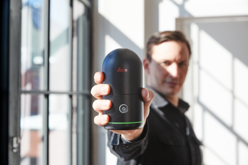
This reality has been changing rapidly over the last five to ten years. In that time, much more palatable price points have been unveiled on a lot of these projects, particularly looking at handheld reality capture scanning devices. Companies like Leica with their BLK360, along with GeoSLAM and NavVis, among others, have put out high-quality scanners with price points in the five-figure range (and usually on the lower end of that range) in US dollars, down considerably from where things were at the turn of the century and allowing a wider range of firms into the entry point in the industry. The price point becomes even more accessible when you consider that even newer version of Apple products like the iPhone and iPad now include a lidar sensor right on the back of them, meaning technically a whole lot of professionals – and non-professionals – are actually carrying a reality capture device right in their pockets nearly all the time.
Making reality capture easier to use
Cost was only one of the major barriers medium and small companies encountered when considering to utilize reality capture on a more regular basis. Even with the pricing issue largely pushed aside, there is still apprehension about the complexities involved with capturing these scans. Traditionally, using reality capture tools meant a lot of training, which can be both costly and time-consuming, keeping people away from other important jobs on their docket. And even just thinking about the physical scanners themselves, a lot of the traditional methods involve heavy and bulky scanners that can be difficult to move, especially with just one person on the job.
As with pricing, these concerns are overblown at this point as the ease of use has improved tremendously. Many of the newer options available for professionals today are handheld or wearable, mobile scanners that take advantage of SLAM technology which allows for self-location and positioning. These can be easily manipulated by a single person, and training is minimal to ensure that an entire site is captured. With these tools, a worker can simply walk an entire site with one of these scanners and capture everything that needs to be captured. This not only simply makes things easier on the workers and frees up more time for other important work, but it also allows for more scans to be completed to get a better picture of a construction project as it’s ongoing. That’s, of course, just one of many use cases in which this simpler workflow can be utilized. Individuals can even take advantage of their lidar-enabled Apple products to, among other things, create models of their home which can be used for planning in renovations or re-decorating projects.
The future of reality capture should only be more accessible
While reality capture is already a fast-growing field, it is only going to become more crucial for many stakeholders in a variety of sectors. Industries such as construction are embracing the value of 3D visualization more and more, and importantly are recognizing how important it is to have updated visuals to ensure maximum knowledge of what is happening on-site. All of this means that reality capture is going to be an increasingly important part of that process. The good news is that the technology should only improve moving forward, with strides still to be made even considering the increased accessibility in recent years.
We’ve talked a lot about price and usability in this article, and those should only improve in the coming years. That means more companies are able to affordably and comfortably make use of this technology. Perhaps even more notable than those continued improvements will be the continued improvement in accuracy. While a lot of the tools discussed above have certainly made it easier for smaller organizations and non-professionals to start their own reality capture workflows, they are also generally less accurate than more traditional tools. That’s fine for some projects, but it still presents a limitation for larger projects that require greater degrees of accuracy. This is perhaps the most important development those in this field can look forward to, with handheld scanners and even those devices in most of our pockets having the capacity to complete what would have been unimaginable even 20 years ago.
There are still strides to be made in the full democratization of reality capture, but it’s certainly hard to argue that rapid progress hasn’t been made in the last decade, and one can only hope that pace continues, or even increases, in the coming ten years.
Want to learn more about the latest in reality capture? Attend the 2023 edition of Geo Week!
Geo Week features more than 180 solutions providers showcasing the latest technology across the disciplines under the Geo Week umbrella – AEC, 3D technology and geospatial/lidar. A powerful conference program will detail practical applications, best practices, and innovative approaches to complex projects. Thousands of attendees will be onsite to network, explore market-specific challenges, and make headway on the larger issues facing the industry as a whole. Registration is now open - click here to register today.


