Intergraph’s Mobile Responder enables access to CAD system on smartphones, tablets
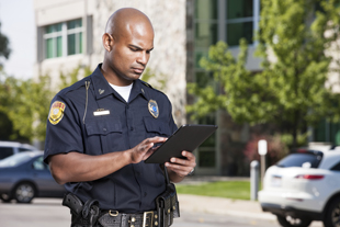
Intergraph Corporation, a global supplier of engineering and geospatial software, on Tuesday released its Mobile Responder, which uses GPS in smartphones to give police, fire and emergency management personnel in the field access to its computer-aided dispatch (CAD) system on mobile devices.
Accessible on Apple iPads, iPhones, and Google Android smartphones and tablets, Mobile Responder can be used as a standalone unit or as an extension to Intergraph’s Mobile for Public Safety software.
Now, firefighters can take a smartphone or tablet into a building to gain situational awareness, and the location of police officers can be instantly known while they are on foot at an incident.
“Mobile Responder changes the way emergency personnel function in the field. Having the technology to be in direct contact with the CAD system while in the field keeps them safer in dangerous situations,” said Kalyn Sims, vice president, public safety portfolio, Intergraph SG&I. “Using Mobile Responder, personnel can also create or update an event from the field, saving time and increasing accuracy.”
Huntsville, Ala.-based Intergraph, a part of Hexagon AB, a global provider of design, measurement, and visualization technologies, operates through two divisions:
- Security, Government & Infrastructure (SG&I), which provides geospatial solutions to the public safety and security, defense and intelligence, government, transportation, photogrammetry, and utilities and communications industries
- Process, Power & Marine (PP&M) provides enterprise engineering software for the design, construction, operation and data management of plants, ships and offshore facilities


