

One of the most striking aspects of walking around the Geo Week show floor is noticing the number of distinctly different types of companies exhibiting. There are obviously commonalities among all of them with some sort of relation to the geospatial industry, but the ways they relate to the broader industry tends to vary.
Among the more unique companies I had the opportunity to speak with during this month’s three-day event in Denver, Colorado was Remote GeoSystems. The company is not a new one in the industry, having been around since 2011, which makes them a veteran by the tech industry’s standards. Remote GeoSystems, based in Colorado, self-describes as “solving the challenges in capturing, displaying, and managing large volumes of geotagged video.” Geo Week News caught up with Managing Director Jeff Dahlke to learn more about the company’s latest offerings.
Dahlke provided background on how the company has progressed over the years, going back to a 2010 alert from the North American Electric Reliability Corporation (NERC) asking facility owners to review conditions of their power lines. Dahlke points to that as being, in his opinion, one of the things that set off a push towards lidar, but it also generated interest in capturing full motion video to determine if lines were built as they were designed. For two or three years, Remote GeoSystems provided software to enable users to click on a structure in a CAD program and cue a video of that location.
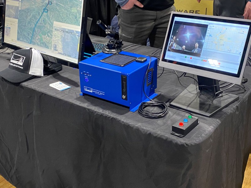
This was the birth of what is today known as LineVision, the company’s software for working with geospatial video data. Eventually, customers began asking for this to be integrated into platforms like Google Earth and Esri – and it now is – and ultimately wondered if there was an easier way to get the actual video content. It was these questions that led to the development of Remote GeoSystems’ flagship offering on the hardware side, the geoDVR, a “multi-channel geospatial full motion video recorder and moving map system in the geoDVR lineup designed to capture continuously georeferenced videos files and metadata from today’s modern 4K Ultra HD and high-definition camera sensors.”
The latest generation of the geoDVR, the Gen4, was released in 2022 and was on display at the company’s booth at Geo Week 2024. Among the features Dahlke mentioned was that the system is camera-agnostic, and some of the optional modules that can be added on. He talked about modules to be able to drop a waypoint, for asset management and alerts, and even for live stream capabilities.
On the software side, Dahlke focused mainly on LineVision Online, which provides an option for using this solution as a web-application rather than a desktop one, with both cloud-based and on-prem offerings. He told Geo Week News that this is a product they’ve had “for a few years,” but it’s primarily been behind a firewall for enterprise customers.
“Now, we’re looking to roll this out more towards a large audience. Instead of having six figures to spend on behind a firewall application server system, we’re making this more of a turnkey solution. People can go online, put in a credit card, upload their video, share out to customers and colleagues, and collaborate.”


