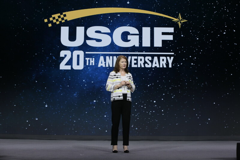
Last week in Florida, the United States Geospatial Intelligence Foundation (USGIF) held its annual GEOINT Symposium, with this year’s event being held at the Gaylord Palms Resort in Kissimmee. This was a particular special GEOINT Symposium, marking the 20th anniversary of both the foundation and the symposium itself. With a theme of “Essential in all domains and dimensions,” the 2024 GEOINT Symposium included 245 exhibitors on the exhibit hall floor along with 215 speakers across a large and diverse conference schedule and representatives in attendance from 30 countries and 48 academic institutions.
As one would expect with this kind of milestone event for both the foundation and symposium, there was plenty of looking backward at how far the broader “geospatial intelligence” sector has come. The conference opened on Monday with a video showcasing the journey GEOINT and the USGIF have come in the last two decades, before USGIF CEO Ronda Schrenk and former National Geospatial-Intelligence Agency (NGA) director Robert Cardillo took the stage and looked at some of the work being done by intelligence personnel today.
That really set the tone for the next three days of listening to sessions, checking out what the exhibitors had to show off at their respective booths, and networking among industry professionals. Amid all of that looking back at how far they’ve come in the last 20 years, the real focus was on where the geospatial industry broadly and the geospatial intelligence sector more specifically is today and where it figures to go in the next 20 years.
With that in mind, below are three of the biggest takeaways Geo Week News had from being in attendance for the three-day event.
Collaboration in all forms
For the most part, the biggest takeaways from this conference from the perspective of Geo Week News was certainly the tools and technology on display throughout the conference schedule and on the show floor. That being said, the easy number one takeaways was far less tangible, with nearly every conversation at some point delving into the idea of needing to work together. This came in a lot of different forms, too, whether it was about different agencies working together – i.e., the NGA and the Space Force in order to get crucial intelligence derived from satellites into the right hands as quickly as possible, to give one example – or collaboration between the public and private sectors.

Given how complex geospatial data is just in general, and then adding in the extreme additional complexity that comes from intelligence workflows, it makes sense that having as many hands on deck as possible. In terms of the inter-agency collaboration that was discussed, many of the specifics around any barriers that have existed were largely kept under wraps, which is to be expected. That said, the gist of these conversations were around how fast this information is often coming to be and how quickly it needs to be acted upon, which makes that kind of comprehensive collaboration much easier said than done. Still, representatives from just about every intelligence arm, as well as military branches in the United States government, including the CIA, made a point to emphasize just how important geospatial intelligence is to their work.
Also interesting was the acknowledgement of how important the private sector is to these missions. This hasn’t necessarily always been the case, but as years have gone on the US intelligence apparatus has had to turn to the private sector more and more. There are a few reasons for this, but one that was covered extensively by public sector speakers throughout the show was the sheer speed private companies tend to move at compared to their public sector counterparts. The fact of the matter is that developments within the government are often limited to some extent by bureaucracy, which means they may not always have the cutting edge at their fingertips. Certainly, some work is done by tools that are developed in-house, but it was clear from this conference that the intelligence apparatus wants the private sector to know that they are a highly important part of this puzzle.
The proliferation of satellite data
Whereas shows like Geo Week and others that focus more on the enterprise side of business, particularly in the AEC industry, more heavily feature lidar and other similar technologies for ground- and air-based data capture, this show focused on the intelligence space understandably had different technologies on the display. Most notable among them was imagery collected from satellites. This, of course, is not surprising as intelligence agencies and professionals generally can’t fly into hostile areas to collect information from closer to the ground. As such, collecting this data from satellites is crucial to these workflows.
Because of this, the exhibit hall floor was notably dominated by satellite companies and others who produce software that helps derive insights from the resulting imagery. We recently published insights from a conversation Geo Week News had with Motoyuki Arai, the founder and CEO of Japanese satellite company Synspective. That conversation was more focused on the commercial side of their business, but they were one of many companies showing off their latest satellites and the capabilities they provide.
In a lot of ways, this theme of the show interacted well with the previous takeaway around collaboration, particularly in the public-private collaboration piece of the conversation. For a long time, the ability to launch satellites, particularly for things like imagery rather than communication, was largely in the purview of the public sector only. However, recent years have made manufacturing and, more importantly, launching satellites from private companies significantly easier. That, combined with the aforementioned aspect of private companies generally moving more quickly with innovation, means more intelligence is coming from space than ever before, and from different corners of the industry.
Digital twins are here and in use
Somehow we’ve come this far without once mentioning the current boom around artificial intelligence, something that’s basically unheard of in today’s environment when talking about any conference that touches technology. That’s not to say that AI was not part of the conversation at all the 2024 GEOINT Symposium. It was, in fact, a constant point of conversation. However, we’re now at the point where AI itself isn’t necessarily the center of conversation, but rather part of a bigger topic. That was certainly the case around satellite imagery, where AI is being leveraged to derive key insights from these massive datasets.
It’s also the part of this final takeaway around digital twins. Another former buzzword, digital twins have become more practical in commercial applications over the last year or so – at least in part thanks to AI making the real-time streams of data more manageable – and it turns out that’s the case in the intelligence and military realms as well. Speakers talked about how they’ve utilized digital twins for modeling potential scenarios based on intelligence derived from satellites, and using accurate 3D models to help practice potential battle scenarios.
Digital twins were also a big topic of conversation on the floor. Tying things back to the previous takeaway, Geo Week News spoke briefly with a representative from Sedaro, who is creating digital twins of satellites that allow manufacturers to simulate potential scenarios in orbit and quickly detect any anomalies with these systems. Companies like Cesium had prominent booths on the floor as well, showing off how important having accurate 3D representations in proper geospatial context is for planning, both for the commercial sector and for those working in intelligence.