
Lidar technology from GeoSLAM is being used to map forests as part of the Centre for Research-based Innovation (SFI) SmartForest in Ås, Norway. SFI SmartForest aspires to put the Norwegian forestry sector at the forefront of technological advances and Industry 4.0, resulting in large efficiency gains in the forest sector, increased production, reduced environmental impacts, and significant climate benefits.
SmartForest will result in a series of innovations and be the catalyst for an internationally competitive forest-tech sector in Norway. The fundamental components for achieving this are in place; a unified and committed forest sector, a leading R&D environment, and a series of progressive data and technology companies. Although Industry 4.0 is still in its infancy, early adopters of smart factories or smart forests can see the benefits of interconnectivity.
Handheld terrestrial laser scanning for forestry applications
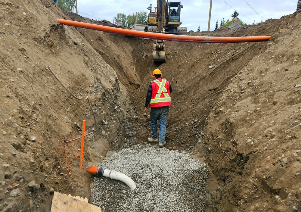
Led by The Norwegian Institute of Bioeconomy Research (NIBIO), the SFI SmartForest aims to bring industry 4.0 to the sector over an 8-year period. Focusing on silviculture, forest operations, wood supply, and the overall digital information flow, SmartForest is investing in sensible enabling technologies such as handheld lidar sensors, to help achieve its goals.
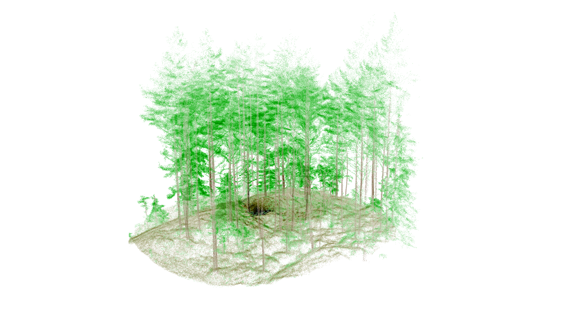
One such lidar solution is the GeoSLAM ZEB Horizon laser scanner, a handheld lidar scanner that can measure 300,000 points per second using 16 sensors with a relative accuracy up to 6 mm with a range of 100 meters. The points are used to produce dense 3D models of large areas, in a short period of time.
Walking and scanning with the ZEB Horizon captures data from beneath the forest’s canopy. The accurate point cloud data includes the forest floor, debris, tree trunks, and thick vegetation. When needed, UAVs capture the heavy vegetation of the forest canopy, merging both datasets.
Scan data provides the foundation for deep learning models
The team, headed by center manager Rasmus Astrup, regularly captures point cloud data in 250 square meter plots of land, with a further ambition to scan larger areas in the future. Some plots will be scanned repeatedly for detection of changes, but the use of drones and handheld lidar is more about scanning new areas quickly and efficiently to cover more plots and forest types.
The ZEB Horizons’ ease of use makes data acquisition a simple, repeatable task for Rasmus and his team and the high-accuracy data provides a foundation for deep learning models. He explains: “It is simply easy to walk through the forest with a scanner when it can be mounted on a backpack. It should also be highlighted that we experience much less challenges with occlusion (not seeing objects because they are blocked by other objects) when walking through the forest rather than having stationary scan positions such as for normal terrestrial laser scanning.”
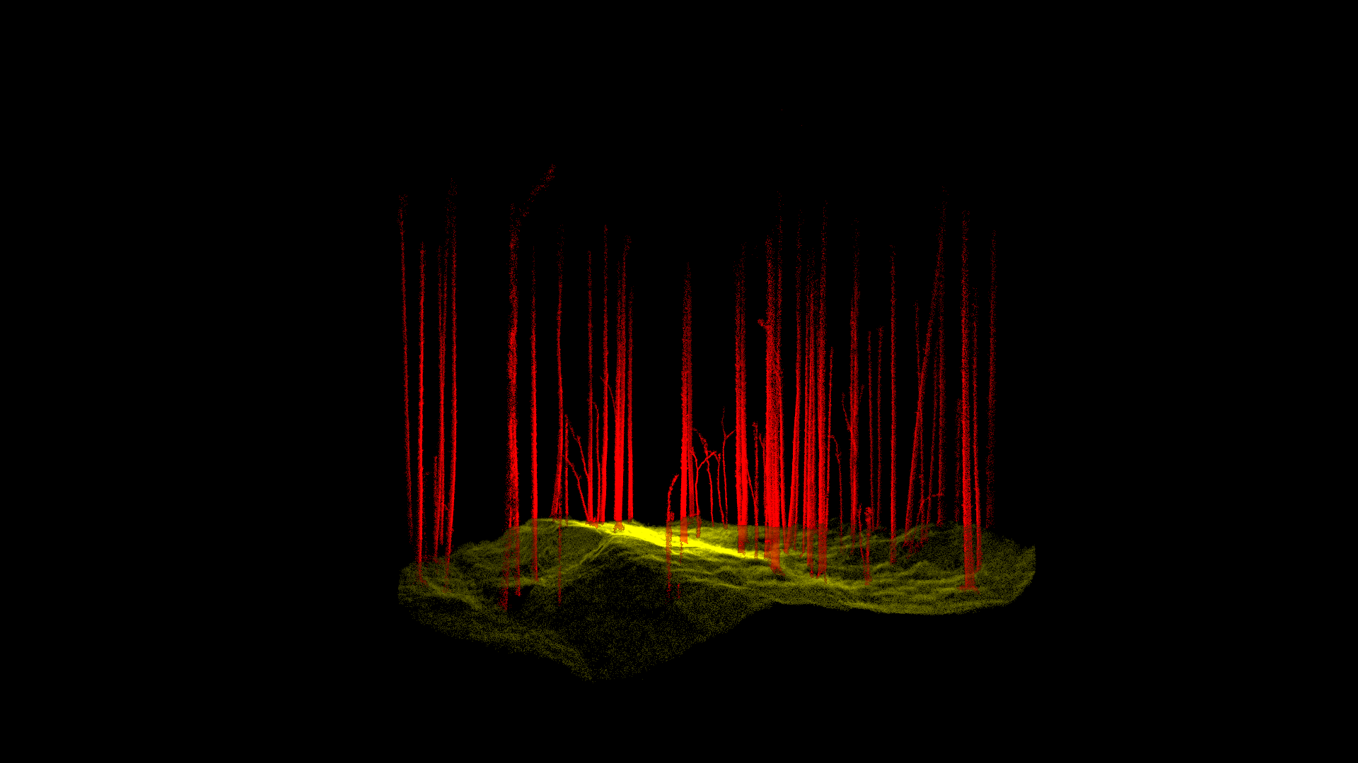
A part of the point clouds have been annotated and are used to train deep learning models. The models aim at both semantic segmentation of the points into semantic classes such as stems, ground, branches, etcetera, but also to instances of individual trees that are then used to derive variables of interest such as stem quality or volume, structure or biodiversity related indicators.
For large-scale applications, the use or air-borne or satellite-based sensors are preferable – for forests, Astrup and his team most often use airborne lidar if they wish results that are “good enough” to make decisions at the local level. The interesting question is if they can use the data from the ZEB to efficiently produce training data (ground truth data) for the airborne sensors. While the project is still in the early stages, SmartForest are already looking at other potential uses for GeoSLAM’s ZEB Horizon scanner, acknowledging the versatility of the handheld lidar solution.