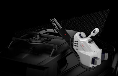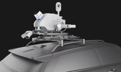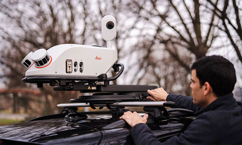
May 20, 2025 - Leica Geosystems, a part of Hexagon, has announced the introduction of its Leica Pegasus TRK300. Billed as “an adaptable system for various mobile mapping applications,” the Pegasus TRK300 gives users with different experience levels the ability to “efficiently capture high-quality point cloud data.”
Christian Schäfer, Business Director Mobile Mapping at Leica Geosystems, said, “The Pegasus TRK300 opens exciting opportunities for any business looking to enhance and grow their mapping capabilities, from identifying potholes to optimizing city center traffic flows.”
In a statement, Leica Geosystems detailed the many features of the Pegasus TRK300. The system includes a multi-beam scanner system with two scanning heads to capture “detailed, high-resolution data from multiple angles to minimize data gaps.” This scanning system has a range of up to 300 meters and “provides comprehensive coverage over wide corridors and large open areas, reducing the need for multiple passes.”
In addition, the Pegasus TRK300 features a “robust design” for “reliable operation in challenging conditions including heavy rain or dust” and seven hours of battery life. Moreover, Leica Geosystems said, the Pegasus TRK300 “seamlessly integrates with Leica Pegasus FIELD for efficient data capture and system monitoring during the data collection process and with Leica Pegasus OFFICE for advanced postprocessing and creating final deliverables.”
Source: Leica Geosystems