

Mobile mapping has been around for a long time in technological contexts, first being established around the time GPS data became readily available, but the viability and accuracy of these tools are only increasing in recent years. A lot of that has been around handheld and wearable tools, which in turn has played a role in the increasing democratization of reality capture, but other methods with scanners attached to vehicles like cars are also seeing improvements as time goes on. One of the companies that has long been among those leading the way in innovations in the space is RIEGL, and a recent announcement continues that trend. Geospatial imaging company Mosaic announced earlier this month that their Mosaic X spherical camera is now compatible with RIEGL’s mobile mapping systems.
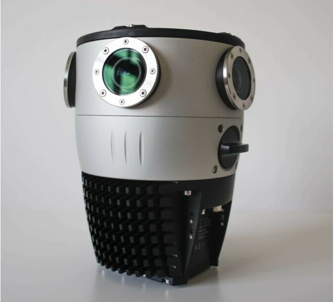
The Mosaic X, which was released earlier this year, was disruptive in its own right as a camera-based mobile mapping tool. The 360-degree camera produces accurate photos and 360-degree videos, as well as photorealistic 3D models, using photogrammetry rather than lidar scanning like many mobile mapping systems. The company touts the camera as the only 360-degree mobile mapping camera featuring global shutter for photogrammetry ability at highway speeds, making it particularly intriguing for those modeling infrastructure and street-view maps of local communities. Now, the advantages that come with using photogrammetry techniques rather than lidar scanners can be combined with those very same lidar scanners in the RIEGL V-Line scanning line.
Per the press release from Mosaic, their Mosaic X camera is able to meet the requirements necessary for integration with RIEGL’s VMX, VMQ, and VMY series because the development of the camera “focused on delivering a high-resolution, global-shutter, 360-degree camera with precise GNSS time stamping.” Now, users can reap the benefits of both photogrammetry and lidar techniques. The RIEGL scanners can produce highly-accurate point cloud data via their lidar scanners, while the Mosaic X can provide photo-realistic data from the same point. With the data from the two scanning methods combined, the data-rish, accurate, dense point cloud is enhanced with the photo-realistic accuracy, a much more understandable presentation than a typical point cloud for most people. That, in turn, will allow for more informed action plans resulting from the data, which is ultimately the goal for all of these projects.
RIEGL is one of the biggest names for lidar scanning in general, boasting products that can be used for terrestrial scanning, airborne scanning – both crewed and uncrewed – industrial scanning, in addition to the mobile scanning we’ve been talking about. Mosaic specifically calls out the VMY, VMX, and VMQ series of scanners from RIEGL as the tools with which the Mosaic X will be compatible. All of these scanners are used, among other applications, for use cases like mapping transportation infrastructure and modeling large areas like cities and towns. Mosaic, meanwhile, is another big name in the geospatial space, with a focus around photogrammetry techniques as opposed to laser scanning, boasting decades of experience in delivering high-quality cameras specifically for mobile mapping applications.
Now, users will have integrated tools from these two experienced companies to produce highly accurate, colorized point cloud data acquired from a combination of lidar and photogrammetry techniques. On how customers will benefit from this integration, Mosaic co-founder and VP of Engineering Rostislav Lisovy said, “The pairing between 360° imaging systems and mobile laser scanning systems, results in high precision LiDAR-based point clouds, colorized by photo-realistic images. This outcome will then have the benefit of both a precise point cloud and panoramic images – for precise measurements and evaluation of textures.” He’d add, “Our customers will be able to gather more valuable data which will assist in the process of automatically assessing the state of infrastructure from the point cloud data (rather than just from a panorama image).”


