By Benoit Cajelot – Fugro’s Regional Manager for Climate & Nature.
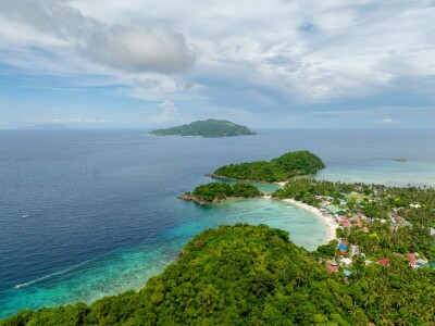
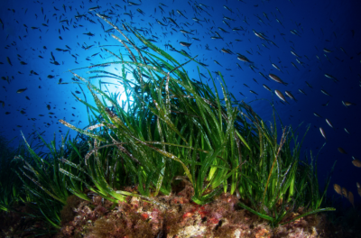
Seagrass meadows are some of the most valuable ecosystems on Earth. They store carbon, support marine biodiversity, and protect coastlines from erosion. In the Mediterranean Sea basin, Posidonia oceanica, a native seagrass species, plays a vital role. But it’s under threat. Pollution, coastal development, anchoring and climate change have caused these meadows to shrink by more than a third in the past 50 years.
Italy’s Marine Ecosystem Restoration (MER) project, led by ISPRA and supported by NextGenerationEU funding, aims to reverse this trend by preserving and, where needed, restoring marine habitats and strengthening coastal habitat monitoring systems.
The essential starting point is clear: better baseline data that is consistently collected, nationally integrated, and ready for decision-making.
From fragmented insights to a national picture
A common bottleneck in marine restoration is the lack of comprehensive geospatial insights. Fragmented datasets and gaps in coverage limit strategic planning, impact assessment, and the ability to scale successful local initiatives. Fugro, working with CGR, EOMAP (a Fugro company) and PlanBlue, is closing this gap by mapping Italy’s entire coastline to locate and assess seagrass meadows and seafloor morphology.
This is one of the largest shallow-water mapping projects ever undertaken in Europe, and it represents a shift from fragmented data to a single, integrated view of coastal habitats that enables smarter, faster and more confident decision-making.
Why an integrated perspective matters
This national-scale dataset gives public bodies, port authorities, developers, conservation organisations, and insurers a shared view to:
·Target investment where it matters most: Focus restoration efforts where they deliver the greatest ecological and economic benefits
· Plan resilient infrastructure: Understand seabed conditions and habitat sensitivities to design projects that last
· Build stronger funding cases: Use clear evidence of ecosystem services, like carbon storage, fisheries, and shoreline protection, to secure support
· Show measurable impact: Track progress with transparent baselines and monitoring that demonstrate real change over time
· Bring stakeholders together: Align decisions around trusted data and clear performance metrics.
Put simply, better data lowers risk, shortens timelines, and increases the likelihood of a project’s success.
Tackling complexity with confidence
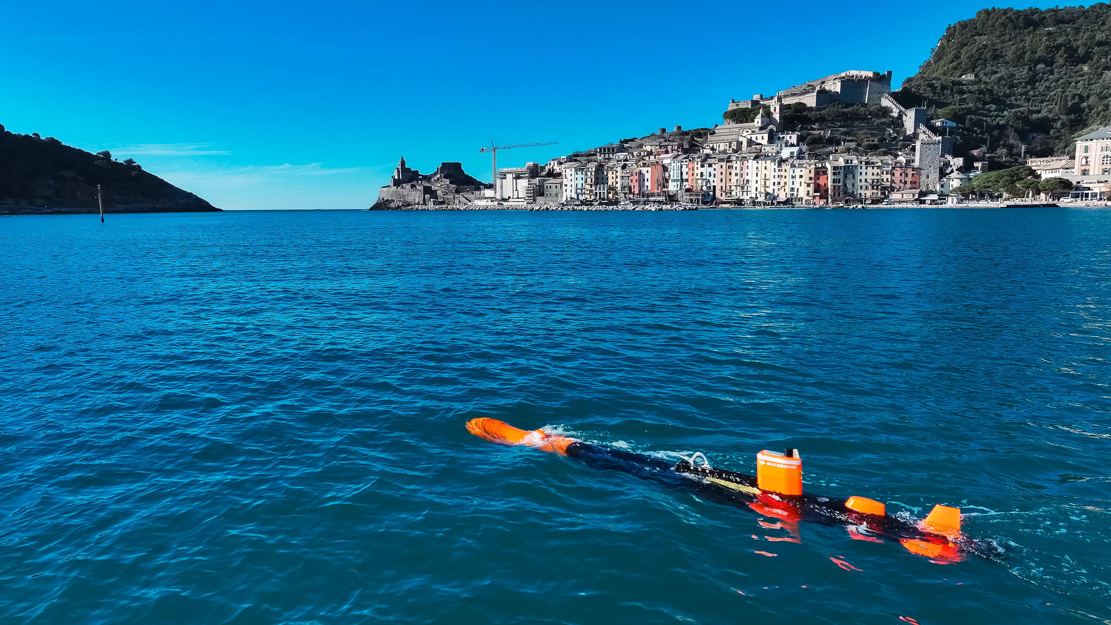
To deliver these outcomes, we combine satellite-derived bathymetry, airborne lidar bathymetry (ALB), multibeam echo sounders (MBES), and AUV-based validation surveys. Together, they create a seamless dataset from land to ~50 metres depth, which is essential for understanding how coastal systems are changing.
All datasets are precisely positioned using advanced GNSS and integrated into Italy’s national reference system. This allows us to produce high-resolution digital elevation models with centimetre-level precision, providing the accuracy needed for reliable analysis and informed decision-making.
We also use Virgeo®, Fugro’s cloud-based data management platform, to keep everything on track. It gives our teams, and our partners, real-time access to project data, vessel locations and progress updates. That means faster decisions, better coordination and more efficient operations.
“It’s not enough to use remote sensing, lidar, or autonomous systems on their own, you need to combine and integrate them into a dynamic, digital system,” said Giordano Giorgi, Project Director at ISPRA. “Without that integration, we won’t be able to turn diverse data into meaningful results. Our coastlines are complex, and mapping them requires a flexible, integrated approach that brings all these tools together.”
To make this possible, we go beyond simple data collection. We normalise intensity values across sensors like MBES and ALB to ensure consistency, a critical step for machine learning and automated seafloor classification. This process turns raw, multi-source data into a unified dataset ready for advanced analysis and actionable insights.
Building a clearer picture for seagrass restoration
Once integrated and processed, the data is classified using machine learning to identify where Posidonia oceanica is growing and where it’s under stress. We also map other seabed types like rock and mobile sediment.
We then segment the data into regions based on shared characteristics. These segments are grouped into thematic classes, validated using high-resolution seabed orthomosaic captured by autonomous underwater vehicles. These images, taken just a few metres above the seabed, give us a clear view of seagrass coverage and health.
Quality and consistency remain essential. We apply rigorous controls to maintain accuracy across all sensors and combine multiple layers, such as slope, aspect, backscatter and intensity, to produce high-resolution habitat maps designed for restoration planning and long-term coastal monitoring.
A sustainable future starts with knowledge
The MER project is more than a technical achievement in shallow-water mapping, it’s a commitment to protecting our oceans and the life they sustain. Most importantly, it demonstrates that the technologies exist to move from local initiatives to national-scale projects. By combining cutting-edge innovation with deep expertise, we are helping Italy build a sustainable future.
Our work gives ISPRA the knowledge it needs to make informed decisions about its marine environment. When we understand the seafloor, we can take meaningful steps to safeguard the ecosystems that support life above and below the waterline.
*The activities are carried out within the framework of the NextGenerationEU investment projects – Mission 2: “Green Revolution and Ecological Transition,” Component 4: “Protection of Land and Water Resources,” Measure 3: “Safeguard air quality and biodiversity through the protection of green areas, soil, and marine areas.” Investment 3.5 has been planned: “Restoration and Protection of Seabeds and Marine Habitats.”
Visit Fugro at Oceanology International 2026 (Oi26) on Stand E600. The world’s leading forum for ocean science, engineering and technology returns to Excel London from 10th to 12th March 2026, connecting more than 8,000 attendees and with every continent in the world represented. For more information or to register, visit the Oi26 website.