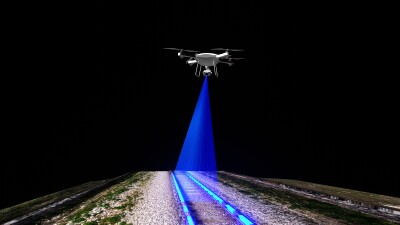
Over the last couple of years at Geo Week News, we have covered some of the major changes that have come to the world of topobathymetric surveying. A number of different technologies have improved to the point where this work is more powerful than ever, and given how important monitoring these coastal areas is for keeping up with the effects of climate change, the improvements came at a perfect time. Lidar has now shrunk to the point where hybrid systems with both lidar and RGB imagery sensors can be put within one system, and of course the lidar has increased in power over time. UAVs have also improved to the point where they can now carry the necessary payloads to complete this work in some instances. On the software side, processing and analyzing this data has also become easier than ever.
Despite all of these improvements, though, the most powerful analysis can still often come from hybrid workflows. This is a truth that permeates throughout the geospatial industry. Every individual type of technology has improved significantly in recent years and the capabilities for these tools have either grown, or at least exceeded previous marks in established workflows. And yet, when you talk to end users they will still tell you that the most effective workflows still come when different tools are combined, each being matched with their area of strength to create a cohesive deliverable. Software improvements have made this combining of data easier, though of course part of being able to take advantage of these combinations is simply being able to afford all of the different tools in the first place.
Getting back to topobathymetric surveying, the ideal combination for many workflows is bringing together data from the improved aerial sensors and sonar data to get the full picture of what’s happening both on the surface and underwater. Each of these technologies has their own strengths, but also shortcomings in specific areas. For the airborne lidar tools, as noted lidar has improved to be able to collect data in shallow waters, but turbidity and waves can affect this data collection, and there is a limitation to how deep they can scan even in near-perfect conditions. Sonar, meanwhile, generally cannot collect data where boats are unable to travel since most sonar sensors are used on boats, so that shallow water collection can be difficult.
The good news about these individual shortcomings is that they overlap almost perfectly, so projects that utilize both technologies can produce the best data. Using lidar to get the shore area plus the shallowest parts of the coastline, and then sonar to get data on the deeper and/or more turbid areas can produce a full land-to-seafloor surface map. There are, of course, issues with this strategy. A lot of this comes down to cost, as acquiring both of these sensors or even outsourcing collection to agencies with both – or two separate third parties – is not feasible for every agency. Plus, while software has markedly improved and artificial intelligence has made much of the processing and analysis easier, it is still a complex process to combine different datasets into a cohesive deliverable. There is training on the front end that needs to take place for these projects to really come together as envisioned.
Today, there are myriad types of projects that can benefit from this hybrid approach for mapping coastal areas. As alluded to above, environmental monitoring projects are among the most significant use cases for these maps. Governments need to have up-to-date maps of coastal areas to understand how much they can withstand during strong storms and simulate potential flooding effects. Coastal cities also need to have a strong understanding of subsea topography to create the most efficient navigation routes and to construct or work on port and other coastal infrastructure. Between the environmental effects on coastal communities and the increasing urbanization around the world, coastal mapping is as important as ever.
Looking forward, it’s not difficult to envision even more potential use cases for this data, or even just enhanced versions of current implementations. Governments are becoming more open to the use of digital twins for their planning and monitoring of areas, and this data could further enhance those digital twins. We could also start to see more accurate and detailed maps become openly available for public use, leading to potentially unforeseen use cases. That, in turn, could also lead to more standardization for how these types of hybrid workflows are completed.
Topobathymetric surveying has clearly reached a point where the technology is more capable and accessible than ever, but the real value continues to come from how those tools are combined. As lidar, sonar, UAVs, and software each push forward, it is the thoughtful blending of these capabilities that produces the most complete and actionable results. The challenges of cost and complexity will not disappear overnight, but the momentum is moving toward greater efficiency, stronger collaboration, and new possibilities for how coastal areas are mapped and managed.