

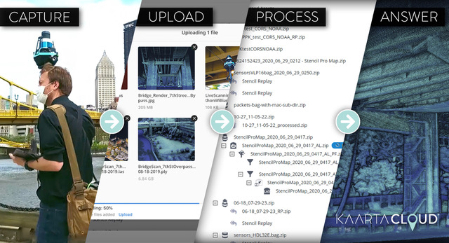
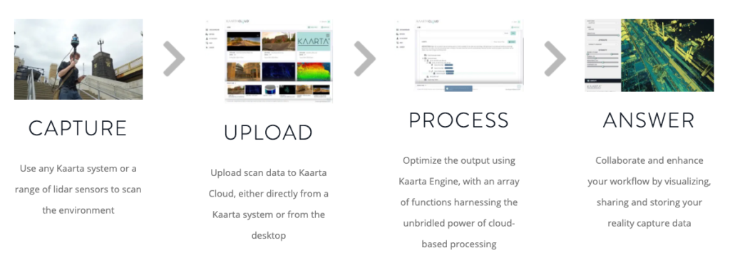
Perhaps the most necessary – but least enjoyable – part of reality capture is the slog of processing and file management. But, the days of processing pains may be approaching their end. Kaarta has just announced the availability of Kaarta Cloud, a critical step in their evolution of point cloud processing and management of large datasets. The cloud-based system is purpose-built for 3D data, offering a crucial piece of the workflow from field capture to finished outputs.
In the last few years, we’ve certainly seen a normalization and uptick in the adoption of cloud-based solutions across industries. However, those that are making the most significant impacts are cloud solutions built to do more than act merely as file storage (like GoogleDrive or Dropbox). Kaarta Cloud’s primary purpose is to offload the “heavy lifting” of the crucial processing step for large, 3D datasets, by bringing that process to the cloud. Kaarta Cloud also allows for more secure file sharing, with the option for auto-expiring links. Share uploaded files to coworkers or stakeholders, and you can control how long your file can be shared – as little as 1 hour or up to 30 days.
Kaarta touts that this solution will “far surpass” the computing power available on local workstations and Kaarta devices. By leveraging an ultra high performance parallel-processed network, their cloud product should easily decrease the time (and subsequent stress) of processing.
Using Kaarta Cloud also has the benefit of freeing up devices for more scanning, rather than leaving them tied up in processing. Workflows can be defined through a chain of tasks and executed with one button click, and multiple jobs can run concurrently for yet more efficiency.
“This platform for supporting digital twin creation is the most effective way to securely and efficiently optimize scans from both Kaarta devices and lidar sensors,” said Kevin Dowling, Kaarta CEO in a press release.
“What’s more, it will be expanded to turn the captured and processed point cloud data into answers that owner operators and other stakeholders need to manage their assets, whether that be 3D models, floor plans, slope analysis, volume analysis or seamless integration with other workflow platforms.”
In addition to working with data captured with Kaarta systems, Kaarta Cloud also processes data collected with lidar sensors. At launch, it supports the Velodyne Puck, UltraPuck and HDL32e. While lidar generates massive amounts of raw points of data, all of that data is typically ephemeral and relative to the sensor itself. Since lidar operates via line of sight, limited views of an environment or project can be challenging to handle. Kaarta Cloud uses advanced algorithms to process raw lidar data into a registered point cloud map, providing a persistent framework to the data which can be viewed, measured and further processed in one multi-vantage environment.
The workflow of Kaarta Cloud is designed to optimize operations, extract the maximum value from scans, and facilitate data sharing and collaboration through its secure cloud storage platform. Alberto Raschieri, Director of Italian architectural and topographical surveying company GeoMar, was a beta tester for Kaarta Cloud, commented on the affect on GeoMar workflows in a press release.
“Using Kaarta’s advanced mobile mapping system, our field survey capture is already agile and fast. Now the additional comprehensive processing such as geo-referencing that our jobs require is all handled by Kaarta Cloud. When we return to the office, the optimized point cloud is ready to be used. The entire operation from start to finish is incredibly efficient and effective.”
Kaarta Cloud is powered by Kaarta Engine, which is their own patent-pending advanced 3D mapping and localization algorithms – providing their highly accurate and robust maps. The uploaded files are automatically recognized by Kaarta Cloud and point cloud data can be optimize with an array of functions including filtering, loop closure, alignment to GNSS trajectory, colorization and conversion.
In June, Kaarta made waves by announcing their new professional-grade SLAM hybrid scanner, the Stencil Pro. Kaarta Cloud will work with the new system but also their entire line, including the Contour, Stencil 2-16 and 2-32. Because it is cloud-based, Kaarta Cloud will automatically incorporate the latest Kaarta software enhancements to the cloud, so users will not have to worry about personally keeping up with software upgrades.
This combination of the Kaarta’s approach to SLAM and the power of cloud-based processing is positioned to be a powerful solution for reality capture – both for SLAM and lidar.
A 30 day free trial is available and there are a number of monthly plans starting at $249 (US) per month to suit a variety of user needs. Interested users can register for the free trial at https://cloud.kaarta.com/register.


