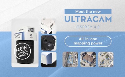
Vexcel Imaging recently announced the UltraCam Osprey 4.2, the company's newest generation pan-sharpening based large-format aerial camera system, designed for both nadir and oblique photogrammetric imaging.
Key features of the UltraCam Osprey 4.2 include a swath width of over 25,000 pixels in nadir, along with enhanced operational flexibility, reducing flight mission costs and improving area coverage. It delivers the highest-detail photogrammetric image quality, ensuring maximum productivity for 3D city modeling, infrastructure monitoring, and high-precision urban mapping applications.
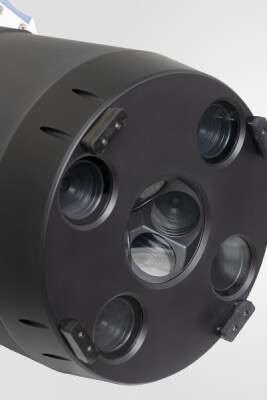
The UltraCam Osprey 4.2 is the first Vexcel system to feature the cutting-edge 247 MP Sony IMX811 CMOS sensor in combination with custom Vexcel lenses, fully resolving the resolution of the new CMOS sensor. Built with an advanced panchromatic nadir channel, the system delivers precise measurements for superior feature extraction, providing the best foundation for creating demanding derivative data products like 3D city models.
Proprietary software-based Adaptive Motion Compensation (AMC) technology eliminates all translational and rotational motion blur in nadir and oblique imagery, preserving full detail at long exposures and low ISO settings in a scale-adaptive manner. This allows users to fully leverage the high dynamic range of the new CMOS sensor, consistently ensuring crisp, high-accuracy imagery even in challenging conditions.
Advancements over the UltraCam Osprey 4.1
The UltraCam Osprey 4.2 brings several significant advancements over its predecessor, the UltraCam Osprey 4.1. One of the key improvements is the 27 percent increase in flight-line efficiency, achieved through a wider swath of over 25,000 pixels. This enhancement reduces the number of flight lines required, leading to more efficient data capture and potentially lower operational costs.
The software-based AMC has been tailored to the new sensor for utmost sharpness. AMC is Vexcel's innovative motion compensation approach that not only corrects image blur in the direction of flight but also addresses blur caused by multi-directional camera movements during a flight and compensates for ground sampling distance variations in oblique imagery.
Another key improvement of the Osprey 4.2 is the offering of an additional new lens system with a significantly longer focal length. This tele-lens system allows for high-altitude data capture while maintaining the same ground sample distance (GSD), expanding the system's operational flexibility and making it suitable for a broader range of mission profiles. Additionally, the UltraCam Osprey 4.2 introduces enhanced oblique imaging modes. Users can now select between several modes, including nadir-only and corridor mapping, providing greater versatility for specific project needs.
Finally, the integration with UltraMap software has been improved. UltraMap is now better equipped to handle higher-resolution data from the Osprey 4.2, enabling efficient processing and the generation of advanced 3D models, such as those required for LOD3 city modeling. This integration ensures seamless workflows, resulting in accurate and precise outputs for a wide range of photogrammetric applications.
Combining nadir and oblique imaging for 3D city modeling and precision mapping
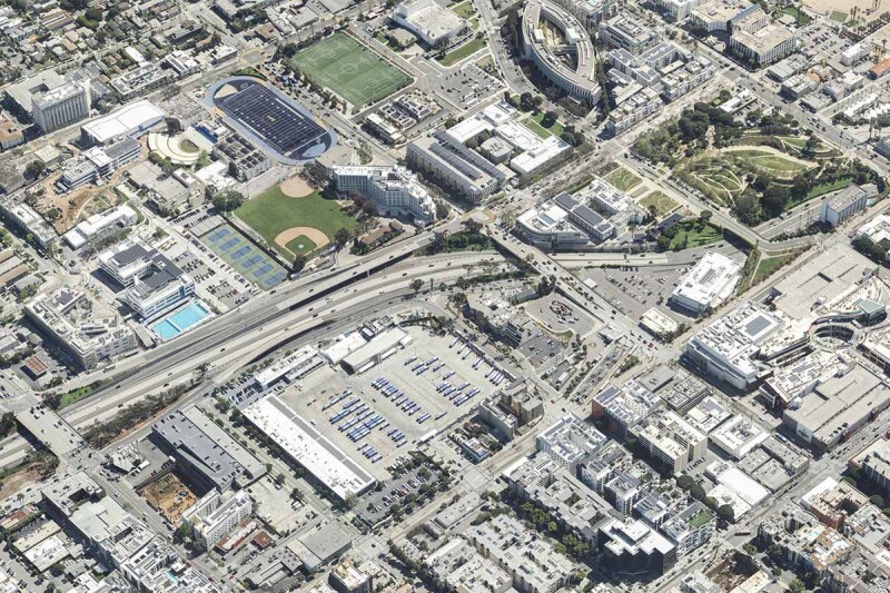
By combining both nadir and oblique imaging, the UltraCam Osprey 4.2 allows for the creation of highly detailed and accurate geospatial data that is crucial for a variety of applications. In 3D city modeling, for example, nadir images capture rooftops and street layouts, while oblique views add critical details like building facades, sides, and height information. This dual perspective is essential for producing LOD2/LOD3 city models used in digital twins, smart cities, and urban planning.
In precision urban mapping, such as cadastral surveys or asset inventories, nadir images deliver high-accuracy georeferencing for mapping property boundaries and city infrastructure. Oblique images enhance context by providing side views and elevation data, supporting tasks like object classification and vegetation analysis.
By integrating both image types, the Osprey 4.2 system delivers a comprehensive, scale-adaptive view of urban and built environments. This combination significantly improves the accuracy, detail, and interpretability of mapping results across a broad range of photogrammetric applications.