
earthmine is a Berkeley, CA startup developing a 3D street-level geospatial platform based on mobile terrestrial photogrammetry. The company’s vision is “indexing reality” – providing a practical, economic way to create complete digital inventories of urban environments to support the next generation of Web-based spatial applications. This story tells how earthmine used CAD-point-shooting technology from BuildExact, another innovator in 3D measurement and dimensional control, to lay out its optics workspace. (earthmine and BuildExact are both on the agenda at SPAR 2008, March 3-5, Houston, TX. Also see our profile of BuildExact’s technology.)
earthmine is the brainchild of co-founders and co-CEOs Anthony Fassero and John Ristevski, who met at the University of California at Berkeley and subsequently worked together at CyArk, the nonprofit organization established by the Kacyra Family Foundation to build a Web-accessible archive of 3D data from archaeological and World Heritage sites. Fassero has worked in Web development, asset and site management, and professional photography; he graduated from the University of California at Berkeley with a degree in architecture. Ristevski was formerly director of R & D at CyArk, and still teaches surveying part-time at Stanford.
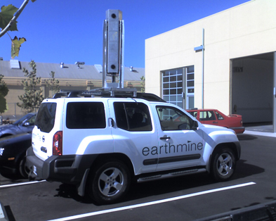
earthmine’s data collection technology uses a calibrated stereo-panoramic camera array to collect imagery at regular driving speeds along streets in cities or metropolitan areas. This imagery is processed into dense 3D point information using advanced stereo-matching algorithms, as well as seamless panoramic images supporting user interaction with the 3D data. Equally important are the company’s tools to let developers integrate earthmine imagery and 3D data into existing and emerging Web-based geospatial applications.
Continued
Workspace layout
earthmine’s camera rig incorporates six wide-angle cameras facing 120 degrees apart and spaced 1m vertically for stereovision. Calibrating the cameras requires imaging a 1x2m polka-dot target set up at 50 different positions successively – this is where BuildExact comes in. Its software lets a user select a point on a CAD model, then the software drives twin total stations to cast a visible crosshair onto a floor, wall or other surface – locating the point in space that was selected in the model. (Figures 2 and 3.)
Continued
Camera calibration
After the optics workspace was laid out, BuildExact was called back to help earthmine in the camera calibration process. The calibration software requires two inputs: the image of the board at each position, and the survey coordinates of its 4 corners.
BuildExact acquired 3D coordinates of the 4 corners of the polka-dot board, accurate to 0.5mm in x,y,z, according to BuildExact CEO Pierre Bierre. The BuildExact system relies on three setup control points and two total stations, each acquiring a directional fix on the unknown vertex. The software uses mathematical ray intersection to determine the point. EDM is not used – Bierre explains that the advantage of ray intersection is that the system is not dependent on a surface to reflect back a laser signal. This allows very precise surveying of edge and corner vertices (depth discontinuities). Also, he says, hitting a target surface at a shallow, glancing angle poses no problem of depth ambivalence.
Fassero and Ristevski will present earthmine’s technology in a track dedicated to New Technologies at SPAR 2008, March 3-5, Houston, TX. Construction applications of BuildExact will be presented by Bierre in SPAR 2008’s Facilities/BIM Integration track.


