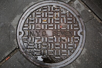
As cities grow older and denser, the infrastructure buried beneath their streets becomes harder to track, and the consequences of not knowing what's down there can be deadly. A recent Geo Week News webinar brought together five experts in land surveying, GIS, and utility engineering to discuss the state of underground infrastructure mapping and the technologies reshaping the industry.
The Legacy Data Problem
At the heart of the challenge is decades of incomplete, paper-based records. Survey firms and utility companies alike have inherited hand-drawn sketches - sometimes from the 1950s or earlier - that may be missing critical measurements, stored in deteriorating file cabinets, or simply lost to floods and fires. The panel agreed that digitizing these records is step one, but that alone isn't enough.
As Jason Graf (SAM NY) put it, the goal is getting data "into a system of record where all stakeholders have access for the lifecycle of the asset."
What's Really Underground
The panelists didn't shy away from the chaos that awaits when a trench is opened. Photos of tangled telecom lines and layered pipe networks illustrated why a simple 2D map falls short. Tim Massi (National Grid) noted that surprises in the ground always cost money, and the 2010 San Bruno, California gas explosion served as a stark reminder of what's at stake when records fail.
Capturing Data in the Field
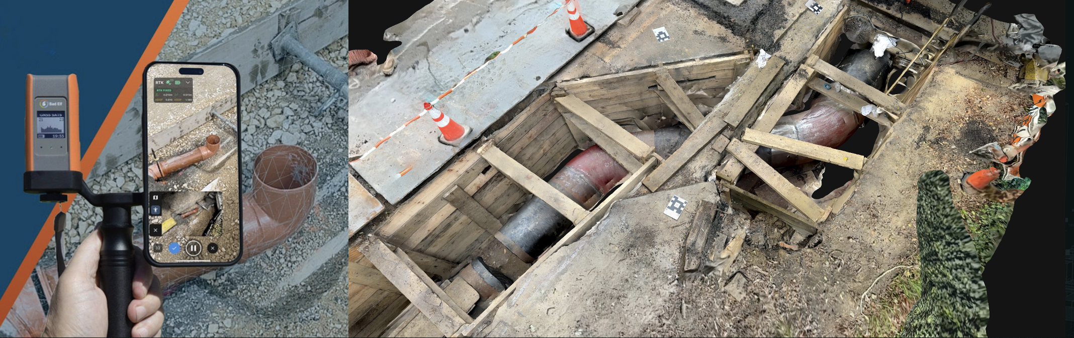
The conversation shifted toward practical solutions for capturing better data at the source. Rather than waiting for a project to be completed and then attempting to reconstruct what was installed, panelists advocated for digital capture at the moment a trench is open. Tools range from traditional total stations and RTK GPS to smartphone photogrammetry platforms like Pix4D Catch. Tom Cerchiara (Pix4D) emphasized scalability: utilities can't deploy a licensed surveyor to every distribution project, so the tools need to be accessible and affordable, even a cell phone can now capture meaningful georeferenced data.
Urban Challenges
Working in dense urban environments like New York City adds another layer of difficulty. GNSS signals are unreliable in urban canyons, and labor agreements can complicate who is permitted to collect data on a job site. The solution, panelists agreed, is the flexibility of combining traditional survey control with modern capture tools, and post-processing mobile data against ground control established by conventional means.
Technology Adoption
For organizations evaluating new technologies, the panel recommended starting small. Demonstrating quick wins, like providing utility locators with a digital CAD product instead of paper markups, builds internal buy-in and reveals workflow gaps before a large-scale rollout. James Melachrinos (Con Edison) noted that the technology is often the easier part; integrating it into existing workflows and getting organizational alignment is the real challenge.
What's Next
Looking ahead, panelists were enthusiastic about Gaussian splatting as a tool for creating hyper-realistic 3D base maps without the overhead of traditional BIM modeling. AI-assisted data interpretation, gigapixel cameras, and augmented reality smart glasses for field crews were all cited as near-horizon developments. On the interoperability front, the consensus was clear: platforms that open their APIs and support data exchange standards will win; closed ecosystems will be left behind.
The Bottom Line
The $30 billion annual cost of not knowing what's underground in utility strikes, service outages, injuries, and deaths makes this more than a technical problem. It's a public safety imperative. The good news? The tools to solve it are increasingly affordable, scalable, and powerful. The challenge now is building the workflows, governance, and organizational will to deploy them at scale.