

We know the capabilities of GIS are ideal for complex workflows that involve any sort of spatial component, allowing users to layer multiple datasets in a geographical context to streamline crucial analysis. This is why so many governments around the world rely on GIS and other geospatial analysis to make decisions that impact the large populations they serve, with nearly every department having some use of the technology. In the context of fire, we’ve covered recently how GIS helped form the base of a new awareness tool around wildfires, with commentary from both Esri and Dr. Lori-Moore Merrell, the then-U.S. Fire Administrator.
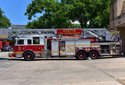
It’s not just the wildfire realm in which GIS is proving helpful, though. For general firefighting duties, particularly in urban environments, we are starting to see more areas embrace geospatial analysis as a crucial part of their work. Generally, these departments are still relatively small – think around five analysts for departments with 1000+ sworn firefighters – but they are growing, and proving their value. Recently, Geo Week News spoke with Braniff Davis, who is a senior geospatial analyst with the Austin Fire Department, as well as Mike Cox, director of fire, rescue, and EMS solutions with Esri, about these trends and how the technology is being used today.
Cox, who previously worked in fire departments prior to joining Esri, noted that he is seeing trends toward more technology – and specifically, geospatial data – being used within the firefighting community.
“Historically in the United States, the fire service has been a volunteer service, so less organized,” he told Geo Week News. “Now we’re starting to see more organization. And certainly, as we have growth and population density increases and you’re providing more services, you’ll see more effort around deploying these technologies to help [fire departments] run their day-to-day operations.”
Davis, who had extensive experience as a GIS analyst before joining AFD, said it hasn’t been much of a problem getting boots-on-the-ground firefighters on board with utilizing this technology, saying that they can be “nerds” about many different topics, including mapping.
“I found that any time we introduce a new feature in [Esri’s ArcGIS] Field Maps, I’ll take them outside in the field next to our station and just be like, Okay, this is how you collect points. This is how you add a line or a polygon,” Davis said. “Once they get over the sort of initial, I don’t know how this works, once they figure it out, they’re really into it.”
As became clear in conversations with both Davis and Cox, once the value of this technology and data starts to show up, there is no argument from anyone in the field about whether or not they should be using it. At the end of the day, the goal for fire departments is to keep their people safe and to protect the citizens they are charged with protecting. Geospatial data and GIS tools are verifiably assisting in that work, so it’s logical that there would be little argument from those in the field about using these tools to whatever extent they can.
Generally, that involves collecting data while out in the field and inputting what they are observing into Field Maps, often using a tablet or phone that is carried around for different calls. The data can then be used to help in real-time and in post-event analysis. In real-time, Cox talked about how these tools make the jobs of those in a command post that much easier, having a much better context of everything happening around a site.
In Austin, Davis spoke about how these tools were used to help when 2021’s Winter Storm Uri rocked the region. That uncharacteristic week of weather brought freezing temperatures, ice, and snow to areas of Texas that never see those kinds of conditions, which resulted in deaths, property damage, and mass power outages across the region. As this was happening, Davis recalled how the city used Field Maps to create a situational awareness platform.
“We had fire crews go out and tag if there were trees that had been brought down, or limbs, or any sorts of hazards,” Davis explained. “In 24 hours, we turned around this platform where we had the fire crews go out and collect the data, and we would use that data and assign, for example, the Texas Fire Service to go out there and cut down the tree. Once they did that, they could go back into the program, check it off, and say that task was completed. That’s an example of how, in an emergency, we were able to quickly use GIS and Esri tools to solve a problem that no one really had a solution for at the time.”

In addition to these on-the-fly solutions leveraging geospatial technologies, both Davis and Cox spoke about how these technologies can be used to review processes within departments and understand how they can be improved. Davis explained that, for example, the goal is for a truck to arrive at an emergency within eight minutes 90 percent of the time. Analysts in AFD are constantly running analyses around response times using GIS to see what stations may be missing this mark and then using that data to determine why that’s happening. This, again, improves the safety of the surrounding communities and helps the firefighters do their jobs better.
“[GIS] keeps the firefighters safe, and I put a fire truck in front of a house 30, 45 seconds sooner because I’m using the right technology for route planning. That’s a win, and obviously the right way to use technology to provide better services,” Cox said.
While there are clear differences between many processes involved in “traditional” urban firefighting and fighting wildfires, there is of course plenty of crossover. We have seen in recent weeks that the crossover is often direct with the wildfires that have ravaged Los Angeles and surrounding communities. Davis, in fact, points out that Austin is one of the most at-risk cities for wildfires in the country outside of those in the far western states. His specific work, in fact, often revolves around wildfires, with GIS tools being used to find specific areas of risk.
Looking forward, it’s expected that geospatial data and technology’s usage within the firefighting community will only grow. Cox notes, for example, that a professional qualification standard for a fire data analyst, known as NFPA 1022, was just recently created. Down the road, he sees things like 3D viewing capabilities – something that is already being used in L.A. – and artificial intelligence will be more involved in day-to-day capabilities. Additionally, he foresees the ability to track the exact whereabouts of a firefighter on X, Y, and Z coordinates within a structure to be known in real-time from a command post, calling that the “holy grail.”
Firefighting isn’t going to be the first sector that comes to mind for anybody when thinking about technology usage, but the value is clear and, according to Davis, there is little pushback to any tool that will demonstrably improve safety for firefighters and the community.
“Once you show a firefighter that these tools will help them in their job, they’re good to go.”


