GeoSLAM Connect 2.0 release
Launched in 2021, GeoSLAM Connect 2.0 is an automated processing platform that provides users with the flexibility to process their data to their exact specifications, all through a series of script-based workflows. Many features of Connect are particularly useful for the mining sector, including automatic georeferencing.
Developed on GeoSLAM’s new operating system, LiDAR OS, and powered by the next generation SLAM algorithm, GeoSLAM Beam, the platform is compatible with the ZEB family of products. Its lightweight scanners can be utilized across a plethora of industries, including construction, real estate and engineering, mining and architecture. The platform minimizes the time and effort needed to manually process datasets, and will provide operators with the freedom to use a range of point cloud cleaning tools to create clean, georeferenced point clouds.
For example, a customer who always scans shafts, or long tunnels, can now apply a predefined SLAM that is suited to these environments. Before, GeoSLAM used a generic SLAM as standard and, if required, some parameters would be changed to suit. With Connect 2.0, the best SLAM is applied to suit the customer’s needs, meaning less down time and a higher first time processing success rate. The data can be then delivered in the best possible format, with the right method of processing applied to suit the delivery of the data. All of this is delivered through code-based workflows which can easily be tailored to suit the customer.
Data processing with Connect 2.0
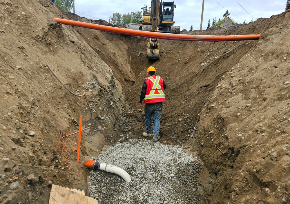
GeoSLAM Connect processes and manages data generated by the ZEB-series of handheld laser scanners, and can be configured to perform end-to-end analysis of this data. Every ZEB scanner is dispatched with Connect 2.0, that hosts many solution-based workflows tailored to real-world problems, including new mining solutions, Production Progress Mapping, Convergence Analysis and Vertical Shaft Inspection.
Once the scan is complete users can automatically process the data by simply connecting the scanner to their computer. The GeoSLAM Connect Software then automatically processes and manages the collected data before being uploaded and exported to view as a 3D data images. Data is processed, filtered, and exported in a suitable format to suit the given application. Filters include a noise filter, range filter, intensity filter and more can be applied.
Particularly useful for mining is the ‘Stop and Go Georeferencing’, allowing users to use ‘adjust to control’ to georeference the data set. Known control points are captured during a scan and are automatically compared and matched to the associated coordinates during the processing stage in Connect 2.0. A rigid and/or a non-rigid adjustment can be made to the dataset and an accuracy report is exported highlighting how successful the transformation was.
Production Progress Mapping
Building on its well-established reputation within mining, the first of its new applications is GeoSLAM Production Progress Mapping – which, when coupled with a ZEB scanner and its own internal coordinate system, allows operators the flexibility to make short-term operational decisions on newly-mined production areas in quick time in a ‘mining-to-plan’ process.

Once the data from each scan has been automatically processed and georeferenced using GeoSLAM Connect, it can be uploaded to any compatible third-party software. Operators will be able to overlap collected data and precisely visualize changes of an area over time to compare with project plans, giving mine owners the freedom to analyze, make real-time decisions and avoid production hold-ups.
Change detection is now a standard feature of Connect 2.0, meaning that users can process and georeference scans before comparing multiple point clouds and highlighting areas of change. Production Progress Mapping is used to measure a change due to human factors, such as mining the materials. A key stage in this process is the ability to automatically georeference the data. Having two datasets of the same area leads to the simple process of running change detection.
The georeferenced data can be viewed as a 3D digital point cloud of the scanned area, to understand the environment. Additionally, operators have the flexibility to make short-term operational decisions on newly-mined production areas quickly in a ‘mining-to-plan’ process.
Production Progress Mapping compiles the datasets to be exported as universal file formats compatible with existing third-party software, seamlessly integrating into systems including Micromine, Deswick and other leading mining solutions. Over time, multiple point clouds can be combined to create cross sections, mesh or solids and compared against a design or plan. This feature means data can be optimized for exact task requirements, and the time-consuming hassle of learning a new system.
Convergence Analysis
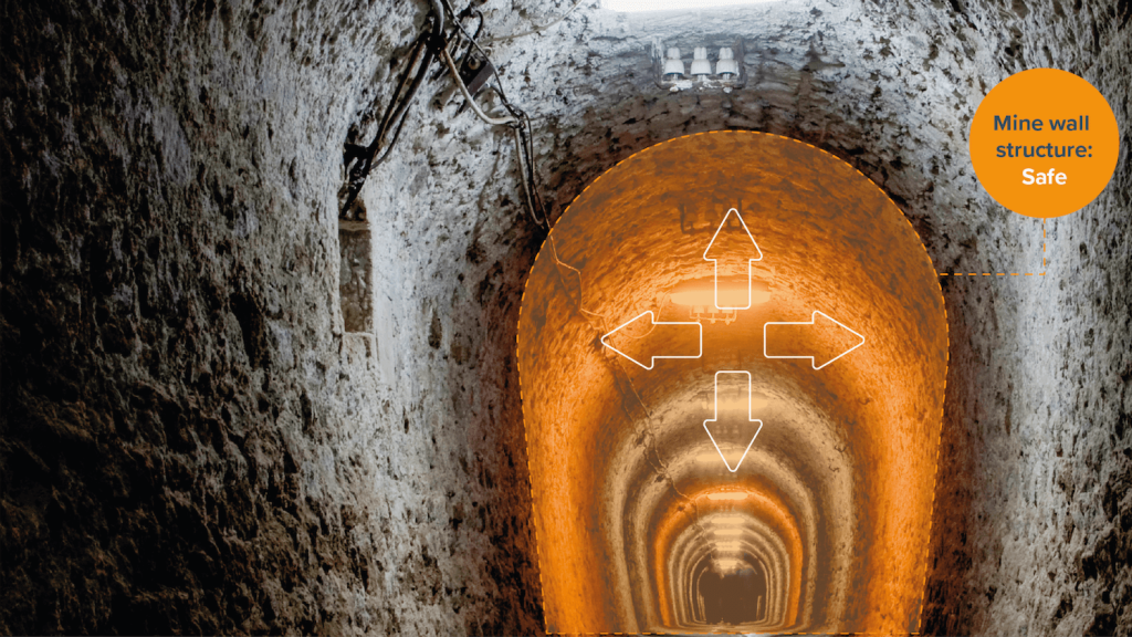
Mining has long been viewed as a hazardous occupation, but digital technologies like GeoSLAM’s new Convergence Analysis are reshaping this outlook by providing mine owners with a rapid and cost-effective way to understand the environment while keeping miners safe.
Utilising GeoSLAM’s unique SLAM (simultaneous localization and mapping) algorithm to create clear 3D visualizations, mine operators will be able to quickly measure rock support – including detecting failure points, the velocity of change, potential slope and areas of displacement – all while remaining at a safe distance, and without the need to disrupt crews, due to the speed of capture.
The ZEB Horizon has a collection rate of 300,000 points per second, an accuracy of up to 6mm (when processed in GeoSLAM Connect 2.0) and the ability to capture precise measurements within a 100m range capacity. The ‘walk-and-scan’ method of data collection offers fully-mobile technology to safely and easily move around mining tunnels, with or without control points.
GeoSLAM Convergence Analysis provides a rapid, regular and cost-effective way of understanding potentially dangerous changes in mine wall structures. Detecting velocity of changes in rock movement is not only operationally important, but also acts as a critical indicator of potential slope and rockface instability.
Dangerous areas can be captured much faster than previously possible, increasing the ease and speed of obtaining repeat scans. This reduces the risk by decreasing the time that miners need to be in dangerous areas to gather data. A greater number of datasets provide more information and therefore, clearer pictures of the mines structure and stability. For particularly hazardous areas, the flexible cradle, pole, vehicle mount and UAV mounting options can be deployed to access hard to reach and unsafe spaces. In addition, the ZEB Revo RT has the ability to be used fully remotely using GeoSLAM’s remote access solution.
Purpose-built shaft inspection
Completing the trio is GeoSLAM’s purpose-built shaft inspection cradle, built for collecting data during inspections and analysing change. From above ground, it allows users to understand the erosion of a shaft wall, view blockages and identify hanging points for ore in hard-to-reach and dangerous vertical shafts.
The cradle is a secure device that a ZEB handheld scanner can be mounted to, in order to be vertically lowered into shafts, wells or other access points, collecting the data using lidar technology and keeping teams out of harm’s way. Teams can capture accurate information without the need to enter and physically inspect the underground areas.

Utilizing the cradle, users can scan the surface before lowering the device into a shaft or void, to easily map and visualize the subsurface features as well as those directly above it. This seamless transition provides surveyors with accurate data to determine if any surface features are at risk due to weaknesses below the ground. All three solutions can be used above ground as the data captured from the ZEB devices is sent automatically to the GeoSLAM Connect software.