Esri has released a new version of its desktop GIS application, ArcGIS Pro. The new update is available from November 8 and includes many new tools and features as well as performance, productivity and quality improvements. An extensive overview of all newly added features and tools in Pro 3.2 is found here. Of particular interest are the availability of 3D basemaps and 3D Tile support.
3D Basemaps
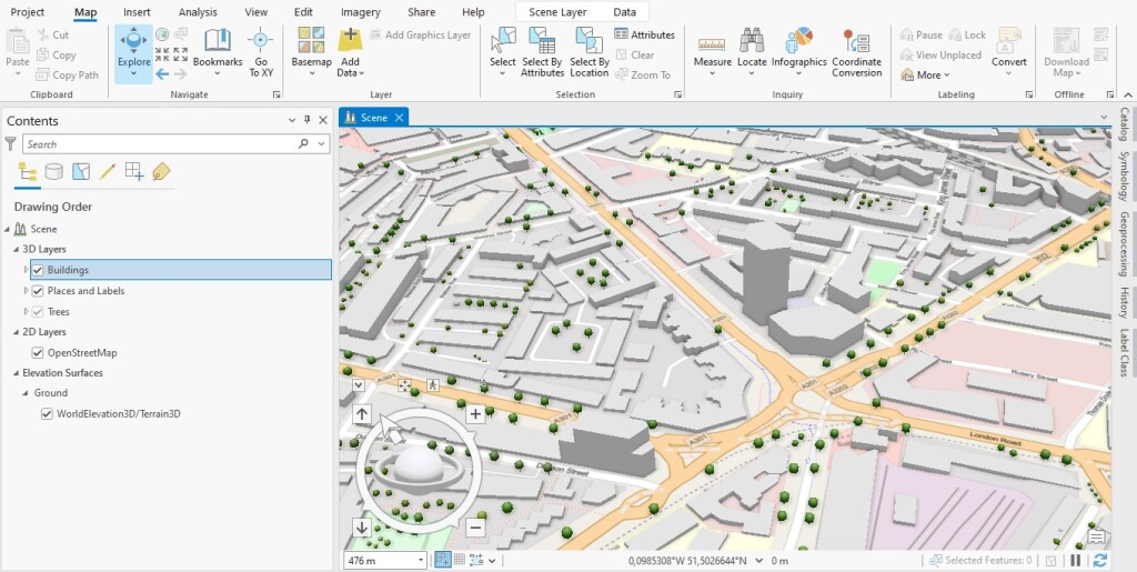
Basemaps serve as reference maps on which geographical data is displayed. They provide a foundation for the user’s map and add context to location data. Users could use a set of predefined basemaps or create their own, using multiple feature, raster or web layers. Until now, these were only available in 2D. ArcGIS Pro 3.2 includes for the first time 3D basemaps. These are designed for local and global scenes. As opposed to 2D maps, they allow GIS users to visualize, analyze and manage geographical information in three dimensions. A global displays data that spans the entire globe, while local scenes use a smaller extent.
3D basemaps for Pro include labels, buildings, and trees data, to which users can add their reference data. If that data interferes or overlaps with these basemap data, you can draw a mask to exclude overlapping 3D basemap layer data, after which you can turn on your layer and visualize your 3D data. To add a 3D basemap to a local or global scene in Pro, the user’s active portal needs to be set to ArcGIS Online. The basemap gallery offers eight different 3D basemaps.
3D Tiles Support
3D Tiles is an open standard for massive, heterogeneous 3D geospatial datasets such as point clouds, buildings, photogrammetry, and vector data. 3D Tiles is a streamable, optimized format designed to tap the potential of 3D geospatial data. The format was first introduced in 2015 by Cesium, an open platform for software applications, and became an OGC Community Standard in 2019. Google now uses 3D Tiles to render its Photorealistic 3D Tiles through its Maps API. A 3D Tiles Github repo can be found here.
3D Tiles are similar to the I3S format, a declarative and extendable data format that can be used to represent different types of 3D data. Pro already offers data visualizations of I3S Scene Layers, that allow users to work with integrated mesh and 3D object data types. The latest Pro release adds support for adding 3D Tiles layers directly to visualize large amounts of 3D data for explorative analysis, such as adding a viewshed to analyze which features are visible or not from a specific point.
The idea behind the integration of 3D tile layers into ArcGIS Pro is to create more 3D realistic data visualizations used for animations, layouts, analysis and exploration tools. The online documentation of Pro offers extensive information on how to work with 3D tiles layers in Pro, such as adding a 3D tiles layer from a .json or .3tz file, or ArcGIS Online or a third-party web server.