

Esri has long been among the global leaders in GIS software, location intelligence, and mapping, with their ArcGIS software serving as the leading GIS software globally. Realizing the direction of the industry towards smarter digital twins utilizing imagery from UAVs, crewed aircraft, and satellites, the Redlands, California-based company has added new software to the ArcGIS platform, announcing the release of their ArcGIS Reality software earlier this month.
This new release enables accurate 3D mapping to form the basis of digital twins for whatever size project a professional may need, looking at something as small as a single job site to potentially as large as an entire nation. As Esri points out in their announcement, the digital twin space is rapidly expanding the market for aerial imaging, which is expected to reach $4 billion in value by 2025, nearly quadrupling where it stood back in 2017, an 14.2 percent compound annual growth rate.
This new ArcGIS Reality software will comprise a family of four products all running on the ArcGIS Reality engine. Those four are, from the Esri announcement:
- ArcGIS Reality for ArcGIS Pro—a new extension of Esri’s flagship desktop GIS software, allowing users to input images from drones or crewed aircraft to generate 3D outputs for reality mapping.
- ArcGIS Reality Studio—a new focused application for reality mapping from aerial images for entire cities and countries. A map-centric intuitive interface enables high production efficiency to deliver survey-grade representations of reality.
- Site Scan for ArcGIS—Esri’s cloud-based end-to-end reality mapping software for drone imagery, designed to simplify drone program management, imagery data collection, processing, and analysis.
- ArcGIS Drone2Map—an intuitive desktop application focused on reality mapping from drone imagery, enabling offline processing and in-the-field rapid mapping.
With the new software now available, a variety of industries will be able to benefit from Esri’s expertise in locational intelligence in creating their digital twins. The data captured by the various tools – whether they be aerial-, drone-, or terrestrial-based – are used by many different industries, and it’s a group that is only going to continue to grow as the value of having these accurate models becomes more readily apparent. This new offering allows that reality capture data to be added into a model and layered with GIS and BIM data to create a truly useful and valuable model for professionals.
That is a sentiment that was echoed by Esri founder and president Jack Dangermond, who said in a prepared press statement, “Digital twins have become a critical tool for many industries, and to be effective they rely on highly accurate and up-to-date maps and 3D models derived from imagery. We are happy to offer this new family of products to the professionals who are digitizing our world to help us all better understand it—whether their operations are large or small, local or global.”
That this new platform from Esri can support larger scale digital twins is particularly exciting given how much more prominent that these are becoming. Governments, both at a local level as well as national, are seeing the value of having accurate models of their cities and countries. Singapore’s is perhaps the most famous of these nation-scale models, with the United Kingdom also having a program to develop their own, while small island nations like Grenada and Tuvalu are doing the same. With these models, governments have greater capacity to do things like prepare for natural disasters by being able to simulate various scenarios, as well as improve sustainability initiatives, among other use cases. These large-scale digital twins is not a new addition to the Esri product line, to be fair, but this update with incorporated reality capture data allows for more detailed, and therefore more actionable, models.
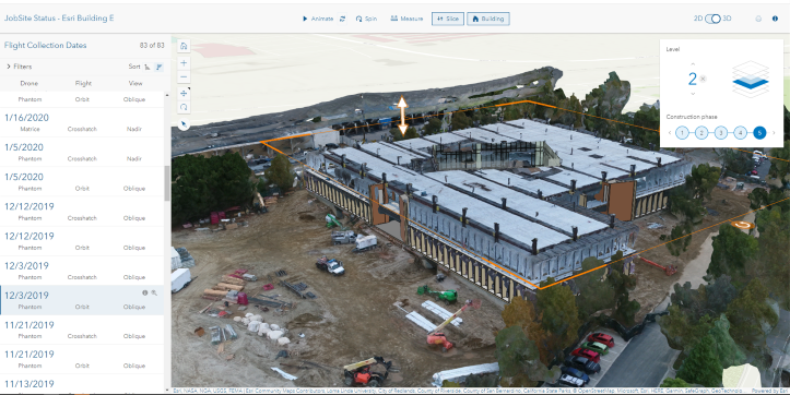
These tools are of course valuable for smaller missions as well. Looking at a city level, these models can provide a key base for smart city implementation, with key decisions being made with the information available from these digital twins. Construction companies use this imagery, including from drones using ArcGIS Drone2Map and/or Site Scan for ArcGIS, to create models of their job sites, getting the ability to monitor changes throughout the life of the project. And for all of these entities, plus plenty more, the demand for accurate models will only grow as the metaverse becomes closer to reality, especially on the industrial level.
In order to get these models, imagery is needed to form the base. Laser scanning takes care of some of that on a smaller level, but in building larger-scale models that imagery is largely pulled from aerial methods. That Esri has now released a product to power the collection and implementation of this reality mapping data, along with other imported data like BIM and CAD, with GIS opens doors for simplified and powerful analysis and actions.
As Dangermond said in his keynote address at Geo Week 2023, speaking of the power of combining all of this data, “This idea that it manages and measures data – remotely sensed data, GPS data, in situ data – that allows us to visualize it and map it, it allows us to model and predict things. It allows us to then, my profession, design on top of that science and then applying that science all the way down to asset management and construction and activities. So, GIS is not simply a technology. It’s also a process and a framework for applying the very work that you do.”


