

One of the more important developments in the world of surveying and mapping in recent years has been the increased accessibility in implementing drone technology with lidar sensors. We recently talked with SPH Engineering CTO Alexey Dobrovolskiy about the benefits for surveying by using lidar-enabled drone, which extends the possibilities of what can be mapped, including areas with heavy vegetation that other cameras and sensors cannot penetrate. It’s a market that is quickly growing, with one estimate indicating the market is projected to grow from $147 million USD in 2022 to $508 million USD. We can certainly expect to see plenty of companies jump on this market as it continues to grow, and Censys Technologies is one of the latest.
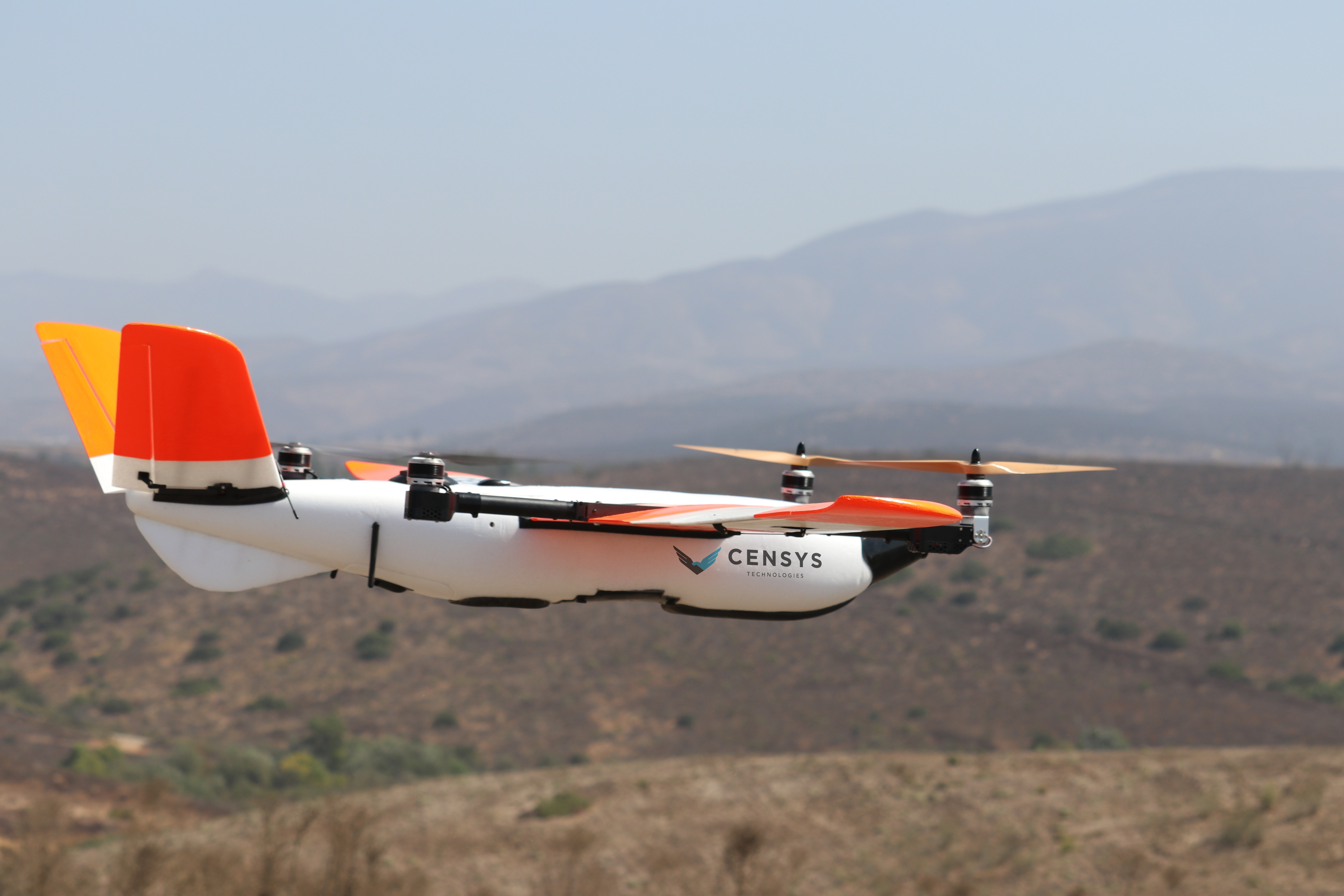
Censys Technologies, which builds remote sensing solutions for a variety of organizations and entities, announced last month that they will be integrating lidar into its fixed-wing vertical take-off and landing (VTOL) drone, the Sentaero. The Sentaero is a fixed-wing line of drones produced by Censys, with models for both visual line of sight (VSOL) and beyond visual line of sight (BVLOS) options. The BVLOS model can be retrofitted for a number of different applications, most of which will certainly benefit from the addition of this lidar payload. In a single flight, the lidar payload has a system precision of 2.5 centimeters, and accuracy of 3 centimeters at 100 meters above ground level.
The Sentaero was already an intriguing option for aerial mapping and surveying for a lot of different use cases, with the BVLOS model in particular fitting that bill. Given its 56-mile range and the ability to fly out of the operator’s view, the potential coverage area for an aerial survey, for example, is quite large. There were already a number of use cases for this drone even without the lidar, as other payloads allowed for some surveying and things like search and rescue missions, among plenty of other use cases. But lidar can add more to these possibilities in combination with the other advantages of a VTOL BVLOS drone. Traditionally, lidar drones have been quadcopters rather than a fixed-wing model.
Censys Technologies is based in Daytona Beach, Florida in the United States and is still a young company, having been founded back in 2017. Despite relative youth, they have already made plenty of inroads with a number of different industries, including surveying and mapping, agriculture, public safety, and utility work. They offer the two Sentaero drones discussed above, and in addition they offer the Sentourion Mobile Command Center, which their website indicates can add 50 miles per week of working distance when used in conjunction with the Sentaero drones.
We are going to see more and more companies make it easier to implement lidar technology into drones, and different kinds of drones. Whether it’s on the sensor side, making the sensors lightweight enough to maintain the same flight capabilities while also ensuring the accuracy of the scans are still up-to-par with customer expectations. On this new addition to the Sentaero line, Censys Technologies CEO and co-founder Trevor Perrott said, “In a fixed-wing VTOL with a history of BVLOS approvals, this is a huge addition to the Sentaero line. We’ve been working hard to integrate LiDAR over the past year to fill customer needs, and now operators who had been chained to quadcopters have a new option to do more.”


