Bathymetric data is a crucial piece of many maritime industries, but can be difficult to obtain due to the scattering of light in water. Getting this information is essential, however, as it provides information for navigation, marine resource management, climate change research, disaster management, and underwater mapping and exploration and many other applications. Without accurate bathymetric data, it can be difficult to make informed decisions about the use and protection of valuable - and vulnerable - coastal areas and waterways.
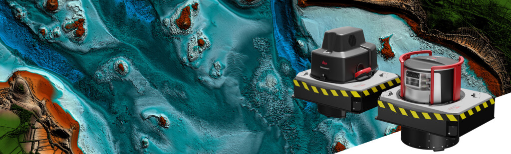
In February, Leica Geosystems, part of Hexagon announced a new airborne bathymetric lidar solution - the HawkEye-5, aiming to provide more efficient airborn bathymetric lidar measurements. The Leica HawkEye-5 expands the capabilities of the Leica Chiroptera-5 bathymetric lidar system, enhancing the productivity of applications that rely on accurate bathymetry.
Hear more about the sensor and its development from Anders Ekelund below: