It is becoming clear in the 3D and reality capture industry that there is never going to be a one-size fits all tool for performing reality capture tasks. There are different tools for different scales - everything from satellites mapping city-sized swaths of land to lidar-enabled apps for personal mobile devices and everything in between. For many projects, there is a need to be able to bring together data from a variety of sources (for example, UAV and terrestrial survey data), which has been historically difficult to manage.
To address this need, 3DUserNet has added online viewing and tools for Imagery, 360 Panoramics, Textured Meshes, Orthographics, Mapping and Documentation, to its existing Point Cloud and Model capability in a major new product launch. 3DUserNetVISION is a new online viewing and collaborating portal for survey data, with additional collaboration features to make working with 3D data even easier for distributed teams, says 3DUserNet CEO, Paul Snudden.
“It’s all about getting great survey data to customers and stakeholders as quickly as possible, looking as good as possible on any device and getting discussion and actions going immediately to dramatically increase efficiency”
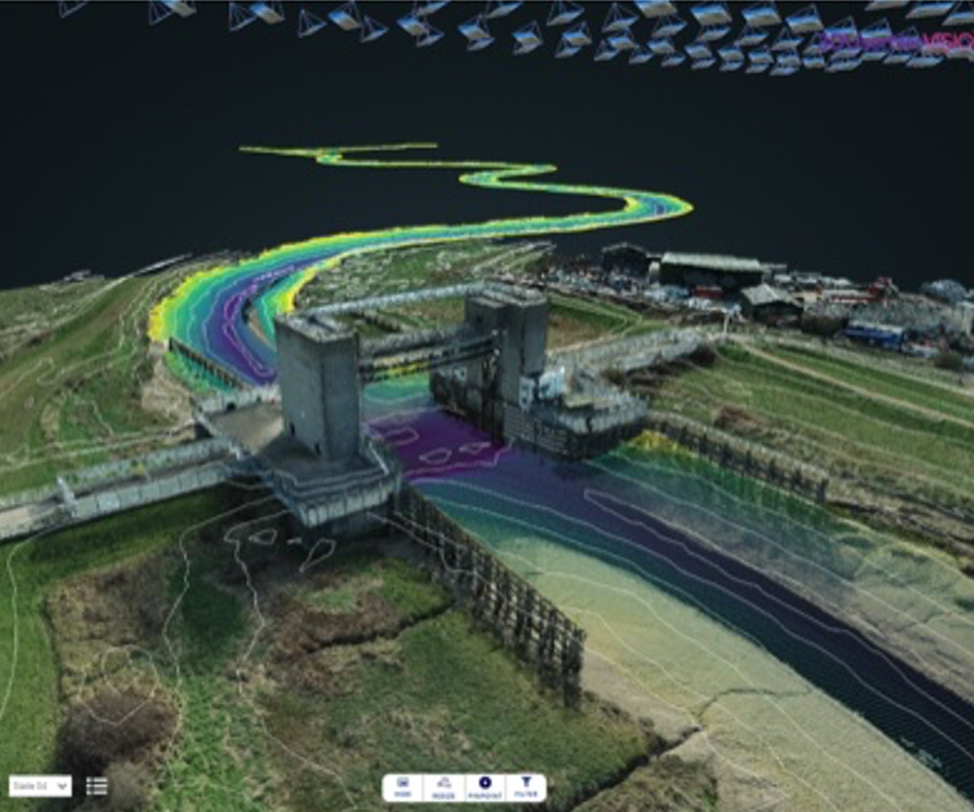
3DUserNetVISION is built to be a comprehensive, high-quality streaming and online work platform for 3D and 2D survey data outputs. Building upon their point cloud streaming know-how, VISION is built to be able to stream data collected from anything from airborne lidar and imagery, mobile and terrestrial scanning instruments, UAV/UAS, remotely operated vehicles and even hydrographic surveys. Combining these with models and line work, VISION can bring project data into one platform - freeing users from device-specific applications and software.

Modules to meet specific business needs
While VISION will handle many applications, 3DUserNet has created a unique modular licensing system to make sure users don’t pay for more than what they need.
“We want to offer customers their own branded survey data portal, negating the need to invest in building their own, and independent of any hardware or processing software” says Snudden
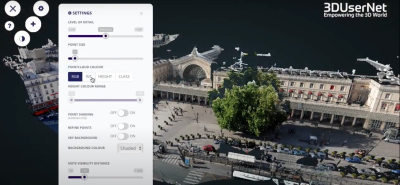
Users can purchase the VISIONCore Module to upload and work with point clouds, models, documents and maps (which include tools for measurements, profiles, cropping, annotations and sharing) and then choose from additional Image and Mesh modules.
The VISIONImage Module can be used for streaming and working with geolocated oriented and un-oriented images and 360 degree panoramics. The ability to stream and place Orthographic photos onto maps or satellite view (and to perform measurements on that dat) provides a contextual view for large area projects.

The VISIONImage Module also includes options for choosing and viewing inspection UAV images on the point cloud, model or mesh, and the ability to focus on small details in high resolution. Markup and annotation tools within this module facilitate team coordination and communication.
The VISIONMesh Module enables the import of high-resolution textured meshes, which include the outputs of Reality Capture, Pix4D and Context Capture. This module allows for these textured meshes to be integrated with point clouds or to be used as its own base data for other overlays.

VISION also allows for unlimited users to access project data. As users add contracts for projects, they can add another UserNet to include their own and their customers’ team members and give each the relevant permissions.
“A major block to effective use and project collaboration on the great data being collected is limiting the number of users allowed to access it. This just isn’t what the whole concept of cloud platforms and easy collaboration is all about,” says 3DUserNet CEO Paul Snudden
More information on VISION, and access to a 21-day free trial is available on 3DUserNet’s website.