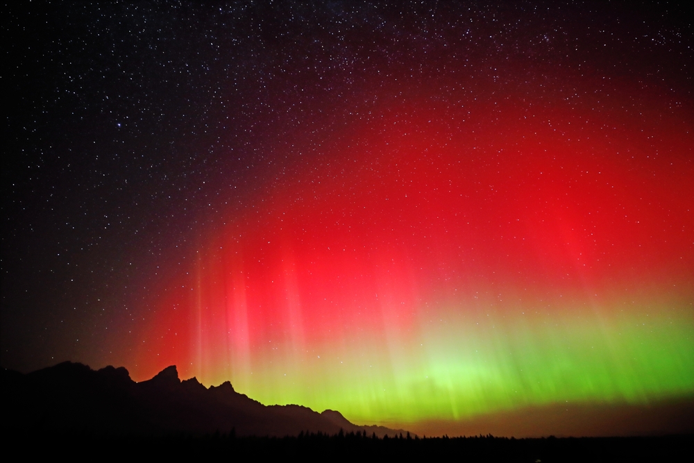
Last night, a strong geomagnetic storm created a dazzling display over most of North America. Bright red and green lights covered the sky, with the extent of the storm being seen as far south as New Mexico and even Florida.
There’s nothing quite like standing beneath the northern lights. At first, it’s just a faint shimmer, maybe a hint of a green light brushing the horizon. Then the color deepens, folds, and stretches until it fills the sky in ribbons of electric movement. Last night, the reds and greens were intense, bright and jaw-dropping, and I found myself urgently texting everyone I could think of to tell them to go outside and look up.
The aurora borealis (and its southern counterpart, the aurora australis) are among the most vivid manifestations of space weather, the constant stream of charged particles and radiation flowing from the Sun. When solar activity increases, those particles interact with Earth’s magnetic field, creating both the light show we marvel at and the magnetic disturbances that geospatial professionals must account for. Right now, we’re approaching the peak of the 11-year solar cycle, and that can have both beautiful and serious impacts on geospatial work.
The Invisible Effects of a Solar Storm
What’s breathtaking for the eyes can be frustrating for the instruments. During periods of intense solar activity, the ionosphere, the atmospheric layer that reflects and refracts radio signals, becomes highly charged and unstable. This can cause satellite-based systems like GPS and GNSS to behave unpredictably, introducing positioning errors that can range from centimeters to several meters.
These same geomagnetic storms can also disrupt satellite communications and operations, leading to brief interruptions or corrupted data in Earth observation imagery. High-frequency radio communications, often used in remote operations or field coordination, can fade or drop out entirely. And on the ground, power grids can experience fluctuations as geomagnetically induced currents surge through electrical systems, threatening the continuity of operations that rely on stable power and connectivity. In the last electrical storm, the impact was enough to trip the electrical breakers in her house.
What Geospatial Professionals Should Know
As we move further into the peak of solar activity, it’s increasingly important for geospatial practitioners to understand how solar weather affects their work.
Staying informed is the first step. Organizations like NOAA’s Space Weather Prediction Center and the European Space Agency’s Space Weather Office offer real-time forecasts and alerts that can help teams plan fieldwork and data collection around heightened solar activity. It’s also wise to build in redundancy: rely on local base stations, inertial systems, or ground control points to validate and back up GNSS data when satellite signals are less reliable. NASA also worked to create a digital twin of the sun to help better predict solar storms before they happen.
Data integrity is key during these periods. Logging collection times, cross-checking results, and noting anomalies can make post-processing corrections far easier later. And communication matters—helping clients, partners, and team members understand that a geomagnetic storm, not human error, may be to blame for temporary discrepancies can prevent unnecessary confusion.
The industry is already innovating to address these challenges. For instance, Trimble recently introduced its IonoGuard technology for NAV-900 and NAV-960 guidance controllers—designed to maintain centimeter-level accuracy even during ionospheric instability. It’s one example of how manufacturers are adapting to ensure reliable positioning when the Sun is at its most active.
Finally, stay curious. Solar weather sits at the fascinating intersection of space science and geospatial technology. The more we understand about how the Sun and Earth interact, the better equipped we are to adapt our systems—and perhaps even to innovate new ones that thrive under those conditions.
The next time you see the sky come alive with color, take it as more than a moment of beauty. It’s a direct connection between the Sun’s energy and the technologies that power our industry. For the geospatial community, the aurora is more than a spectacle. It’s a signal to stay adaptable, data-savvy, and ready for whatever the next (solar) storm brings.