Using 360° imagery to document railway corridors
RMI Valuation is a real estate appraisal services firm from Northbrook, Illinois. The company has expertise in corridors, conservation easements, and other unique properties. In a recently published article, CEO Cameron Rexton describes how the company captures integrated 360° imagery to document, value, and manage railway corridors. It also provides an overview of the evolution of how panoramic imagery is captured, processed, and integrated in GIS software over the last ten years.
RMI Valuation started using imagery to document corridors in 2014, switching to 360° two years later. While the first experiments without using 360° imagery made it clear that a visual context was critical for the job, its perspective was fixed. Using 360° cameras solved this problem, although new challenges arose, including proprietary data formats and a limited integration of imagery inside GIS tools.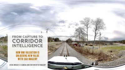
Today, RMI Valuation captures 360° imagery using the Mosaic 51 camera, combined with an external Emlid Reach RS3 unit that provides real-time correction data during capture. On the software side, RMI Valuation embraced Esri’s Oriented Imagery technology, which allows users to manage, view and interact with spatially referenced images directly within the map environment, based on camera location, orientation, and footprint.
Rexton describes the benefits of 360° imagery for different stakeholders, including railroads and corridor operators. The data itself is captured quicker than before, is of high quality, and can be used by multiple stakeholders. For example, a historical panoramic imagery archive can support future appraisals, trailing development plans, engineering studies, and public communications.
RMI Valuation is already looking at the future to see how existing imagery workflows can be improved and applied to other areas of interest. Geoprocessing individual datasets has already been automated through a Python tool that speeds up separate tasks such as tagging, labeling, and publishing. The current railroad corridor workflow is expandable to other areas, while AI-powered image analysis can help human image experts to speed up image analysis.
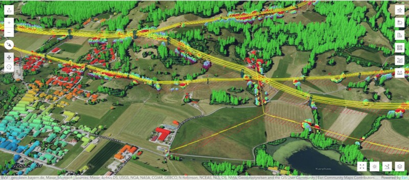
ArcGIS Pro Corridor Mapping workflow
Matthias Stängel (Esri Germany) wrote an online article on corridor mapping with ArcGIS Pro. The article is available online as an Esri Storymap, a digital content form that combines interactive maps, text, photos, and videos in a single web page. It is this visual approach that makes this article worth reading, and shows how 3D point clouds are visualized, classified, and combined with other 3D data to contextualize the point clouds.
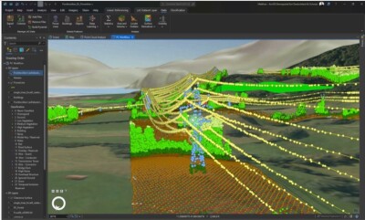
The first half of the article explains how to create point clouds and import them into ArcGIS Pro. From there, multiple analysis tools enable the user to turn them into actionable insights. The remainder of the article covers a corridor mapping workflow that uses an unclassified lidar point cloud to classify ground, buildings, and vegetation.
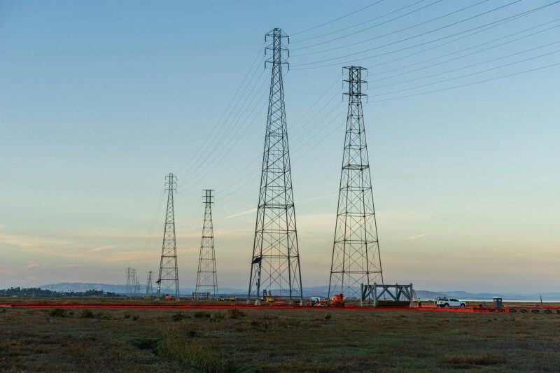
Finally, deep learning is used to classify powerlines. For this task, a deep learning model designed to extract distribution wires at street level is used. This model is available from Esri’s Living Atlas of the World. With both the vegetation and powerlines classified as features inside Pro, it is possible to identify vegetation encroachment around power lines. This information is valuable for preventing fires and power outage.
Corridor maintenance best practices
While the first two articles focus on hardware and software technology for corridor mapping, the third and last takes a different approach by focusing on good corridor management practices. Michael Wahl has dedicated more than 30 years to advancing high-voltage infrastructure and ecological corridor management (ECM). His experience comes to the fore in an article on LiveEO’s blog on corridor maintenance best practices.
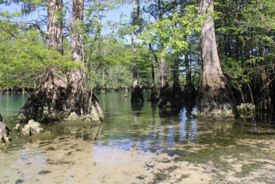
Before talking about technological solutions, it’s important to understand what ecological corridor maintenance entails, and why it is important. Knowledge of different vegetation and soil conditions is essential for successful ecological corridor management, combined with a long-term view to measure the its benefits.
LiveEO is a provider of earth observation technologies and solutions for asset monitoring. The company provides vegetation management solutions, such as a Treeline solution delivering timely and actionable intelligence to protect linear infrastructures like electrical grids or rail networks against vegetation-related risks. In his article, Wahl mentions GIS and satellite imagery as available tools for mapping corridors, and describes how AI will streamline the mapping and planning process of corridors in the future, as well as monitoring maintenance measures.
Wahl writes that ECM has the potential to become an important building block in the energy transition: energy needs can only be met with cleanly produced electricity, which requires of supply networks, especially in non-urban areas.