There aren't a lot of novels with a 3D documentation subplot. So when I stumble into one by accident, I pay attention. Honestly, Cloud Cuckoo Land by Anthony Doerr sat on my to-be-read pile for more than a few years (it came out in 2021). But I finally picked it up recently, and there's a thread running through it that feels less like historical fiction and more like this morning's news.
Without spoiling too much, one of the throughlines in the book takes place in Constantinople in 1453, on the eve of the city's fall. A pair of protagonists are searching in the chaos to locate a crumbling manuscript, a copy of an ancient Greek text, that nobody is supposed to care about when an empire is ending, but they do. That impulse to grab something irreplaceable, to protect it, to keep it from disappearing into the rubble, turns out to be one of the most human things in the book.
The second timeline is set far in the future, aboard a generation ship called the Argos, following a young girl who has never set foot on Earth, but has access to is something called Ilium, a fully immersive digital replica of the planet, every city, landscape, and street, reconstructed in meticulous detail. It is, for all practical purposes, a digital twin of a world she will never visit. For her, the record has become the reality. The scan has outlasted the thing itself.
We are living through the earliest chapters of that story. The tools to create something like Ilium exist right now, not as science fiction but as active, operational technology. And increasingly, the reason we reach for those tools is the same reason the characters reached for that manuscript: because something is about to be lost.
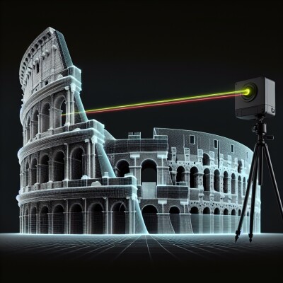
In Ukraine, engineers and volunteers have been scanning cathedrals and monuments since nearly the first days of the Russian invasion. The Backup Ukraine initiative, built around the Polycam mobile scanning app, allowed everyday Ukrainians to point their phones at statues and buildings and upload them to a permanent digital archive. The scans are detailed enough to serve as blueprints for physical reconstruction if the originals are destroyed.
Now a version of the same race is unfolding in Iran, where archaeologists have launched an interactive map geolocating cultural sites damaged by U.S. and Israeli strikes. The map was developed by researchers at Goethe University Frankfurt and the University of Chicago's Center for Ancient Middle Eastern Landscapes. Over 69 entries have already been catalogued, each requiring verification from multiple sources. The researchers described it as not just a documentation tool but a visual platform showing that Iran's cultural heritage and identity are at risk. Iran holds more than 34,000 registered historic sites. UNESCO has already confirmed damage to Golestan Palace, the Chehel Sotoun palace, and the Masjed-e Jame, the country's oldest Friday mosque.
We wrote about this moment before the conflict in Ukraine escalated, in a piece called "Before the Bombs Fall." The argument then was that digital preservation of at-risk heritage sites should be treated as infrastructure, not a nice-to-have. What Cloud Cuckoo Land adds to that argument is a longer view.
Doerr is asking something bigger than whether we can save things before they're destroyed. He's asking what it means to live inside the record. Konstance doesn't experience Ilium as a backup. She experiences it as the world. The digital twin isn't a consolation prize for a lost original. It's the primary way she understands where she came from.
That future isn't as distant as it sounds. Notre Dame's reconstruction after the 2019 fire leaned heavily on detailed point cloud data captured years earlier by art historian Andrew Tallon. The scan didn't replace the cathedral. It made rebuilding possible. In Ukraine, Skeiron's founders have been candid that for some of what they've scanned, the digital record may be all that future generations can access. The scan and the site are the same thing now.
That's the line Doerr is drawing across centuries. A character copies a manuscript by hand in a burning city. Another navigates a digital Earth from a ship in deep space. In between, a community of geospatial professionals is doing something that looks a lot like both, quietly building the infrastructure that turns records into reality.
The tools exist. The question this story keeps raising is one the geospatial industry might want to sit with. We're not just preserving the past anymore. We're building what the future will understand the present to have been.